The Ultimate 5100km Prep: Setting the Stage for an Epic 19-Day Challenge Part 1

Why You Must Drive the Sichuan-Tibet Highway at Least Once in Your Lifetime
In a person’s life, if you ever get the chance, you absolutely must drive the Sichuan-Tibet Highway (川藏线) yourself. Only when you actually set foot (or wheels) on this route will you truly understand what real beauty is and what untouched natural scenery really means.
When most people travel in China, especially in the developed eastern coastal cities, they usually visit man-made attractions inside ticketed scenic areas. But in the western highlands, especially on the Sichuan-Tibet route, the real attractions are all along the road. You don’t even need to deliberately detour to any particular “scenic spot” — the scenery the entire way is breathtaking enough.
I fulfilled this dream in September 2024. I flew from Kunming to Chengdu, rented a car there, entered Tibet via the legendary G318 (Chengdu → Lhasa), and returned via G317, ending back in Chengdu. The whole self-driving loop took 19 days (including the days traveling from Kunming to Chengdu).
Driving the Sichuan-Tibet Highway had been my dream for many years. Back in university, I planned to cycle from Wuhan to Lhasa with classmates. I was full of confidence and even bought a Merida bicycle. But I got lost before even leaving Wuhan city limits, and the training was too intense — I gave up almost immediately. Many people wonder, “How do you get lost in your own city?” Well, back then there was basically no smartphone navigation. Those two reasons killed the cycling plan, but my longing for Tibet never faded.

After graduating more than 10 years ago, I never found the right chance. First, the cost of self-driving to Tibet was quite high; second, I needed to properly adapt to high-altitude environments.
In 2018, I lived in Chengdu for a whole year. I didn’t own a car yet and rarely went to the plateau — only once or twice. The deepest memory is a group tour to Seda (色达). The county seat sits at over 3,800 meters. During the day I felt fine, but at night I couldn’t sleep at all. Around 2 a.m., the headache became unbearable. I told the guide and went to the hospital to inhale oxygen. I didn’t sleep after 2 a.m. and waited until 6 a.m. the next morning to head back to Chengdu.

While chatting with the doctor, he said every year some tourists die from lack of oxygen in these areas. Conditions and facilities back then were much worse than today, and tourists’ awareness was lower. Now, safety awareness is much higher and supporting facilities are far better — fatal high-altitude pulmonary edema cases have dropped dramatically.
In 2022, I lived in Chengdu again for a year and self-drove countless times around the Western Sichuan Plateau. The only regret: I never crossed into actual Tibet. But I became very familiar with plateau environments and had been to almost everywhere below 4,500 meters. My fear disappeared, and my desire to visit Tibet only grew stronger.
Early 2024, I made plans with two friends to drive together in September. But in August, one backed out due to personal matters, and the other said he didn’t want to go with just two people. I thought: this is something I must do, I’ve already postponed it for years — no more delays. So I decided to go alone, rented the car in advance, and on September 3rd, 2024, officially started my journey into Tibet.
A little side story: Because I wanted to visit Tibet so badly, when the driving plan fell through the first time, I flew there in May 2024. I was lucky — we landed safely in Lhasa. Many people don’t realize that a safe landing in Lhasa is actually a matter of luck. I’m not talking about flight accidents. Lhasa Gonggar Airport is one of the highest airports in the world, with strong winds and frequently low visibility. Sometimes planes circle and can’t land, so they return all the way to Chengdu (there’s no suitable alternate airport in between). Even Kunming airport at only ~2,000 m sometimes diverts flights because of wind!

During that May trip, I ignored online advice that says “rest completely on the first day, don’t walk far.” Since my body handles altitude well, I walked 5–6 kilometers on arrival day — no problem at all. The second day I walked even farther — still perfectly fine, and I barely felt any serious altitude sickness at night. That experience gave me huge confidence for the self-driving trip.
So when the two friends canceled at the end of August, I immediately confirmed the rental car, and on September 3rd, the adventure officially began.

What Preparations Did I Make?
Here’s what I did — hope it helps anyone planning the same trip:
1. Physical preparation
I’ve been to plateau regions more than 10 times over the years. Overall, my altitude reactions have never been severe. I also take good care of my health normally. As they say, “Your body is the capital of revolution” — I definitely meet the requirements.
2. Financial preparation
My total cost was quite reasonable — under 20,000 RMB (~2,800 USD). I stayed in ordinary hotels/guesthouses and rented a Toyota RAV4 (荣放). Not luxury, but perfectly sufficient.

3. Time preparation
Driving the Sichuan-Tibet Highway cannot be squeezed into a weekend. I never drive at night on the plateau — it’s extremely unsafe. My full loop took 19 days; even counting only from Chengdu and back, it was 16 days.
Recommendation: If you want to drive both ways, budget at least this much time. If you’re short on time (e.g., only one week), you can drive one way to Lhasa, return the car there, and fly or take the train out. Currently the only railway out of Tibet is the Qinghai-Tibet Railway to Xining. The Sichuan-Tibet Railway is still under construction — the earliest completion estimate is 2032 or later.
4. Gear & supplies preparation
- Tow hook & anti-slip snow chains — Even in September, snow is possible at high passes. Temperature drops 6–7 °C per 1,000 m elevation gain. 25 °C in Chengdu can become sub-zero at 4,000+ m.
- Folding camping chair (“Kriete chair”) — Perfect for stopping anytime on the roadside to sit, eat, and enjoy the insane views.
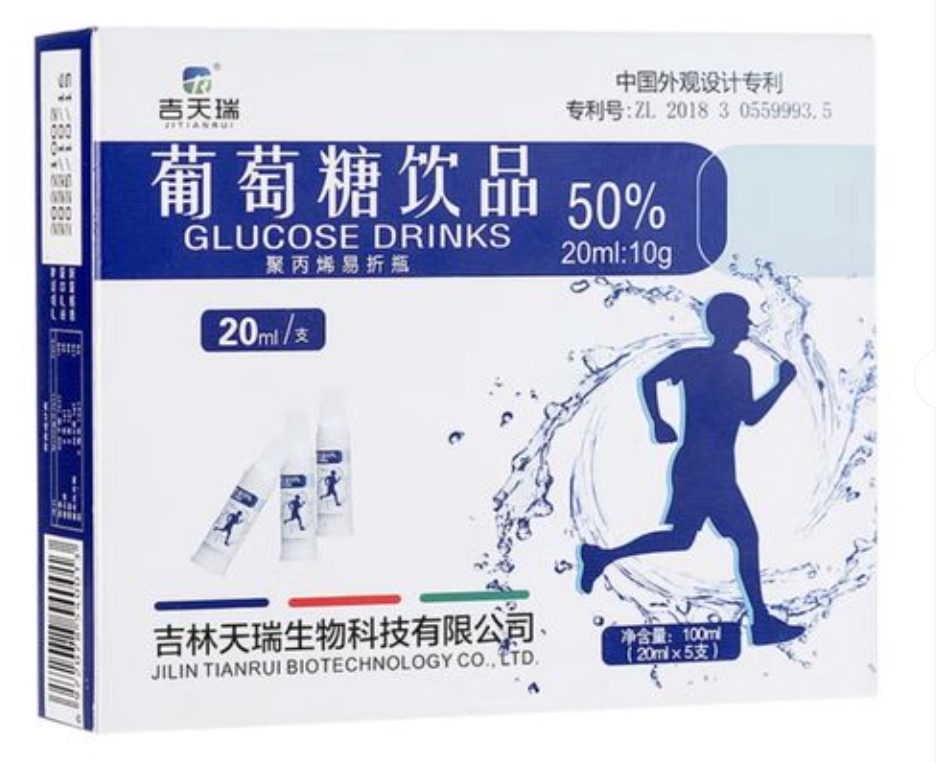
- Small vials of liquid glucose — Fastest energy source when you feel weak from altitude. One box of 5 vials costs less than 10 RMB in any Chengdu pharmacy.
- Rhodiola (红景天) — Helps some people prevent altitude sickness. Effects vary; best to start taking it one week in advance. If you don’t have time, skipping it is fine too.
- Cold medicine — A cold on the plateau is completely different from lowland colds. It can quickly develop into life-threatening pulmonary edema if not treated promptly.
5. Mental preparation
You will feel some discomfort — that’s normal. Don’t panic and give up at the first headache. Once you’re one-third or halfway through the journey, you can’t easily turn back anyway. Remember: G318 & G317 are now mature, well-paved national highways, not extreme off-road adventures. Millions have done it safely.
More tips will come later when I remember them!
For first-time plateau travelers, please study guides carefully and take altitude sickness seriously.
This post is just the preparation part of my 5,100-kilometer self-drive journey.
In the next part, I’ll share the detailed itinerary of the first 5 days.
All the really in-depth topics —
“How to stay safe from altitude sickness”,
“How to drive safely on the plateau”,
“How to book hotels & find fuel along the way”, etc. —
will be exclusive content for my Lifetime Members. The value of any single one of those guides far exceeds the membership price.
Stay tuned for Part 2! 🚙💨

Comments (0)
CC BY-NC-ND 4.0 License
Credit to Gerry Hu / ChinaTravelPDF
No commercial use
No modifications allowed
Unlock Remaining 70% Premium Content
This is a VIP Exclusive Article. Become a lifetime member to unlock all VIP articles and all available city guides.
🎁 1 Year Free Expert Q&A Support (Early Bird Exclusive - First 500 Only)
China National Highway 318
20 Must-Visit Attractions You'll Regret Missing (FREE PDF)
Related Articles

The Ultimate 5100km Solo Drive: Leaving Tibet via G317 – Jinsha River, Dege Parkhang & 19-Day Goodbye – PART 6
In Part 6, the traveler departs Tibet via G317 after entering via G318, focusing on the eastward journey from Dingqing through eastern Tibet into Sichuan over several days. From Dingqing to Changdu on Day 15, the route includes skipping the bumpy, unpaved 11 km dirt road to Zizhu Temple at 5,000 meters due to poor conditions, opting instead for drone shots of the temple on Zizhu Mountain. Stops feature the massive Naicha Mani Stone Pile, a 3 km-long sacred site where pilgrims pray, and Qiangbalin Temple, the largest in Kham with roots in the Ming Dynasty. Evening brings a serene stroll at Qiangbalin Square, witnessing the crystal-clear Zhaqu River merging with the muddy Ngomqu to form the Lancang River (Mekong). On Day 16, from Changdu to Dege, the path crosses the Jinsha River (upper Yangtze) at the Sichuan-Tibet border, passing solar farms, red Aga-soil houses, and the Gangtuo 18th Army Crossing Memorial Hall. Entering Sichuan after a checkpoint, Dege offers peace, with a night visit to the majestic Dege Parkhang, a historic Tibetan printing house emitting chants and printing scents. Day 17 detours via Baiyu for superior scenery along Jinsha River, visiting Yanbi Village's mural, Jinsha River First Bend confluence, Baiyu Temple atop a steep climb with prayer wheels and incense, Changtai Grassland, Yachen Gar (largest nunnery in western Sichuan, remote and tranquil), and Lalong Cuo Lake, a shrinking tectonic lake with salt flats and herder tents. The route includes Zhuo Da La Mountain's photo spot and a long tunnel descent to Garzê County. Day 18 covers Garzê to Maerkang with gentle downhill, autumn colors, monkey encounters, and cautious navigation through extensive gravel construction zones with rockfall risks. The 19-day trip concludes on Day 19 with a smooth expressway drive to Chengdu, reflecting on plateaus, monasteries, and inner calm. Survival tips include early starts to avoid packed schedules, confident driving for narrow, steep accesses like Baiyu Temple, careful slow driving on unpaved or gravel sections, drone use limited by altitude, and awareness of high-plateau winds, cold, and emotional reluctance at borders.

The Ultimate 5100km Solo Drive: I Ended Up in Hospital at 4500m & Still Say G317 Is Worth It – Here’s Exactly How to Survive It PART 5
Part 5 of the blog details the G317 Northern Route from Lhasa to Naqu and beyond, emphasizing high-altitude survival challenges. Starting at Lhasa's 3,650 meters, the drive north to Naqu (around 4,500 meters) involves steady climbs, with landscapes shifting to vast plateaus, grasslands, and snow-capped peaks under Bön religious influences. High passes and elevations exceed those on the G318 Southern Route, making altitude sickness the primary challenge; the author experienced severe oxygen deprivation at Naqu due to a poorly ventilated hotel without supplemental oxygen, leading to a midnight hospital visit for oxygen therapy at Naqu City People’s Hospital, where 10–15 minutes of treatment provided significant relief, and staying until morning ensured rest. Descending to Suo County (3,800 meters) alleviated symptoms, with tips like sipping glucose water for mild issues. High passes include the Nyenchen Tanglha Mountains viewpoint, but the route features smoother, flatter roads with lighter traffic—one-third of G318’s—and fewer steep climbs. Wildlife is minimally mentioned, with no specific encounters noted. Travel advice includes booking oxygen-supplied hotels (200–300 yuan extra), checking vehicles thoroughly before Lhasa departure due to remote repairs, carrying portable oxygen cans if altitude-sensitive, knowing personal limits, and preparing for profound, peaceful scenery in quieter northern Tibet.

The Ultimate 5100km Solo Drive: 4 Defining Days (5-8) Navigating the G318/G317's Highest Passes Part 3
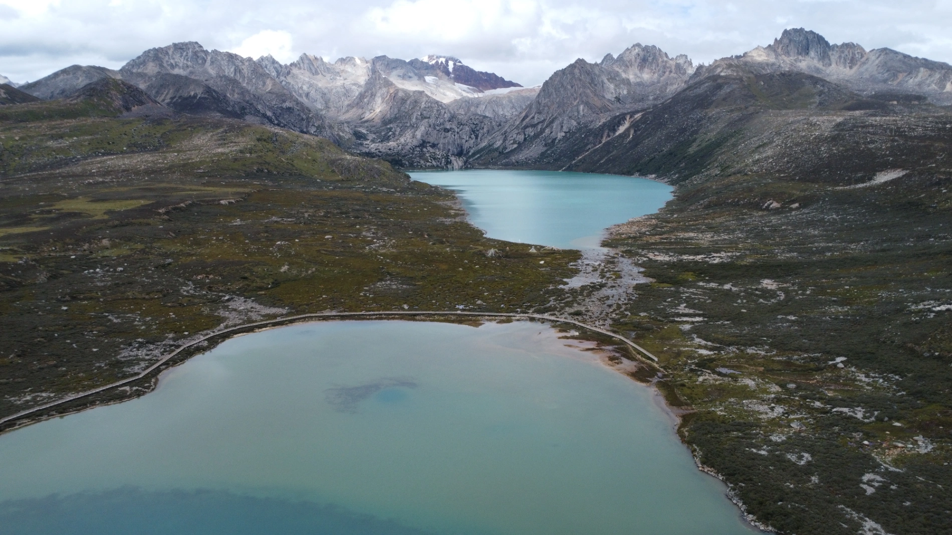
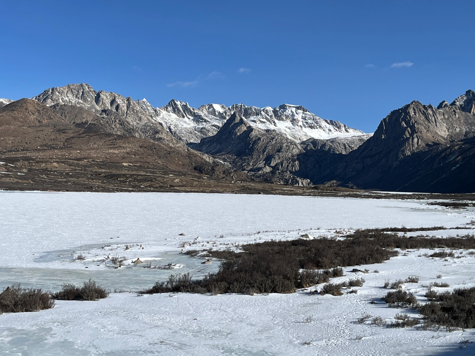
In Part 3, the journey crosses from Sichuan into Tibet, starting in Batang (2,800 m) and entering via the Jinsha River Bridge into Mangkang, surrounded by flaming-red mountains. Day 5 involves conquering three high passes—Yela Shan, Jueba Shan, and Dongda Shan (5,130 m, the highest on G318 & G317)—with elevations up to 5,130 m, followed by a downhill to Zuogong (3,750 m). Precautions include watching for landslides and mud-rock flows. Day 6 features foggy starts in Zuogong, a revisit to Yela Shan (4,658 m), and the terrifying Nu River 72 Turns with narrow roads, crumbling rocks, sheer drops, potholes, and a 3-hour traffic jam from a landslide. Attractions include Bangda Grassland viewpoint. Overnight in Basu. Day 7 offers rewards like Ranwu Lake at sunrise (mirror-calm waters reflecting peaks) and Laigu Glacier (gigantic white glacier with boardwalk), with drone tips for cold winds. Day 8 includes Sutong Horseshoe Bend on Palong Zangbo River, Lulang Gongcuo Lake, Lulang Forest Sea, and Sejila Mountain (4,728 m). Ends in Nyingchi (Linzhi), Tibet's mild "Jiangnan." The Batang to Basu segment (~360 km) crosses three rivers (Jinsha, Lancang, Nu) and four major passes (Lawu at 4,338 m, Jueba at 3,940 m, Dongda at 5,130 m, Yela at 4,658 m), noted as the most epic and demanding. Advice: Check road conditions nightly via WeChat, avoid tired driving, book hotels and parking ahead, especially for plateau inexperience.