The Ultimate Sichuan-Tibet Highway Survival Guide: I Drove 5,100 km Solo in 19 Days and Wrote Down Every Single Piece of Hardcore Advice (Lifetime Updates Included)

My name is Gerry Hu. I’ve lost 3 drones to the sky, been scammed 19 times, and visited plateau regions more than 10 times. Every crash, every scam, every failure has made the outline of the sky clearer—and shown me the stubborn obsession in my own heart. When a drone breaks its wings in the fierce plateau wind and the signal vanishes in no-man’s-land, yet I still keep crossing 5,000-meter passes, it’s not that I don’t know when to quit. It’s that I understand dreams are built from countless failures. When the drone can’t fly, a person has to learn to stand up by himself.

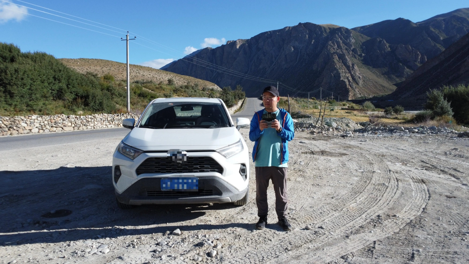
In September 2024, I finally completed the G318 Sichuan–Tibet Highway that I owed myself since university: high-speed train from Kunming to Chengdu, rented a Toyota RAV4, solo, 19 days, 5,100 kilometers. Entered Tibet via G318, exited via G317, crossed multiple passes above 5,000 meters, crossed the Jinsha River, Lancang River, and Nu River three times each, spent a night in the world’s highest city Naqu (4,700 m), then descended via Dege Scripture Printing House, the First Bend of the Jinsha River, Yachen Gar, all the way back to Chengdu.
Let me tell you why the Sichuan–Tibet Highway is the most hardcore travel route on Earth.
Why the Sichuan–Tibet Highway (G318) Is the Most Hardcore Road on the Planet
1. You’re literally driving on the “crash site” of two supercontinents
The entire G318 runs along the collision suture between the Indian Plate and the Eurasian Plate (Yarlung Tsangpo Suture Zone). When you ride from Bomi to Tongmai, the left side is the sheer wall of Namcha Barwa (7,782 m), the right side is the 800-meter-deep Parlung Tsangpo Canyon—a vertical drop of almost 7,000 meters. This is the living proof that the Indian Plate is still pushing northward at 4 cm per year, lifting the Tibetan Plateau into the roof of the world. A 40-million-year violent car crash has now become your photo spot. Is there any road on Earth more hardcore than this?

2. 500 km from equator to arctic circle
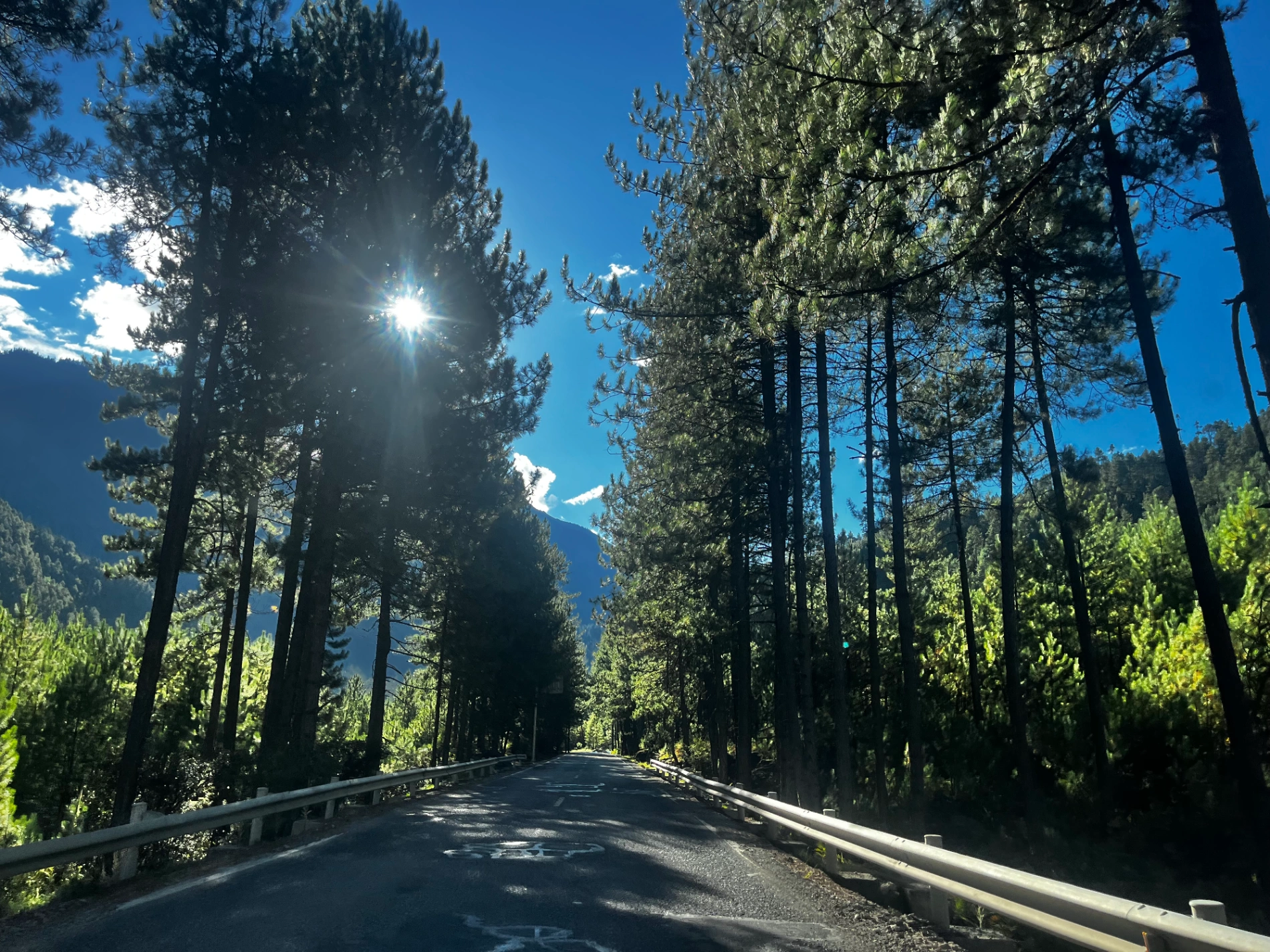
From Bayi District, Nyingchi (2,900 m, subtropical) to Haizi Mountain (4,700 m, cold desert)—only 500 km horizontally, yet you climb almost 2,000 m vertically. It’s like riding from Ecuador’s rainforest straight to the Norwegian Arctic Circle in one day. The Hengduan Mountains act as a giant wall blocking the warm, moist Indian Ocean monsoon, so in the morning you can wear a T-shirt in Peach Blossom Valley, and by afternoon you’re freezing under glaciers. No other highway on Earth lets you experience 7 climate zones in a single day.
3. The Tibetan Plateau is still growing—so landslides never end
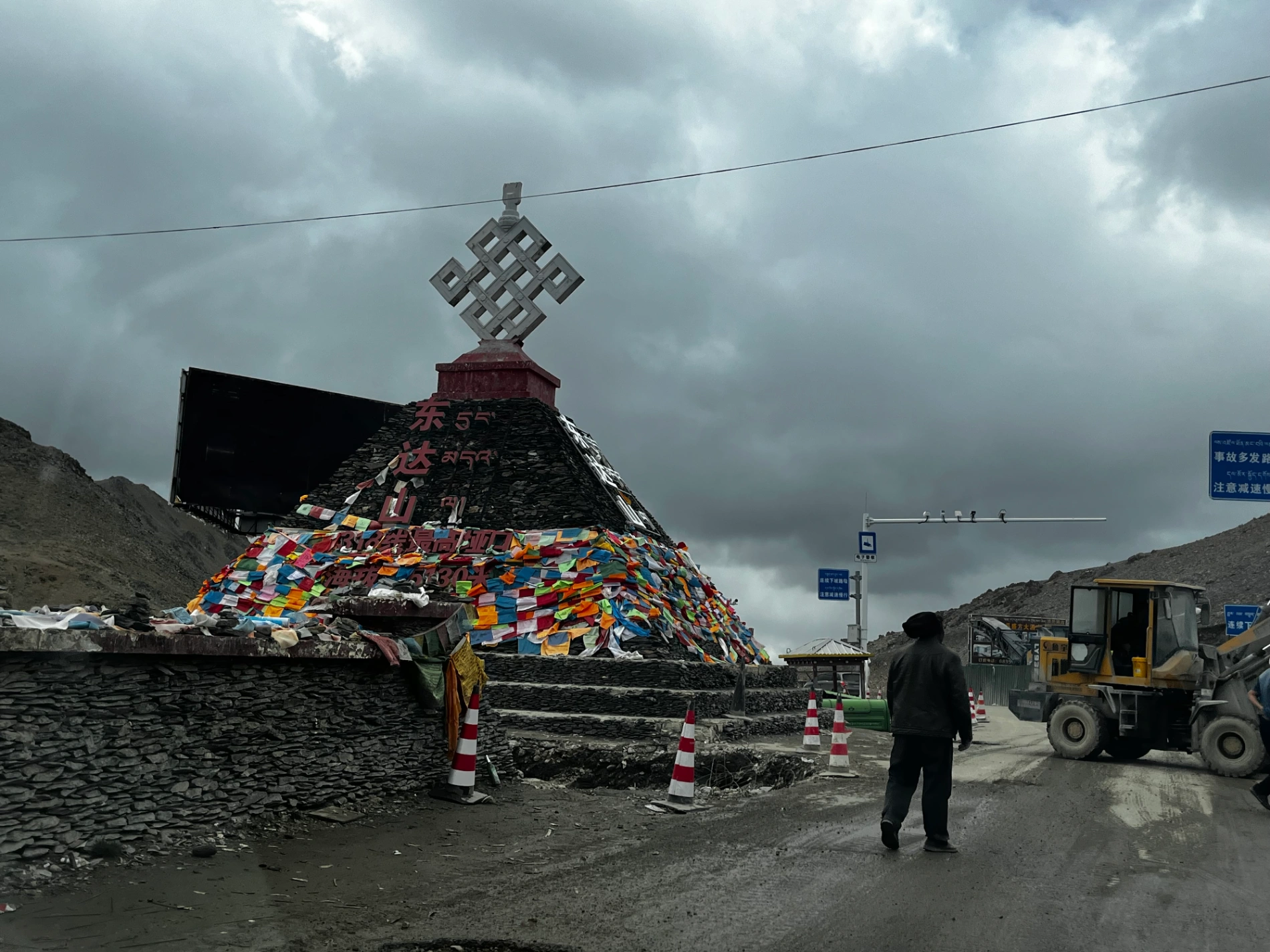
GPS data shows the plateau is still rising 5–7 mm every year. Mountains grow, rocks crack, summer rainstorms flush, winter freeze–thaw explosions happen—fresh landslides arrive like daily delivery. The huge boulder piles you see on Dongda Pass and Yela Pass fell just yesterday or last week. You’re not riding a road; you’re wrestling with a planet that is still growing.

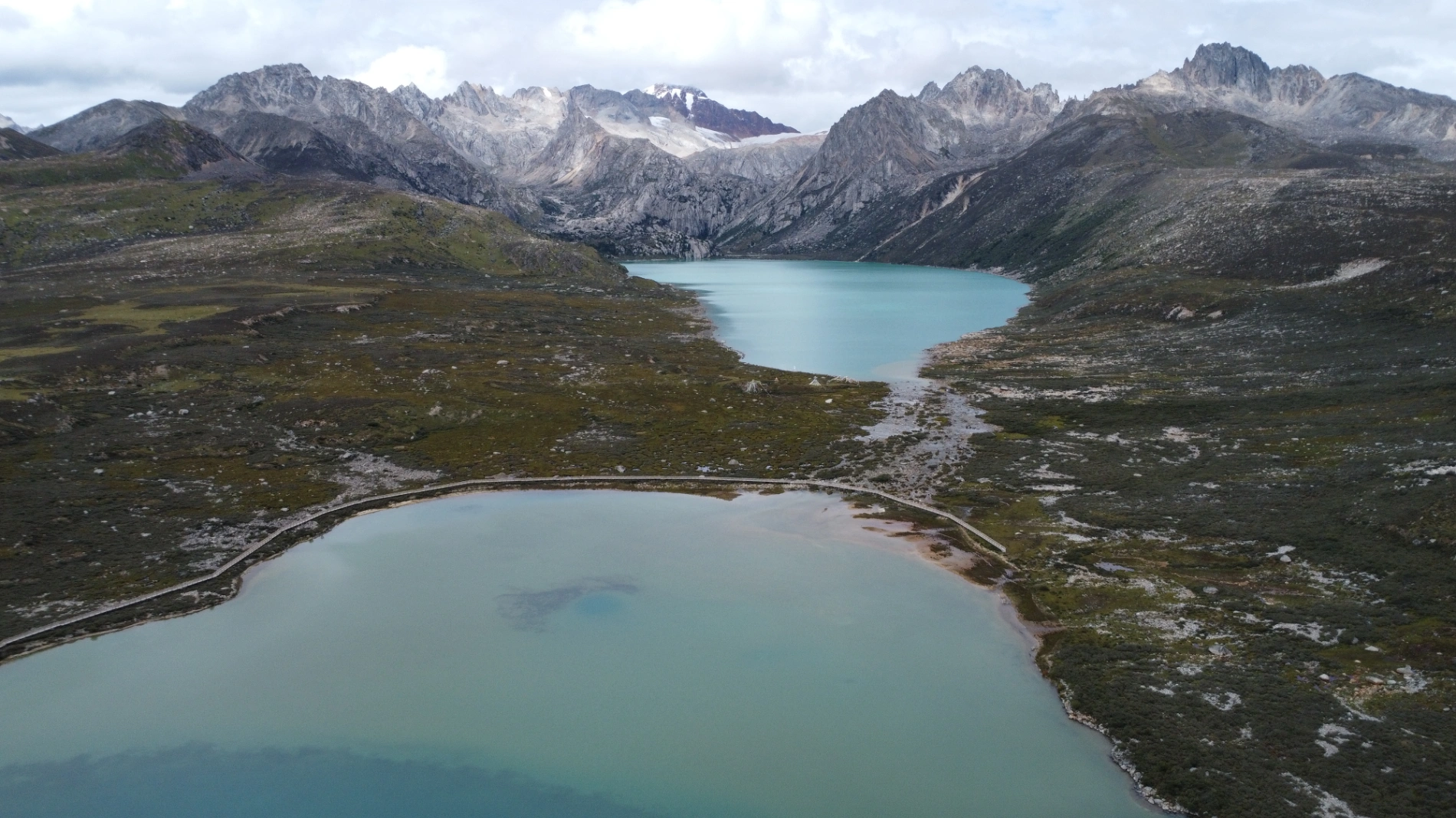
4. Why Ranwu Lake is blue like liquid sky
The water comes from the melt of Midui Glacier and Laigu Glacier, carrying ultra-fine glacial rock flour. These particles only scatter blue light, creating that “so fake your phone can’t even capture it” sapphire color. Scientists call it “glacier milk”; local Tibetans call it “water the gods bathe in”. Take one photo and 99% of your friends will think you Photoshopped it.

5. Haizi Mountain — the “bottom of the glacier” from tens of thousands of years ago
At 4,650–4,800 m, the Sister Lakes area is covered in fist-sized stones with almost no soil. This was once completely covered by Quaternary ice sheets. Glaciers acted like giant sandpaper, scraping everything clean. The ground you’re walking on was the bottom of an ice cap tens of thousands of years ago. When the wind blows, the stones ring like wind chimes—the whole plateau is talking to you.
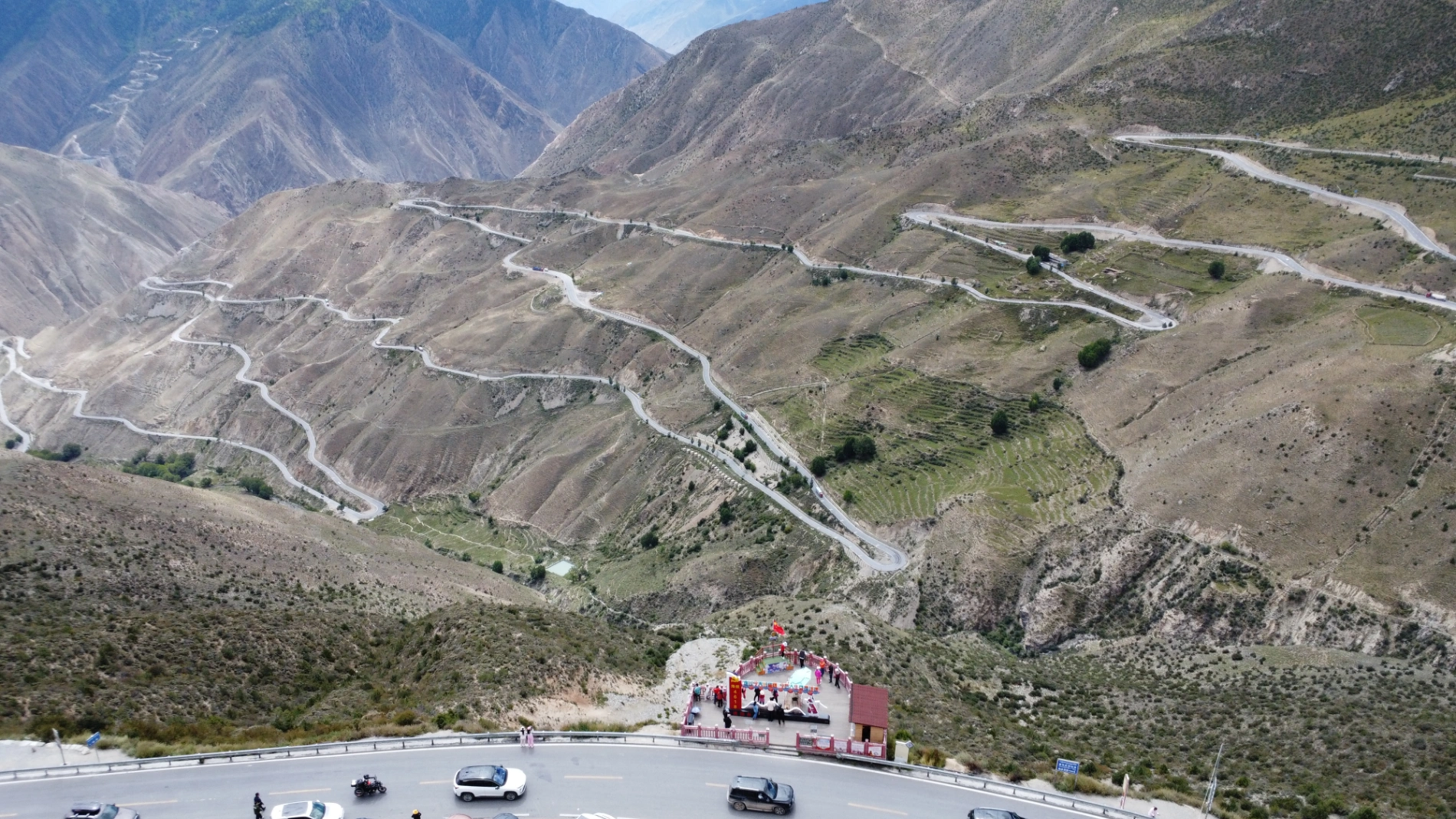
6. 72 Hairpin Bends of the Nu River — the death climb of the Indian monsoon
From 2,500 m in the Nu River Valley to 4,650 m at Que’er Mountain Pass, 30 km, 72 hairpin turns, 2,100 m vertical gain. Why so steep? You’re climbing the sharpest ridge of the Hengduan Mountains—the monsoon gets blocked here and dumps everything as rain, hail or snow. This section has bad weather more than 200 days a year and constantly ranks in the global top 3 for steepest highways.
7. The water you drink was on the summit of the Himalayas 5 minutes ago
Every river along the route—the Jinsha, Lancang, and Nu—starts from snow peaks at 5,000–6,000 m. Glacier → alpine lake → 5 minutes later it’s the stream beside the road. You scoop a mouthful and it might have been snow on Namcha Barwa this morning. Few places on Earth let you drink glacier water this fresh.
8. Sejila Pass (5,013 m) — climbing from the Indian Plate to the roof of the Eurasian Plate
This is the most accessible point on the official plate boundary. Look west: Yarlung Tsangpo Grand Canyon (Indian Plate). Look east: Nyenchen Tanglha Range (Eurasian Plate). Standing at the stone monument, your left foot is on India, your right foot on Eurasia—the thin national highway under your feet is the only gap two supercontinents left for humans after 40 million years of collision.
9. Litang to Batang — the planet’s biggest “temperature-difference gym”
Average elevation 4,200 m in Litang. Daytime direct sunshine can reach 25 °C, night-time radiative cooling drops to -15 °C—a 40 °C swing in 24 hours. Morning: down jacket. Noon: T-shirt. Night: wrapped like a dumpling. UV radiation is 3–5 times stronger than at sea level—one hour here equals a full day at the beach. That’s why almost everyone on the plateau has the famous “plateau red” cheeks.
10. The Sichuan–Tibet Highway is not a road—it’s the Earth’s scar
The entire G318 runs through plate sutures, giant fault zones, glacial U-shaped valleys, and debris-flow fans. Every canyon, every pass, every landslide you see is a scar left by the planet’s most violent geological movements over the past 50 million years. Finishing this route isn’t just a trip—you’ve touched the bones of the planet with your own hands.
Based on everything above, I can say with full responsibility: this is a road that lets you measure the pulse of Earth’s life with your own footsteps. Everyone should walk (or drive) it at least once in their lifetime—no regrets.
My Top 10 Most Unforgettable Moments from the 19-Day Journey
1. Day 1 Chengdu–Kunming high-speed railway: 7 hours, 150+ tunnels, 180 viaducts—felt like the world’s longest roller coaster
2. Day 2 Rainy misty morning beside the Qingyi River in Ya’an, steaming hot tattie noodles, heart already flying toward the snow mountains beyond Erlang Pass
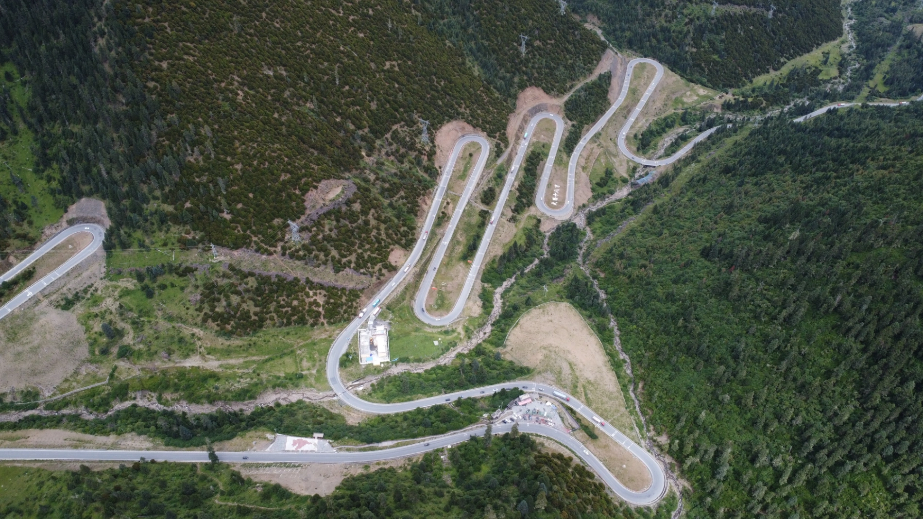
3. Day 3 Jianziquwan (4,659 m) — endless 180° hairpin bends, altitude sickness headache, every turn a conversation with nature
4. Day 4 Sister Lakes in September — treasure-blue water mirroring snow peaks, compared to the all-white frozen version I saw in winter 2022, same place, two different planets
5. Day 5 Dongda Pass (5,130 m) — first time ever standing above 5,000 m, at the summit all the terrible roads were instantly healed
6. Day 6 72 Hairpin Bends under construction — forced to overtake more than ten trucks and cars on a narrow gravel cliff road, soul almost left body, nearly said goodbye to the Nu River forever
7. Day 7 Laigu Glacier — drone flew 2 km out, face-to-face with the white dragon ice tongue, time completely froze
8. Day 8 Parlung Tsangpo horseshoe bend — standing on a thousand-meter cliff looking down at the shocking ink-green U-turn, only awe remained
9. Day 9 Mila Pass (5,013 m) almost deserted, prayer flags dancing silently with snow mountains, the last pass before Lhasa, so quiet it made me want to cry
10. Day 19 Returning the car in Chengdu — 19 days of snow mountains, landslides, altitude sickness, and loneliness all rushed back at once, tears collapsed instantly
Practical Issues Everyone Cares About on the Sichuan–Tibet Highway
Whether you self-drive or join a tour, the following information will definitely help you.
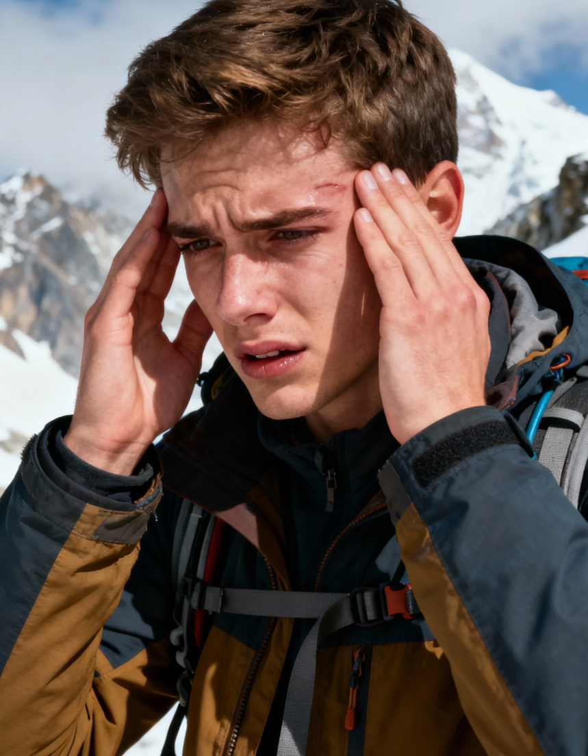
1. Altitude Sickness (High-Reaction, “高反”)
Altitude sickness is the most impartial test on the Sichuan–Tibet Highway — it doesn’t care about your age, gender, or how many times you’ve been to the plateau. We must never take it lightly, because on the plateau, altitude sickness can kill. Always follow your doctor’s advice.
Some people think “I’m in great shape, I can tough it out even if I feel bad on the first day.” Very often, these are exactly the people who end up in tragedy.
When symptoms appear, you must make a basic judgment about your own condition:
- Is your headache extremely painful?
- Ask someone to check your lips or look in the mirror — are they turning purple or black?
- Are your fingernails purple?
If you have any of these signs, stop advancing immediately, take the medicine prescribed by your doctor, use oxygen, and if necessary descend quickly to lower altitude.
Never believe altitude sickness can be beaten by willpower alone — every warning from your body could be the line between life and death.
On the other hand, if you only feel slightly short of breath and get tired after walking a few steps, with no vomiting or more serious symptoms — that is completely normal and happens to everyone. Adapting to the plateau takes time. Move slowly, drink plenty of water, avoid strenuous exercise, keep a relaxed mindset (anxiety makes everything worse), and most people feel much better after 1–2 days.
However, if symptoms keep getting worse, never take chances. After all, we come here to travel — safety is always No.1.
2. Vehicle
Your vehicle is the guarantee of a smooth journey. Whether you bring your own car or rent one, do a full pre-trip inspection: tires, brakes, coolant, battery, and four-wheel-drive system are the most critical.
Gas stations are far apart — fill up every time you see one, especially after entering Tibet proper.
Recommendation: choose a high-chassis SUV or real off-road vehicle with strong passing ability — you’ll thank yourself on landslide sections, gravel roads, and muddy stretches.
If renting, confirm the insurance covers the entire route and save all emergency rescue contacts.
While driving: obey speed limits, never drive tired, check tires and fluids every day. When you meet extreme weather or terrible road conditions, better to stay put than take risks. Arriving safely is far more important than arriving on schedule.
Can a two-wheel-drive car do the Sichuan–Tibet Highway?
My very responsible answer: Yes, but it depends on the car.
- If the car is fully loaded with passengers and luggage → you need at least 2.0T turbo.
- If you travel solo like me → 1.5T or 2.0L naturally aspirated is enough.
On the plateau not only humans lack oxygen — engines do too. There are many very steep, long climbs; if the engine is too weak you literally cannot move from a standstill.
A little extra knowledge everyone sees on G318 South (especially Volkswagen owners):
You will see countless VW cars — Tiguan, Tayron, Teramont, Passat, Magotan, Lavida… — stopped on the roadside with their hoods propped open. 99% of the time it’s the same reason: engine overheating, relying on natural airflow to cool down.
Why do VW cars “boil over” so easily on the Sichuan–Tibet Highway?
1. Super-long climbs + thin air: from ~500 m at Xinduqiao all the way up to passes above 5,000 m, continuous 20–40% gradients for dozens of kilometres. The 1.4T/2.0T EA888/EA211 engines have to work like crazy, but there’s less oxygen, less air for the intercooler, water temperature shoots to 110 ℃+.
2. These engines have very little cooling margin to begin with.
3. Nobody dares to turn on the A/C — it adds another 20 ℃ instantly, so everyone chooses to roast inside a sauna-like cabin.
4. Propping the hood 30–50 cm with the factory rod creates a “chimney effect” — heat escapes upward 5–10 times faster than idling. Many old drivers also put a wet towel on the thermostat or pour bottled water on the intercooler.
Classic scenes you’ll witness:
- Top of Zheduo Pass: 8 out of 10 VWs have their hoods up
- Before descending Jianziquwan hairpins: a whole row of Tiguan/Tayron cooling down together
- Dongda Pass: Passat, Magotan, Teramont lined up like they’re “sunbathing their engines”
The Sichuan–Tibet Highway doesn’t test your courage — it tortures your engine’s cooling system. VW drivers suffer the most, so propping the hood has become a VW-exclusive ritual on this route.
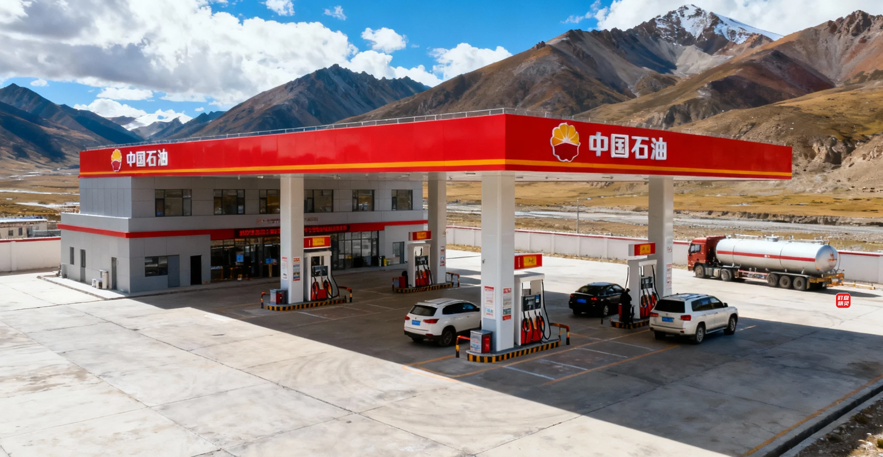
3. Fuel & Charging
Never let your tank drop below 1/4, and ideally fill up every chance you get. On the plains you can find stations every 10 km; on the plateau the next station can be 50–100 km away — and sometimes it’s completely out of fuel!
I personally ran into this in early 2022: drove to Batang, wanted to refuel first, but the station had no 92-octane left. I thought “the hotel is only 2 km away, I’ll do it tomorrow”. Next morning there was fuel, but a long queue, and if I had arrived 30 minutes later it would have been gone again. Five years ago this happened even more often.
Some drivers like night driving — if you get stuck by snow or landslide at 5,000 m, a full tank can literally save your life by keeping the heater running all night.
Electric vehicles face even bigger challenges: charging stations are sparse, winter temperatures cut range by 40%+, charging speed drops dramatically in the cold. Between Litang and Batang there are almost no fast chargers. My personal strong recommendation: use a petrol/diesel car — it’s simply safer.
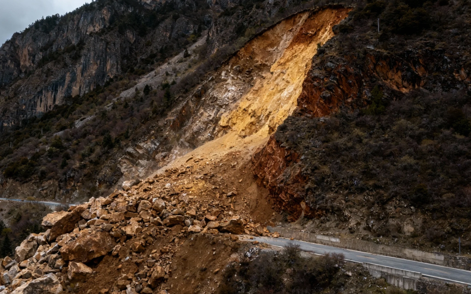
4. Landslides & Mudslides
Most landslides happen because of loose geology + extreme weather. Some sections are in permanent high-risk zones, especially during the July–August rainy season.
When passing risky areas, watch the mountainside closely: more falling rocks, muddy water in ditches, leaning trees, mud on the road → slow down but keep moving fast, never stop.
Best prevention: avoid July and August altogether. If you must travel then, carry at least 3 days of food, drinking water, warm clothing, medicine, powerful flashlight + spare batteries.
5. Accommodation
Hotels along the main G318 are now quite plentiful, but book in advance, especially in peak season. Otherwise: higher prices, no parking, or no room at all. Parking is a real headache — many hotels have tiny lots. If you arrive late you’ll end up on the street, and if you parked deep inside early, next morning you’ll have to wake half the hotel to move cars so you can leave. Arrive early!
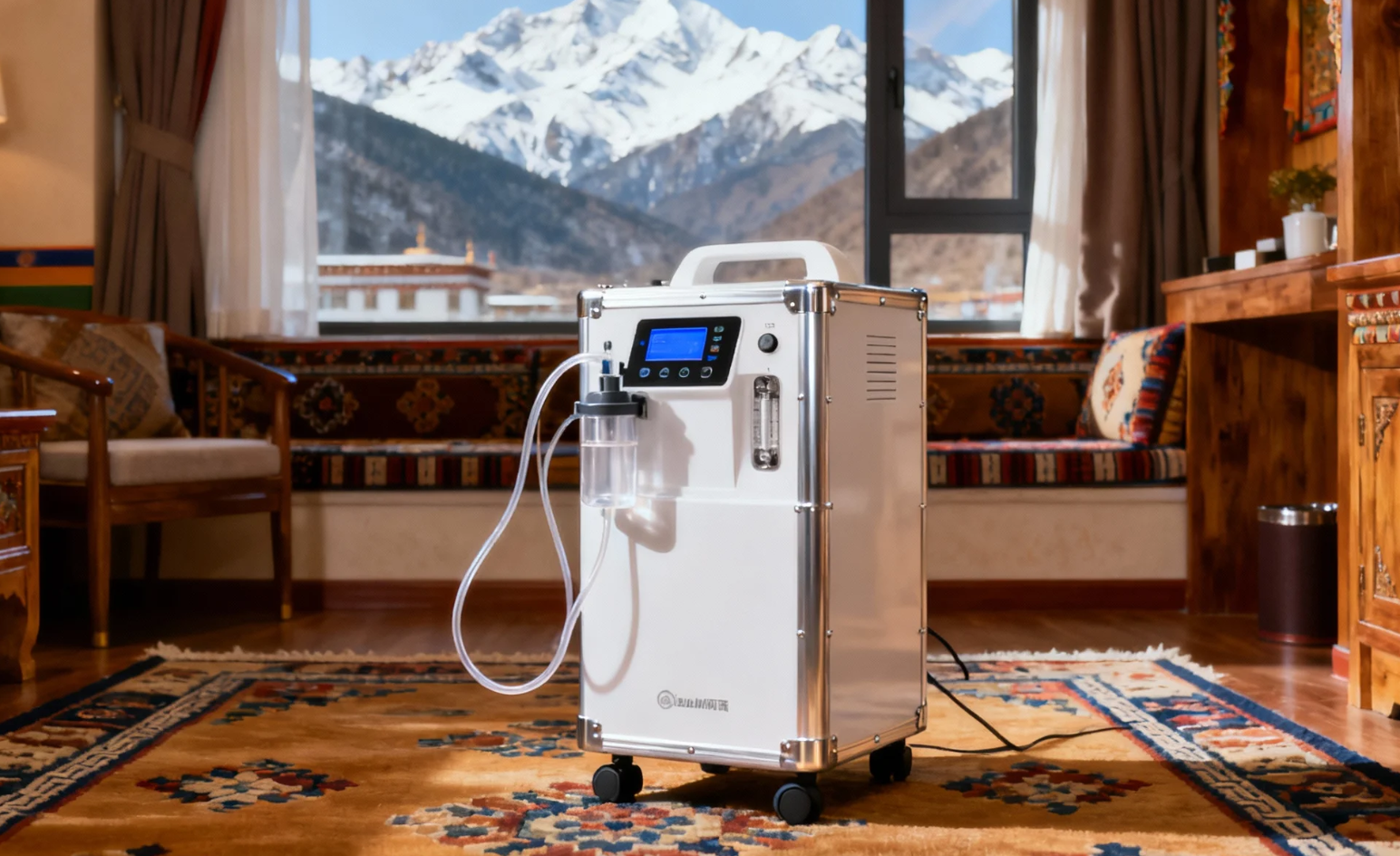
6. Oxygen
First-timers with unknown tolerance: I recommend at least 2 large pillow-size oxygen bags + 5 small portable cans. Better to carry them unused than to need one and not have it — they can save your life.
A personal story from 2018 in Seda: the tour guide scared everyone by saying “a tourist just died of altitude sickness in the car ahead”. I immediately bought a small canister from him for 120 RMB. Later I discovered the same canister costs only 20 RMB online. Lesson learned: prepare everything yourself in advance and double-check anything the guide tells you.
For sleeping, if symptoms are a bit serious, stay in oxygen-supplied hotels (very limited, book early).
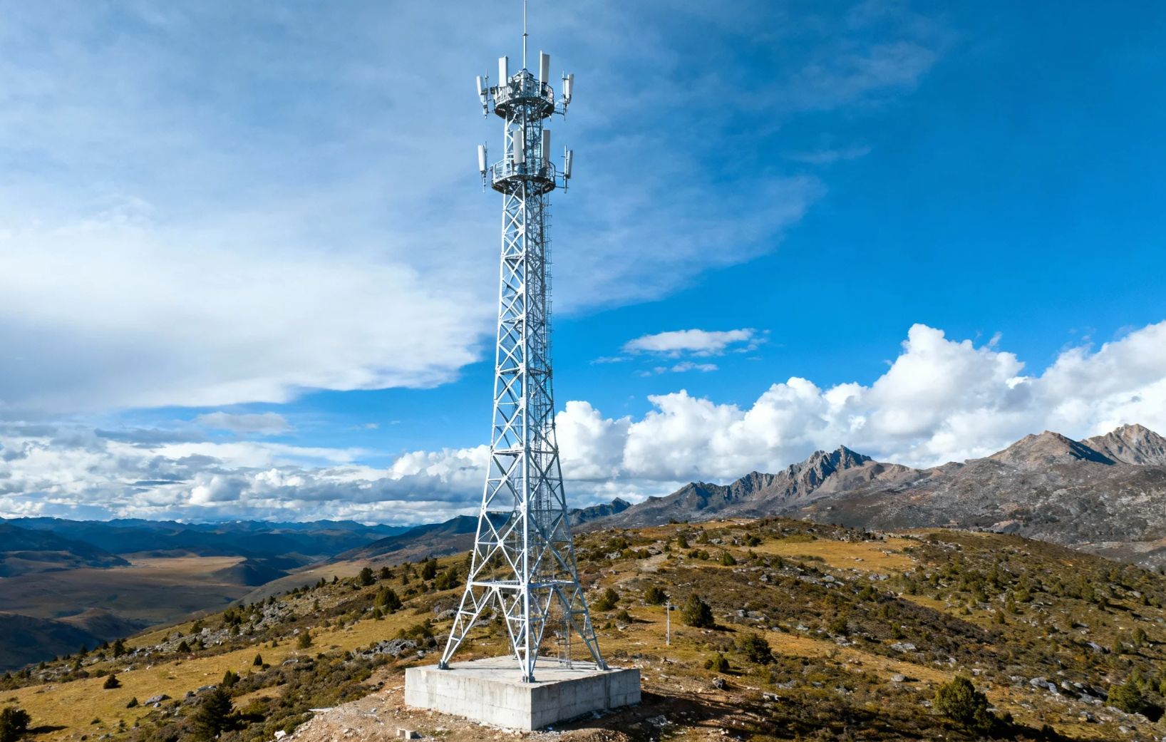
7. Communication
If you stick to the main G318/G317, normal mobile signal is acceptable. If you plan serious off-road detours, bring a reliable satellite phone — in those signal-dead zones it is your last link to the outside world.
I didn’t bring one (too expensive and I stay on main routes), but I always carry at least two SIM cards — China Mobile has by far the best coverage.
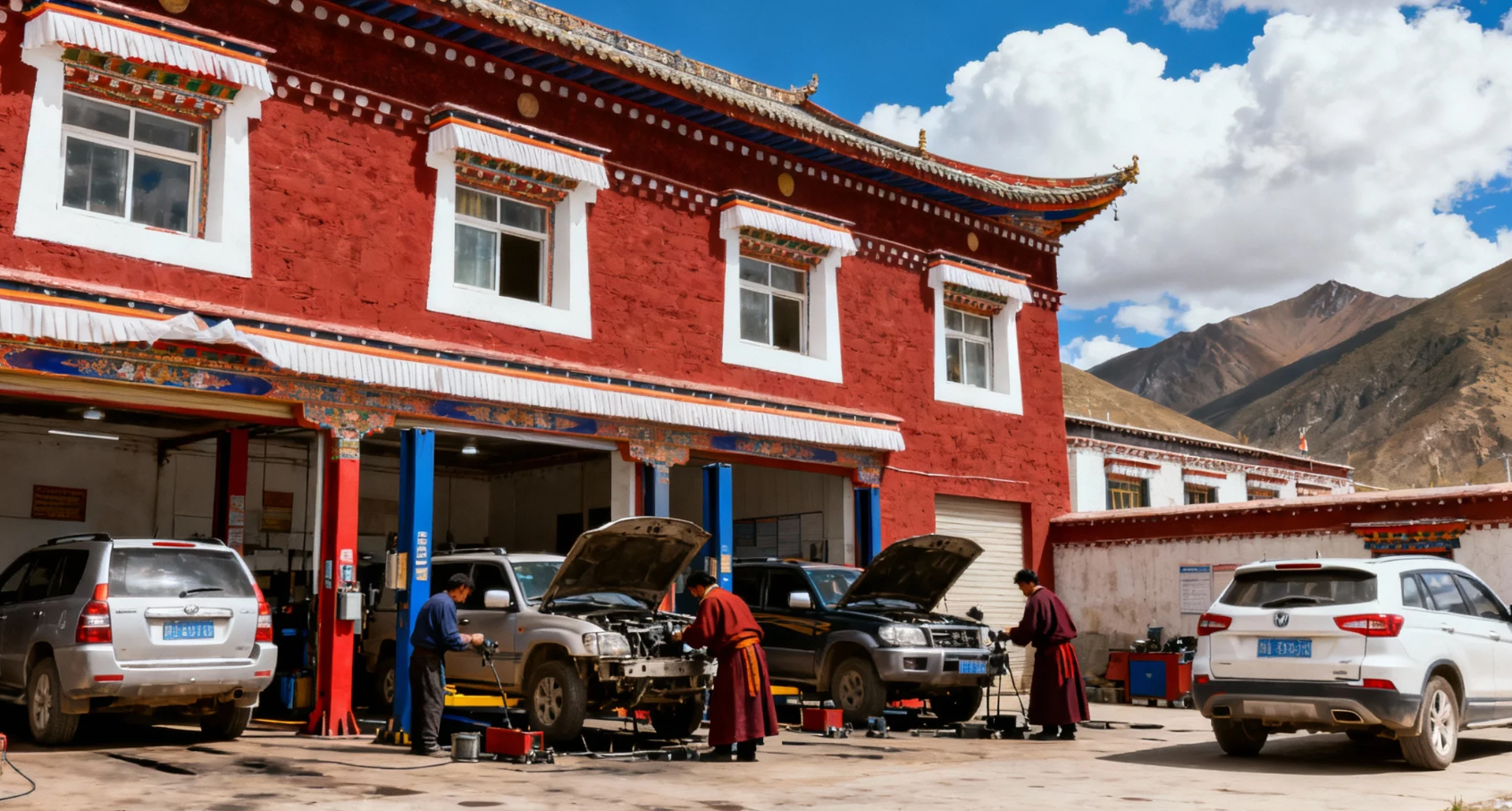
8. Vehicle Repair
Rent the newest car you can afford — never save money by taking a high-mileage old car. Changing a tire at 4,500 m in freezing wind while out of breath is no joke.
If something breaks, rescue can take a full day or more, and rare models can leave you stuck for a week waiting for parts.
I was lucky — nothing broke — but I still carried anti-slip chains, tire sealant, and a portable pump.
Golden rule: choose a very common model (Toyota, etc.) so parts are available in every prefecture-level city. Also research repair shop reputation in advance via Chinese car forums — many mechanics work by “experience” only and ignore proper torque specs.
9. Permits & Checkpoint Checks (2026 Updated)
Foreigners are not allowed to self-drive inside Tibet Autonomous Region. You can self-drive freely in Western Sichuan (Garzê & Ngawa Prefectures) — scenery is just as stunning and one month is not enough to see everything.
For self-driving Western Sichuan you need:
1. Valid Chinese visa
2. Temporary Chinese driving permit (apply in Chengdu with passport + international license + translation + health certificate + photos, 1–3 days, almost free)
3. Full insurance + rental contract
4. Border permit only if going to remote areas like Dege or Baiyu
For entering Tibet proper you must join an organized tour and:
1. Chinese visa
2. Tibet Travel Permit (TTP) — only through registered Tibet travel agency, 7–15 days in advance
3. Border Defense Permit listing every remote county you will visit
10. Budget
My 19-day solo days cost a little more than 18,000 RMB — I saved money by booking the rental car early, eating simple food (noodles every day is fine for me), staying in basic non-oxygen hotels (I know my body well), and buying zero souvenirs (most are cheap Yiwu wholesale goods — I used to live and work in Yiwu, I know the real cost).
Fuel alone was about 3,000 RMB (≈0.5 RMB/km for ~6,000 km total driving).
Everyone’s comfort level and budget are different, so I can’t give an exact figure, but this is a realistic “frugal but comfortable” reference.

5 Best Photography Spots on G318 + Lhasa Loop
1. Heavenly Road 18 Bends (Jianziquwan Pass) – 4,659 m, endless hairpins, drone heaven
2. Sister Lakes (Haizi Mountain) – September sapphire lakes + snow peaks, sacred beauty
3. Laigu Glacier – white dragon ice tongue, drone 2 km face-to-face, time freezes

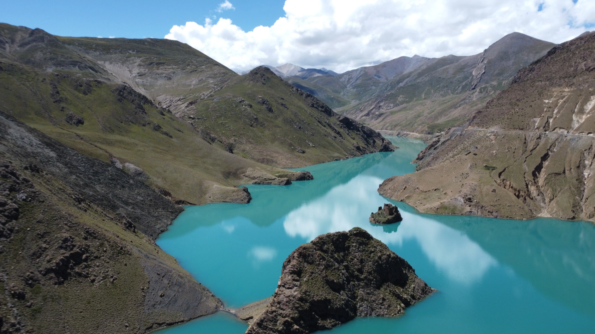
4. Manla Reservoir – bluest water I’ve ever seen in Tibet
5. Yamdrak Lake (Sheep Lake) – one of Tibet’s three holy lakes, 4,441 m turquoise ribbon that changes color with light

Why I Created the Lifetime Membership (Instead of Just Selling PDFs)
Because I truly love travel, and more and more foreigners are coming to drive Western China & Tibet. This is a unique and harsh geographical unit that most people never experience in their lifetime. I want to share real, hard-earned experience so you can travel safer and smoother.
After you return home, you’ll still receive continuous updates, share photos, and keep the memories alive forever instead of forgetting after a few years.
Every place in my guides I have personally visited (the few I haven’t are clearly marked and will be verified in person). This is responsibility and passion.
Your support gives me the motivation and resources to keep exploring and keep delivering authentic, warm, reliable guides. Every update is new exploration; every membership is us together writing the beauty of China.
The Sichuan–Tibet Highway is not just a road—it’s a ceremony to restart your life. Whether you self-drive or join a tour, come once. When you stand at the top of Jianziquwan Pass overlooking the dragon-like 18 bends, that moment of shock and awe will stay with you forever.
See you on the roof of the world!
“If you found this guide helpful and want to keep it forever fresh,
consider joining as my Lifetime Member —
From now on — Sichuan-Tibet, Qinghai-Tibet, Xinjiang-Tibet…
Every new route I drive, every policy change, every updated road condition,
I’ll push the latest version to you for free, the moment I come back.
One payment, lifetime updates, never expires.
Interested? Tap the button below→
Comments (0)
CC BY-NC-ND 4.0 License
Credit to Gerry Hu / ChinaTravelPDF
No commercial use
No modifications allowed
Unlock Remaining 70% Premium Content
This is a VIP Exclusive Article. Become a lifetime member to unlock all VIP articles and all available city guides.
🎁 1 Year Free Expert Q&A Support (Early Bird Exclusive - First 500 Only)
China National Highway 318
20 Must-Visit Attractions You'll Regret Missing (FREE PDF)
Related Articles

The Ultimate 5100km Solo Drive: Leaving Tibet via G317 – Jinsha River, Dege Parkhang & 19-Day Goodbye – PART 6
In Part 6, the traveler departs Tibet via G317 after entering via G318, focusing on the eastward journey from Dingqing through eastern Tibet into Sichuan over several days. From Dingqing to Changdu on Day 15, the route includes skipping the bumpy, unpaved 11 km dirt road to Zizhu Temple at 5,000 meters due to poor conditions, opting instead for drone shots of the temple on Zizhu Mountain. Stops feature the massive Naicha Mani Stone Pile, a 3 km-long sacred site where pilgrims pray, and Qiangbalin Temple, the largest in Kham with roots in the Ming Dynasty. Evening brings a serene stroll at Qiangbalin Square, witnessing the crystal-clear Zhaqu River merging with the muddy Ngomqu to form the Lancang River (Mekong). On Day 16, from Changdu to Dege, the path crosses the Jinsha River (upper Yangtze) at the Sichuan-Tibet border, passing solar farms, red Aga-soil houses, and the Gangtuo 18th Army Crossing Memorial Hall. Entering Sichuan after a checkpoint, Dege offers peace, with a night visit to the majestic Dege Parkhang, a historic Tibetan printing house emitting chants and printing scents. Day 17 detours via Baiyu for superior scenery along Jinsha River, visiting Yanbi Village's mural, Jinsha River First Bend confluence, Baiyu Temple atop a steep climb with prayer wheels and incense, Changtai Grassland, Yachen Gar (largest nunnery in western Sichuan, remote and tranquil), and Lalong Cuo Lake, a shrinking tectonic lake with salt flats and herder tents. The route includes Zhuo Da La Mountain's photo spot and a long tunnel descent to Garzê County. Day 18 covers Garzê to Maerkang with gentle downhill, autumn colors, monkey encounters, and cautious navigation through extensive gravel construction zones with rockfall risks. The 19-day trip concludes on Day 19 with a smooth expressway drive to Chengdu, reflecting on plateaus, monasteries, and inner calm. Survival tips include early starts to avoid packed schedules, confident driving for narrow, steep accesses like Baiyu Temple, careful slow driving on unpaved or gravel sections, drone use limited by altitude, and awareness of high-plateau winds, cold, and emotional reluctance at borders.

The Ultimate 5100km Solo Drive: I Ended Up in Hospital at 4500m & Still Say G317 Is Worth It – Here’s Exactly How to Survive It PART 5
Part 5 of the blog details the G317 Northern Route from Lhasa to Naqu and beyond, emphasizing high-altitude survival challenges. Starting at Lhasa's 3,650 meters, the drive north to Naqu (around 4,500 meters) involves steady climbs, with landscapes shifting to vast plateaus, grasslands, and snow-capped peaks under Bön religious influences. High passes and elevations exceed those on the G318 Southern Route, making altitude sickness the primary challenge; the author experienced severe oxygen deprivation at Naqu due to a poorly ventilated hotel without supplemental oxygen, leading to a midnight hospital visit for oxygen therapy at Naqu City People’s Hospital, where 10–15 minutes of treatment provided significant relief, and staying until morning ensured rest. Descending to Suo County (3,800 meters) alleviated symptoms, with tips like sipping glucose water for mild issues. High passes include the Nyenchen Tanglha Mountains viewpoint, but the route features smoother, flatter roads with lighter traffic—one-third of G318’s—and fewer steep climbs. Wildlife is minimally mentioned, with no specific encounters noted. Travel advice includes booking oxygen-supplied hotels (200–300 yuan extra), checking vehicles thoroughly before Lhasa departure due to remote repairs, carrying portable oxygen cans if altitude-sensitive, knowing personal limits, and preparing for profound, peaceful scenery in quieter northern Tibet.

The Ultimate 5100km Solo Drive: 4 Defining Days (5-8) Navigating the G318/G317's Highest Passes Part 3
In Part 3, the journey crosses from Sichuan into Tibet, starting in Batang (2,800 m) and entering via the Jinsha River Bridge into Mangkang, surrounded by flaming-red mountains. Day 5 involves conquering three high passes—Yela Shan, Jueba Shan, and Dongda Shan (5,130 m, the highest on G318 & G317)—with elevations up to 5,130 m, followed by a downhill to Zuogong (3,750 m). Precautions include watching for landslides and mud-rock flows. Day 6 features foggy starts in Zuogong, a revisit to Yela Shan (4,658 m), and the terrifying Nu River 72 Turns with narrow roads, crumbling rocks, sheer drops, potholes, and a 3-hour traffic jam from a landslide. Attractions include Bangda Grassland viewpoint. Overnight in Basu. Day 7 offers rewards like Ranwu Lake at sunrise (mirror-calm waters reflecting peaks) and Laigu Glacier (gigantic white glacier with boardwalk), with drone tips for cold winds. Day 8 includes Sutong Horseshoe Bend on Palong Zangbo River, Lulang Gongcuo Lake, Lulang Forest Sea, and Sejila Mountain (4,728 m). Ends in Nyingchi (Linzhi), Tibet's mild "Jiangnan." The Batang to Basu segment (~360 km) crosses three rivers (Jinsha, Lancang, Nu) and four major passes (Lawu at 4,338 m, Jueba at 3,940 m, Dongda at 5,130 m, Yela at 4,658 m), noted as the most epic and demanding. Advice: Check road conditions nightly via WeChat, avoid tired driving, book hotels and parking ahead, especially for plateau inexperience.