The Ultimate 5100km Solo Drive: 4 Defining Days (5-8) Navigating the G318/G317's Highest Passes Part 3

Part 3: Crossing into Tibet – Batang to Nyingchi (Day 5–8)
DAY 5: September 7, 2024 – Batang → Mangkang → Zuogong (Left Gong)
Entering the Real Tibet
Slept like a baby in Batang (2,800 m) — way better than Litang. Rule of thumb: always choose Batang over Litang for overnight if you have the choice. Litang’s 4,014 m knocks many people out and makes them want to quit the whole route.
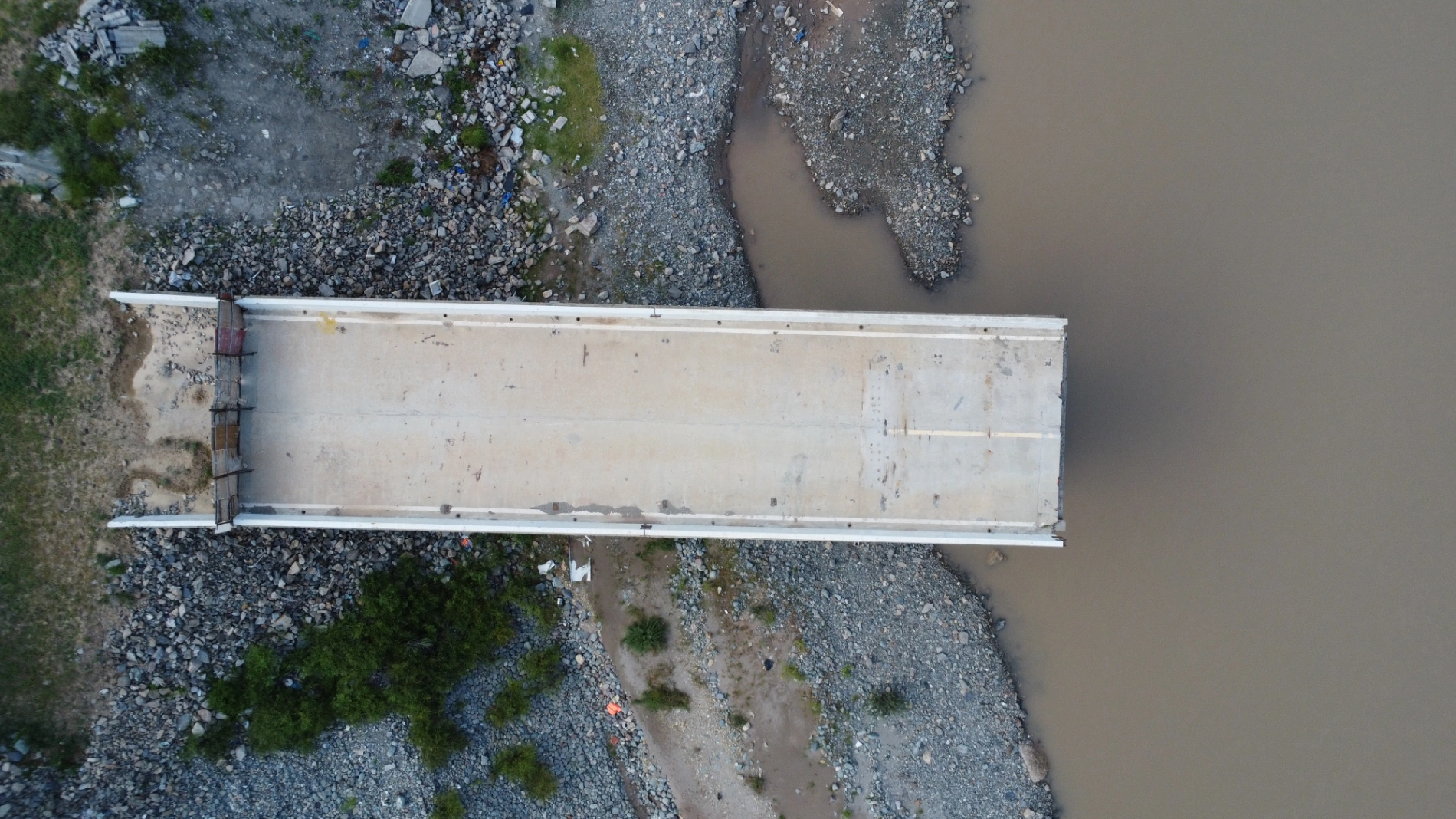
Morning drive to the Jinsha River — the natural border between Sichuan and Tibet Autonomous Region. Crossed the brand-new Jinsha River Bridge (the old one was destroyed by floods years ago). The second my wheels rolled over that bridge, I was officially in Tibet.
Instant change: the mountains turned shattered and red, rock faces fractured like the earth had been ripped open. Landslides and mud-rock flows are common here — warning signs every few hundred meters.
First checkpoint: waited about 1 hour. Then straight to Mangkang (Mangkam) — the whole town is surrounded by flaming-red mountains.
Quick lunch, then tackled three monsters in one day:
- Yela Shan (Ye La Mountain)
- Jueba Shan (Jue Ba Mountain)
- Dongda Shan (东达山, 5,130 m) — the highest point of the entire G318 & G317 loop.
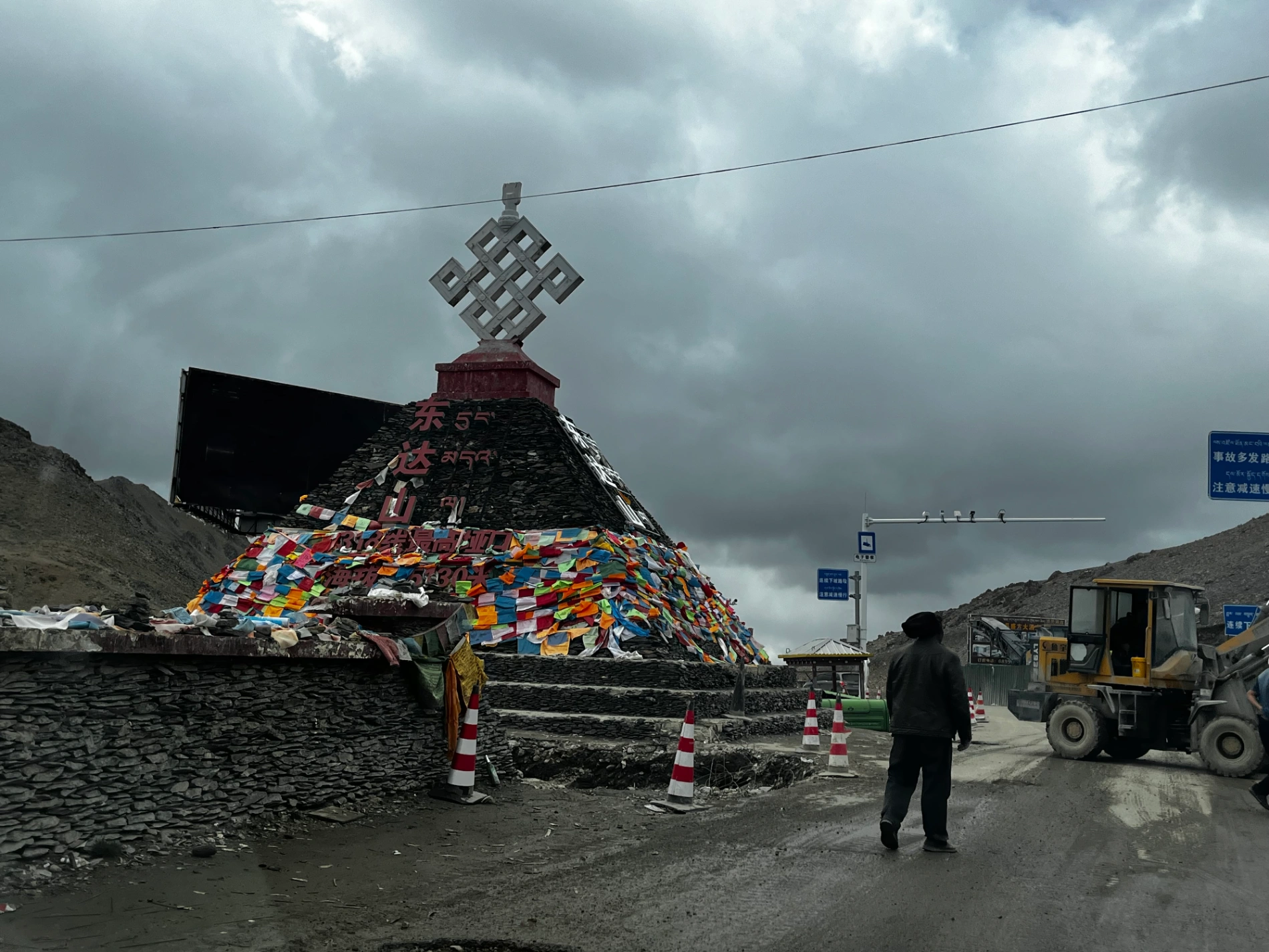
Stood at Dongda Pass (5,130 m) — my first time ever above 5,000 m. Construction everywhere, road half-destroyed, but the view made every pothole worth it. Felt like I had conquered something massive.
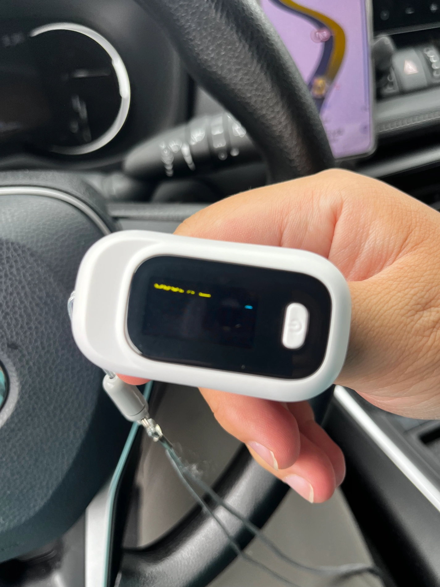
(The pulse oximeter is fine, just didn't get a good reading)
Downhill roller-coaster all the way to Zuogong (3,750 m). Body was exhausted from three 4,000 m+ passes in one day. First night ever sleeping above 3,000 m on this trip. Was a little nervous (remembering my severe reaction at 3,800 m years ago), but woke up perfectly fine. No oxygen rooms for me — this whole journey is also a test of how far my body can actually go.
DAY 6: September 8, 2024 – Zuogong → Basu (Baxoi) via the Terrifying Nu River 72 Turns
Woke up to thick fog in Zuogong — visibility under 50 m. Sent the drone up for some eerie shots.

Lunch in Bangda, then to the Bangda Grassland viewpoint — stunning. A lovely couple saw my drone photos, added my WeChat, and I sent them the files. Little moments like that melt away the loneliness.
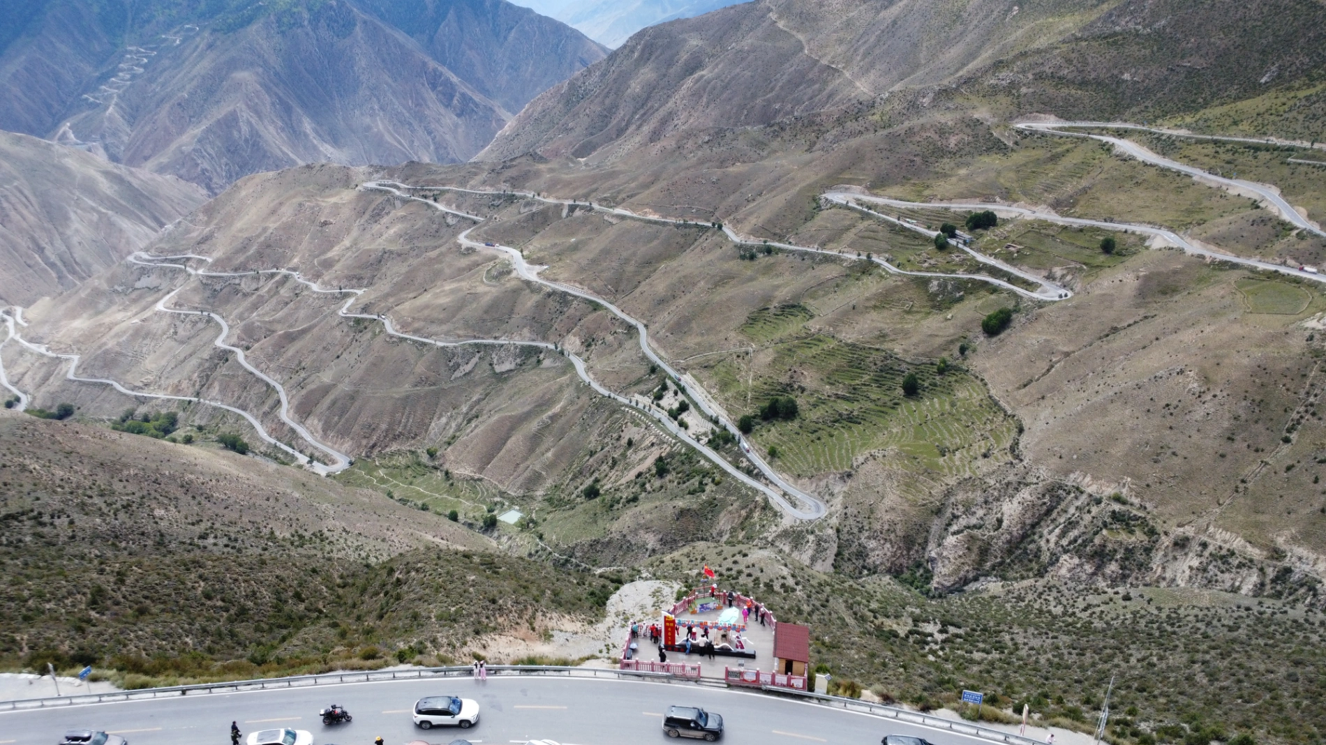
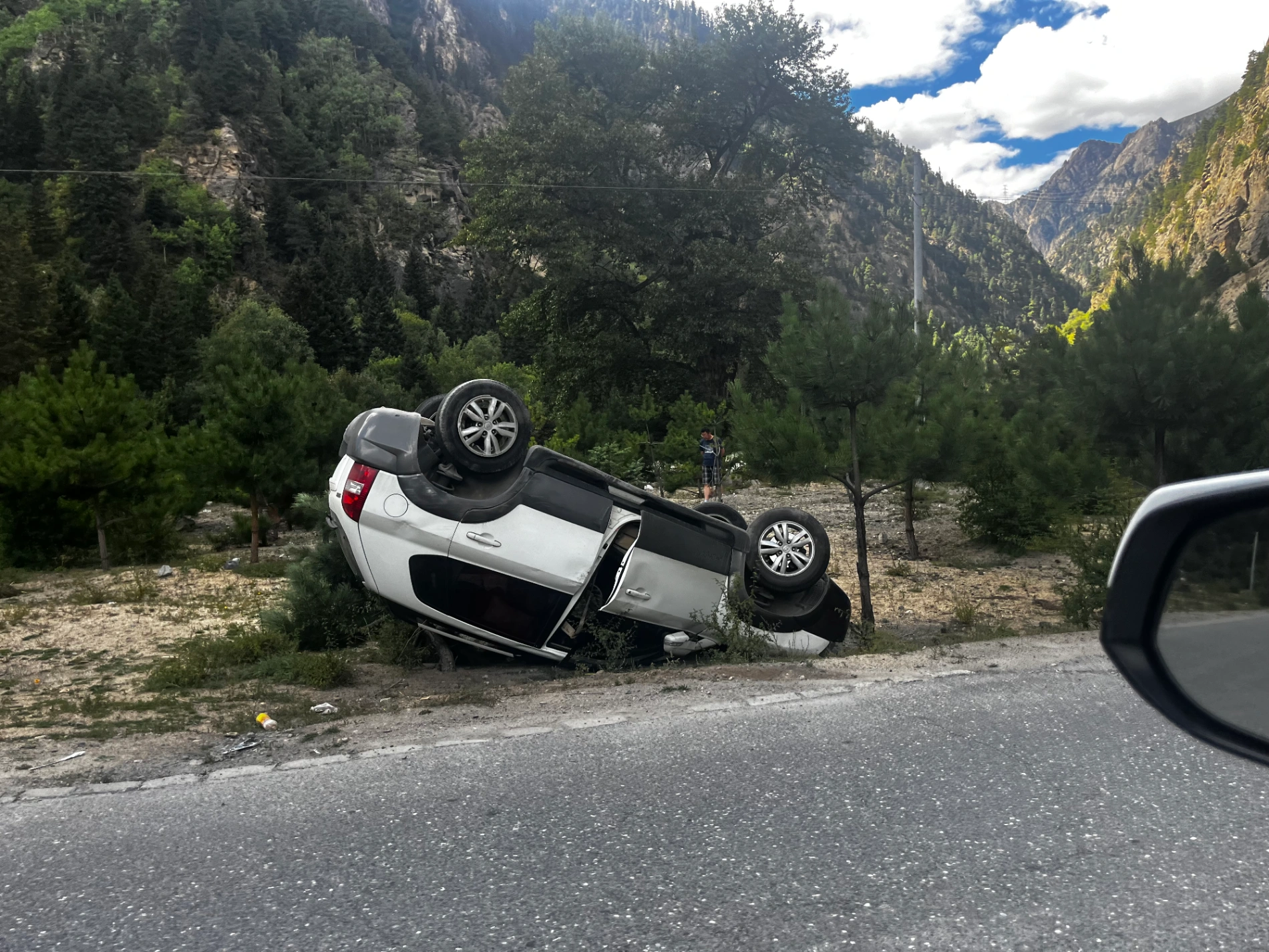
Then came the infamous Yela Shan (4,658 m) again (different side) and the heart-in-mouth Nu River 72 Turns (怒江72拐) — the single most nerve-wracking stretch I drove the entire 18 days.
The road is insanely narrow, rock walls crumbling on one side, sheer drop to the Nu River on the other. Ongoing construction, potholes everywhere. Got stuck behind a convoy of slow trucks for ages. Finally lost patience and overtook one by one on blind hairpins — looking back, that was reckless. One tiny mistake and you’re gone forever.
Reached the bottom… and hit the worst traffic jam of the trip: 3 solid hours because of a small landslide repair. Sitting there staring at loose boulders above me, praying they wouldn’t fall.

Finally released, arrived Basu (八宿) around dusk. Tiny town, nothing to do — dinner, short walk, sleep.
DAY 7: September 9, 2024 – Basu → Ranwu Lake → Laigu Glacier → Bomi
The two hardest driving days were behind me — today felt like reward day.
Skipped breakfast (my 10+ year habit — science says it’s fine and my body agrees).
First stop: Ranwu Lake (然乌湖) at sunrise — mirror-calm water reflecting snow peaks. Did the west side (tourist center), lunch in Ranwu town, then the far superior east viewpoint. Sat on a rock for ages just listening to the wind.

Then the absolute highlight: Laigu Glacier (来古冰川) — a gigantic white dragon spilling into the valley. Walked the boardwalk, freezing air hitting my face. Pro tip: bring a drone and fly with a 100 % charged battery. Cold + strong wind drains power fast. I lost 3 drones in the past learning this the hard way. (Full drone survival guide coming exclusively for Lifetime Members.)

On the way out, a tour guide saw me jump in the car alone and asked, “Brother, you really doing this solo?” Gave me a big thumbs-up. Smiled, started the engine, and rolled on.
Overnight in quiet little Bomi (波密).
DAY 8: September 10, 2024 – Bomi → Nyingchi (Linzhi), the “Jiangnan of Tibet”

Early start again. First stop: the jaw-dropping Sutong Horseshoe Bend on the Palong Zangbo River — a perfect U-turn carved into the canyon. Stood on the cliff edge in morning mist — pure awe.
Thanks to a road-repair WeChat alert the night before, I left extra early and beat the single-lane traffic — I was literally the 5th car in line.
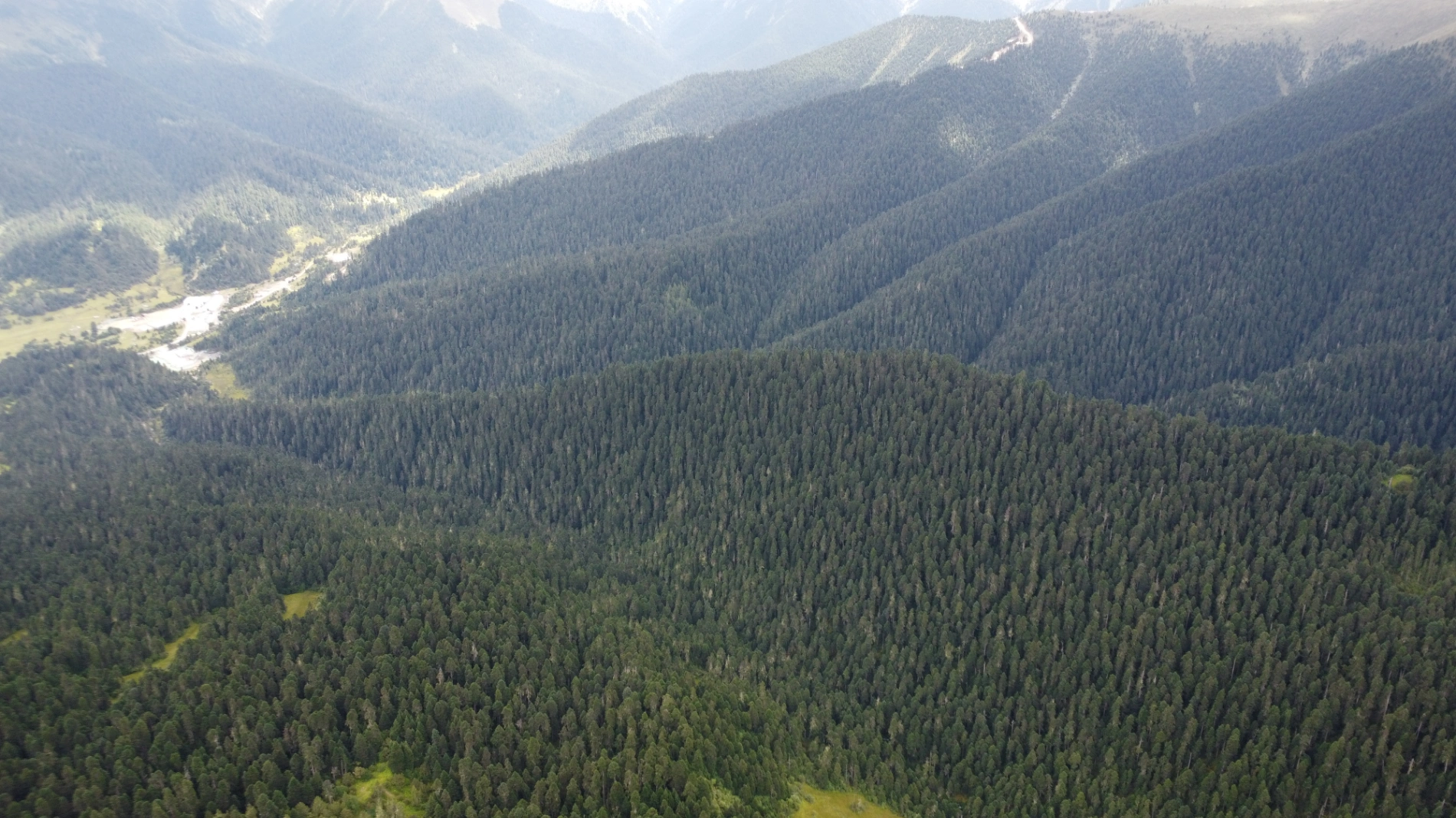
Quick spin around Lulang Gongcuo Lake, nap in the car, lunch in Lulang Town, then drone up over the massive Lulang Forest Sea. Clear day — could’ve seen Namcha Barwa (7,782 m) from the viewpoint, but like 99 % of visitors, it stayed hidden in cloud. No regrets — its mystery is part of the magic.
Last pass of the day: Sejila Mountain (色季拉山, 4,728 m) — chilly, but after 5,130 m it felt easy.
Rolled into Nyingchi around 3 p.m. — Tibet’s green, mild “Jiangnan”. Ordered delivery, chilled in a square, wrote notes so I wouldn’t forget these days.
Summary: The Legendary Batang → Basu Core Section – The Most Epic & Demanding Stretch of G318
This ~360 km segment from Batang to Basu is universally regarded as the absolute heart and soul of the southern Sichuan-Tibet Highway (G318) — the most dramatic, most beautiful, and most dangerous part of the entire route. In just two driving days you cross three world-famous rivers and conquer four major high-altitude passes, including the highest point on the whole G318.
Four Monster Passes You Must Conquer
- Lawu Pass (拉乌山) – 4,338 m
Your first big climb after entering Tibet from Mangkang.
- Jueba Pass (觉巴山) – 3,940 m
Not the highest, but insanely steep switchbacks plunging straight into the Lancang River gorge.
- Dongda Pass (东达山) – 5,130 m
Highest point on the entire G318 main line — the ultimate test of car, body, and mind.
- Yela Pass (业拉山 / Yela Mountain) – 4,658 m
Immediately followed by the world-famous Nu River 72 Turns (怒江72拐 / 99 Bends) — one of the most visually shocking road sections on Earth.
Three Mighty Rivers You Cross
- Jinsha River (金沙江) – New bridge marks the official Sichuan → Tibet border.
- Lancang River (澜沧江 / upper Mekong) – Crossed near Zhuka after Jueba Pass.
- Nu River (怒江 / Salween) – Bottom of the 72 Turns; end of the scariest continuous descent.

Town & Overnight Sequence
Batang (Sichuan) → Mangkang → Zuogong → Bangda → Basu (八宿)
(Recommended overnights: Batang or Mangkang → Zuogong → Basu)
Hard-Earned Advice from Someone Who Just Did It Solo
- This section is complex and unforgiving. It’s not about whether you can drive — it’s whether you’ve ever driven at 4,000–5,000 m altitude with crumbling roads, zero guardrails, and sudden weather.
- Check road conditions every single night via local traffic WeChat public accounts or road-condition groups.
- Never drive tired. Fatigue + thin air + bad roads = disaster. Every proper night’s sleep is literally an act of responsibility toward your own life.
- Book hotels & parking ahead (especially Zuogong & Basu).
For anyone without plateau driving experience: the in-depth, no-BS plateau self-driving survival guide . will be released exclusively in the Lifetime Member area very soon. One single tip from it can easily prevent a life-threatening mistake.
Next stop: Lhasa — the holy city is waiting.
Four days, four worlds: from the raw, broken gates of Tibet to glacier tongues and emerald rivers. Tomorrow — Lhasa at last.
Next part: the holy city, Potala Palace, and the long journey home via G317.
Stay tuned — the roof of the world is calling louder than ever. 🚙🏔️
(End of Part 3)
Comments (0)
CC BY-NC-ND 4.0 License
Credit to Gerry Hu / ChinaTravelPDF
No commercial use
No modifications allowed
Unlock Remaining 70% Premium Content
This is a VIP Exclusive Article. Become a lifetime member to unlock all VIP articles and all available city guides.
🎁 1 Year Free Expert Q&A Support (Early Bird Exclusive - First 500 Only)
China National Highway 318
20 Must-Visit Attractions You'll Regret Missing (FREE PDF)
Related Articles

The Ultimate 5100km Solo Drive: Leaving Tibet via G317 – Jinsha River, Dege Parkhang & 19-Day Goodbye – PART 6
In Part 6, the traveler departs Tibet via G317 after entering via G318, focusing on the eastward journey from Dingqing through eastern Tibet into Sichuan over several days. From Dingqing to Changdu on Day 15, the route includes skipping the bumpy, unpaved 11 km dirt road to Zizhu Temple at 5,000 meters due to poor conditions, opting instead for drone shots of the temple on Zizhu Mountain. Stops feature the massive Naicha Mani Stone Pile, a 3 km-long sacred site where pilgrims pray, and Qiangbalin Temple, the largest in Kham with roots in the Ming Dynasty. Evening brings a serene stroll at Qiangbalin Square, witnessing the crystal-clear Zhaqu River merging with the muddy Ngomqu to form the Lancang River (Mekong). On Day 16, from Changdu to Dege, the path crosses the Jinsha River (upper Yangtze) at the Sichuan-Tibet border, passing solar farms, red Aga-soil houses, and the Gangtuo 18th Army Crossing Memorial Hall. Entering Sichuan after a checkpoint, Dege offers peace, with a night visit to the majestic Dege Parkhang, a historic Tibetan printing house emitting chants and printing scents. Day 17 detours via Baiyu for superior scenery along Jinsha River, visiting Yanbi Village's mural, Jinsha River First Bend confluence, Baiyu Temple atop a steep climb with prayer wheels and incense, Changtai Grassland, Yachen Gar (largest nunnery in western Sichuan, remote and tranquil), and Lalong Cuo Lake, a shrinking tectonic lake with salt flats and herder tents. The route includes Zhuo Da La Mountain's photo spot and a long tunnel descent to Garzê County. Day 18 covers Garzê to Maerkang with gentle downhill, autumn colors, monkey encounters, and cautious navigation through extensive gravel construction zones with rockfall risks. The 19-day trip concludes on Day 19 with a smooth expressway drive to Chengdu, reflecting on plateaus, monasteries, and inner calm. Survival tips include early starts to avoid packed schedules, confident driving for narrow, steep accesses like Baiyu Temple, careful slow driving on unpaved or gravel sections, drone use limited by altitude, and awareness of high-plateau winds, cold, and emotional reluctance at borders.

The Ultimate 5100km Solo Drive: I Ended Up in Hospital at 4500m & Still Say G317 Is Worth It – Here’s Exactly How to Survive It PART 5
Part 5 of the blog details the G317 Northern Route from Lhasa to Naqu and beyond, emphasizing high-altitude survival challenges. Starting at Lhasa's 3,650 meters, the drive north to Naqu (around 4,500 meters) involves steady climbs, with landscapes shifting to vast plateaus, grasslands, and snow-capped peaks under Bön religious influences. High passes and elevations exceed those on the G318 Southern Route, making altitude sickness the primary challenge; the author experienced severe oxygen deprivation at Naqu due to a poorly ventilated hotel without supplemental oxygen, leading to a midnight hospital visit for oxygen therapy at Naqu City People’s Hospital, where 10–15 minutes of treatment provided significant relief, and staying until morning ensured rest. Descending to Suo County (3,800 meters) alleviated symptoms, with tips like sipping glucose water for mild issues. High passes include the Nyenchen Tanglha Mountains viewpoint, but the route features smoother, flatter roads with lighter traffic—one-third of G318’s—and fewer steep climbs. Wildlife is minimally mentioned, with no specific encounters noted. Travel advice includes booking oxygen-supplied hotels (200–300 yuan extra), checking vehicles thoroughly before Lhasa departure due to remote repairs, carrying portable oxygen cans if altitude-sensitive, knowing personal limits, and preparing for profound, peaceful scenery in quieter northern Tibet.

The Ultimate 5100km Solo Drive: Sacred Lakes, Mila Pass & The Guide to High-Altitude Safety PART 4
In Part 4, the journey covers the drive from Nyingchi to Lhasa via Mila Pass (5,013 meters), a key climatic divide where altitude sickness must be monitored. The author exits the expressway to take the national highway for the pass, enjoying its tranquil setting with prayer flags and snow-capped mountains, then descends while flying a drone outside restricted zones to capture the Yarlung Tsangpo River's shallow riverbed and sandbanks. From Lhasa, the route shifts to the G318 National Highway to Shigatse, offering scenic views of the river, farmlands, and mountains at the Qushui Bridge. Cultural highlights include visits to Drepung Monastery (famous for its Buddha Unfolding Festival), Tashilhunpo Monastery (seat of Panchen Lamas), and Shigatse Municipal Museum with its exhibits. On the return via a different route, stops feature Jiangsa National Wetland Park, Pelkor Chode Monastery with its 100,000-Buddha Kumbum Stupa, Gyantse Dzong Fortress (symbolizing historical resistance), and Manla Reservoir, described as a stunning blue sapphire reflecting peaks. The trip culminates at Yamdrok Lake, one of Tibet's Three Great Sacred Lakes at 4,441 meters, with its elegant, color-shifting waters like the Eye of the Earth, deemed worth any entrance fee for its unique beauty. Driving tips emphasize caution on mountain passes, avoiding strenuous activity at high altitudes, checking weather and road conditions to prevent landslides or fog-related risks, and adapting to extreme temperature differences with warm clothing and sun protection. Drone use is forbidden in Lhasa to avoid penalties.