The Ultimate 5100km Solo Drive: Leaving Tibet via G317 – Jinsha River, Dege Parkhang & 19-Day Goodbye – PART 6

Day 15: Dingqing to Changdu
The journey following National Highway 318 into Tibet and 317 out has already passed more than halfway. On the 15th day, my destination was Changdu, the largest city in eastern Tibet.
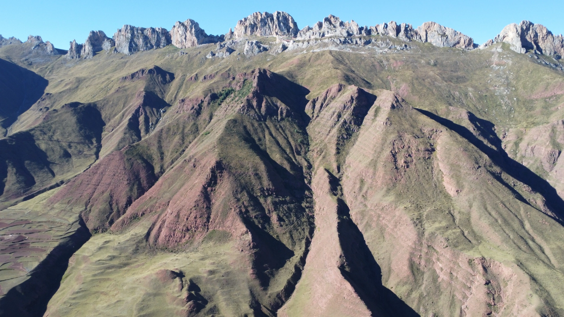
The first stop on the road from Dingqing to Changdu was Zizhu Temple, a very famous monastery in Tibet because of its unique significance. I had been hesitating whether to visit it or not. Why the hesitation? Because reaching Zizhu Temple requires crossing Zizhu Mountain at nearly 5,000 meters above sea level — though that wasn’t the main issue (I had already crossed the higher Dongda Mountain). The real problem was the final 11 kilometers from the mountain base to the temple itself: entirely unpaved dirt road, extremely bumpy, and full of sharp hairpin turns.
After driving just 200 meters onto that dirt section, I immediately decided to turn around and leave. The road condition was truly terrible, and I figured there would be future opportunities to return. Besides, the main attraction was just the temple itself, which didn’t appeal to me that much this time. As I turned back at the junction, some out-of-town self-drive tourists asked if the road was blocked. I told them no, it’s passable, but the condition is really bad and I didn’t feel like risking it.
A little while later, I reached another parking area. Right across from it stood Zizhu Mountain, with Zizhu Temple perched at the very top. I immediately parked, took out my drone, and flew it up. Unfortunately, the altitude limit prevented me from reaching the famous circular window area of the temple. I pushed it to the maximum legal height, captured a relatively clear panoramic shot, and brought it back down. Honestly, the photo still turned out pretty nice — take a look!

(Summit Front)
(the back of the foot of the mountain)
Next came Naicha Mani Stone Pile, considered one of the largest mani stone mounds in the world and holding profound religious importance in Tibetan areas. Its scale is staggering — reportedly stretching 3 kilometers long, 70 meters wide, and 30 meters high. A “mani pile” is a sacred Tibetan Buddhist practice where devotees stack stones engraved with scriptures, deities, or prayers to accumulate merit and pray for safety. Naicha Mani Pile represents the ultimate expression of this faith.
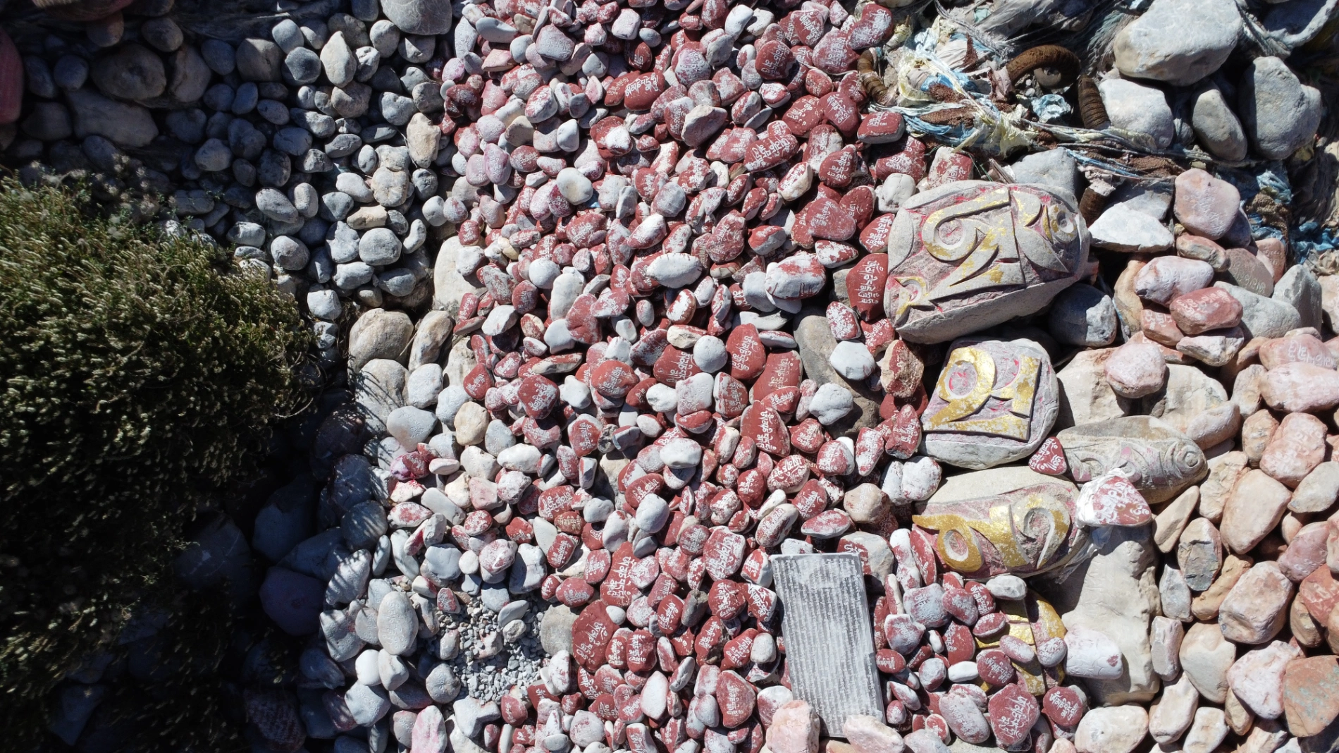
I saw many pilgrims circumambulating the mound in prayer. When my drone landed, local people gathered around curiously. After I showed them the photos I’d taken of them, they smiled happily from ear to ear.

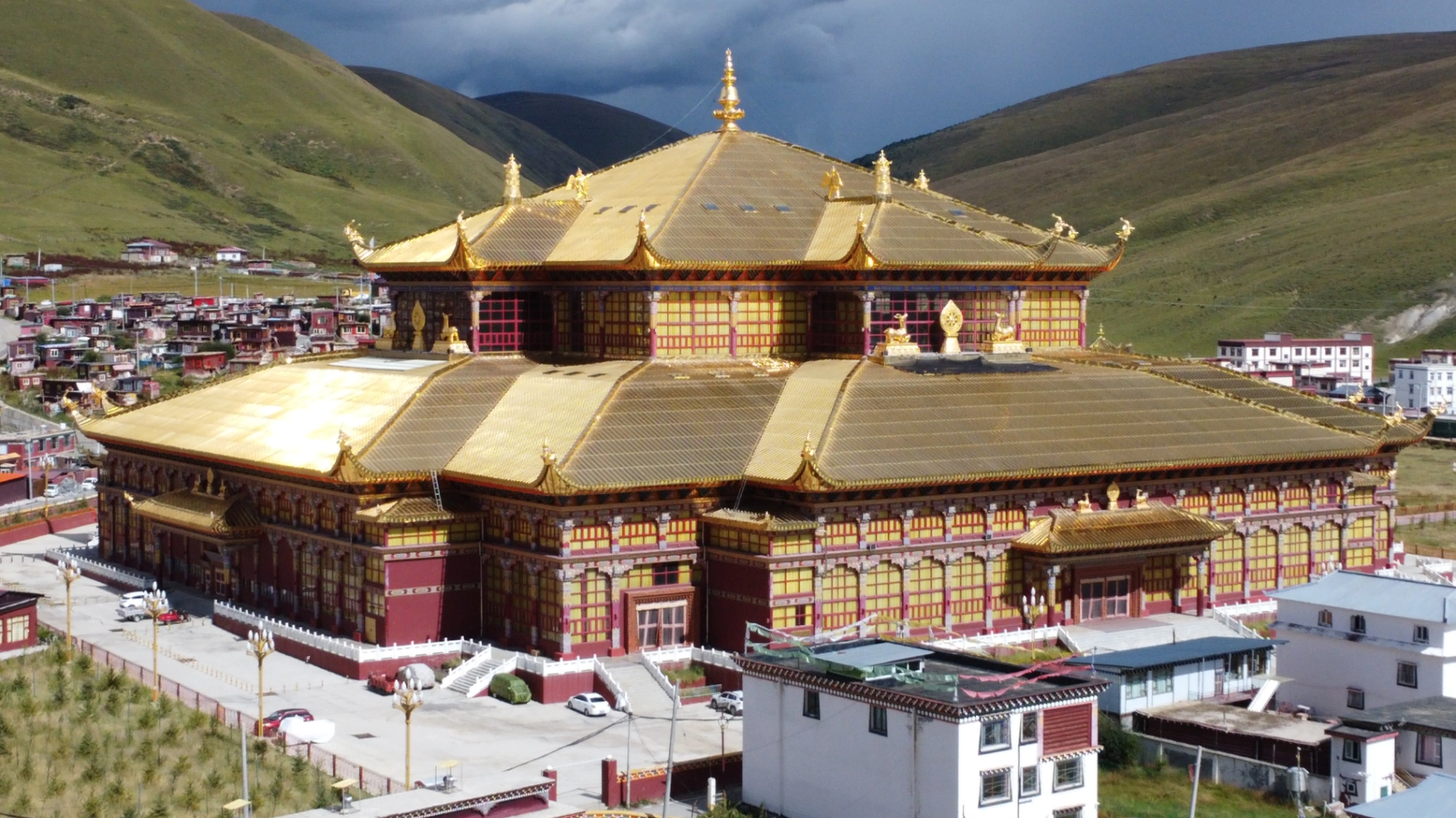
After that, I drove straight into downtown Changdu and visited Qiangbalin Temple, originally built during the Ming Dynasty. It is the largest temple in the Kham region and is named after its principal Buddha — Maitreya, the Future Buddha. The temple complex is genuinely huge. Having visited so many monasteries over the past ten-plus days, I only walked around briefly before heading back to the hotel.

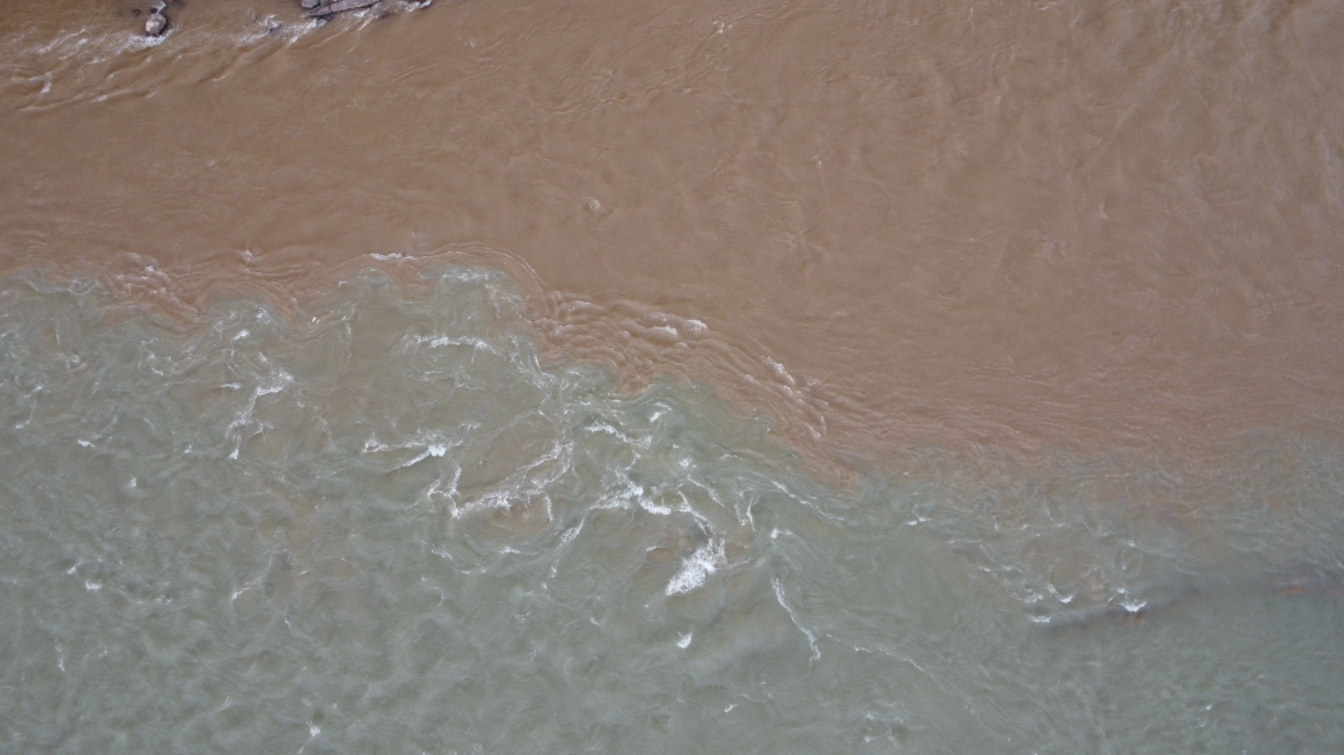
Around 5–6 PM, after dinner, I went for a stroll and ended up at Qiangbalin Square in Changdu. This is where the Zhaqu and Ngomqu rivers converge to form the Lancang River (Mekong). In fact, the Zhaqu is the true source of the Lancang. At the confluence, there’s a striking visual contrast: the Zhaqu runs crystal clear while the Ngomqu is muddy yellow — the separation is incredibly distinct (you can see it clearly in the photo).

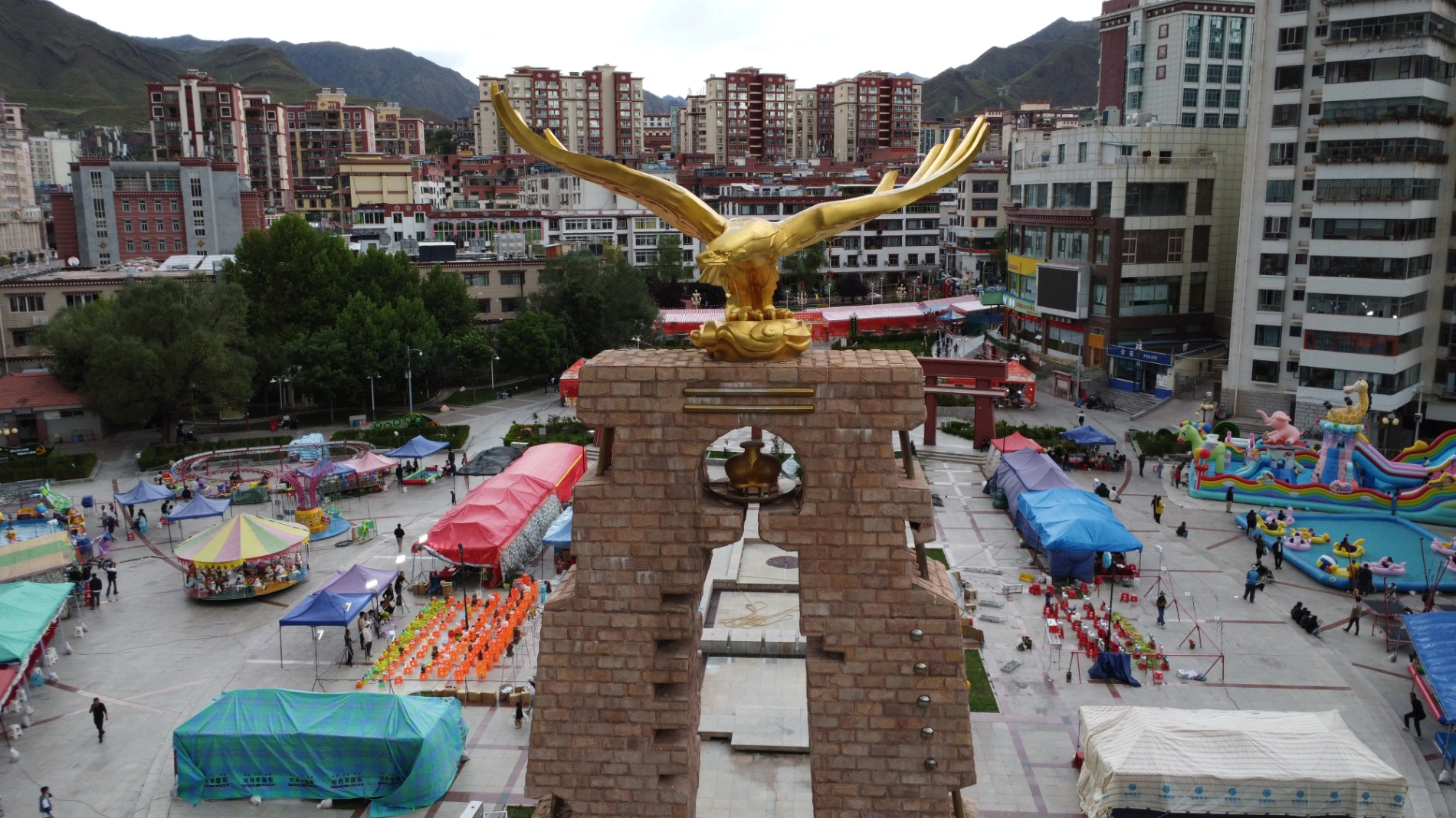
Many locals were relaxing in the square — walking, taking photos, elderly people sunbathing by the river, children running and playing. The atmosphere was peaceful and pleasant. After enjoying the scene for a while, I returned to the hotel to rest.
Day 16: Changdu to Dege
Changdu is a city in eastern Tibet, while Dege is a county-level town under Garzê Tibetan Autonomous Prefecture in Sichuan Province — meaning I was about to leave Tibet and enter Sichuan.
The first scenic spot I passed had a sign saying “One-Line-Sky Gorge”, though I didn’t photograph the exact name and can’t recall it now. The canyon itself was quite short.
Then I spotted vast fields of solar photovoltaic panels. I’ve seen plenty of solar farms in Qinghai and Xinjiang, but in Tibet this was the first time I encountered such a large-scale array along my route.
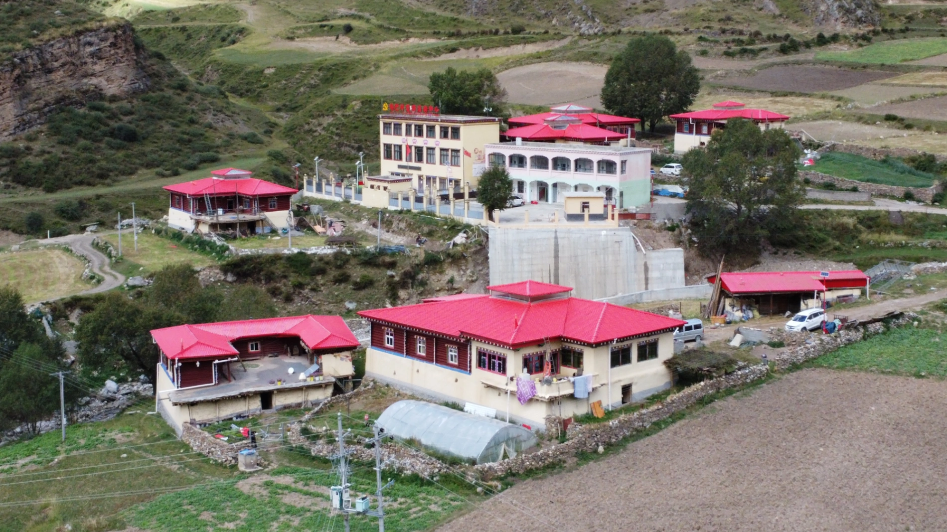
The iconic bright red houses of the Changdu area are truly stunning. Painted with local Aga soil, these vibrant red homes are scattered across hillsides and river valleys. After years of sun and rain, the walls develop unique weathered textures that glow strikingly under the intense plateau sunlight.

About an hour later, I arrived at the Gangtuo 18th Army Crossing Memorial Hall, located on the Tibet side of the Sichuan–Tibet border. It commemorates the historic moment when the 18th Army of the PLA crossed the river here during their march to peacefully liberate Tibet — the very first station of the liberation campaign.
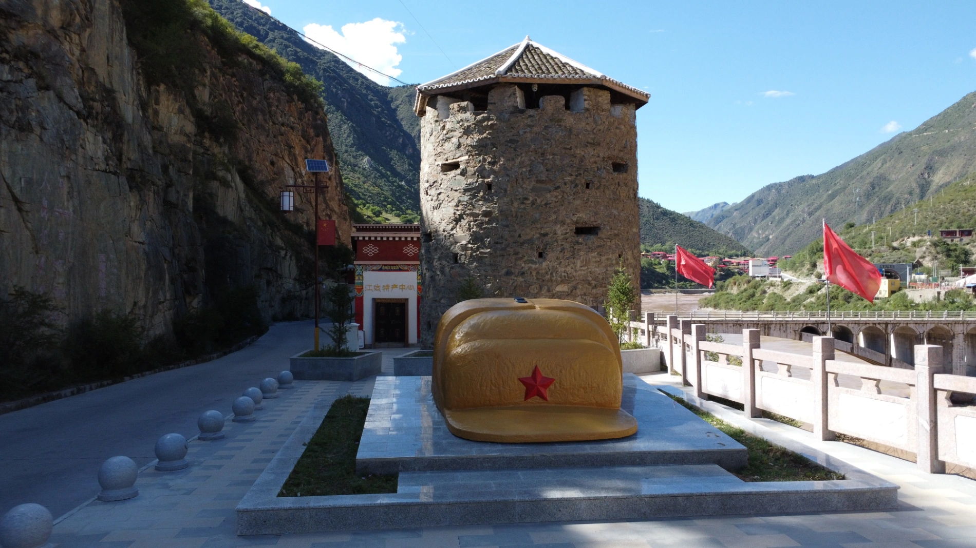
I took some photos, gazed at the quietly flowing Jinsha River (upper Yangtze), and suddenly felt a pang of reluctance. Crossing into Sichuan meant my journey was nearing its end. But then I reminded myself: this isn’t the last time — there will be more chances in the future.
After crossing the Jinsha River Bridge into Sichuan, there was a quick checkpoint inspection, then I was waved through. Dege County town is very close — only about 30 minutes away. Though small, the town feels extraordinarily peaceful and serene. I checked into my hotel, rested a bit, then took a taxi in the evening to the area around Dege Parkhang, the famous Tibetan printing house known for its massive collection of woodblocks.
Under the night sky, the printing house appeared solemn and majestic, its outer walls bathed in warm yellow light. I walked slowly along the circumambulation path, listening to the low murmur of chanting. Monks occasionally passed by carrying scriptures. The scent of traditional woodblock printing filled the lanes — it felt as if a thousand years of cultural heritage were still flowing here. Standing at the entrance, I was filled with deep respect for this enduring legacy. After a quiet moment of reflection, I returned to the hotel.
Day 17: Dege → Baiyu County → Garzê County
I could have taken the shorter direct route from Dege to Garzê, but I deliberately detoured via Baiyu because the scenery along the Dege–Baiyu–Ganbai Road is far superior. Because of the detour, the day was quite packed, so I set off early at 7:30 AM.
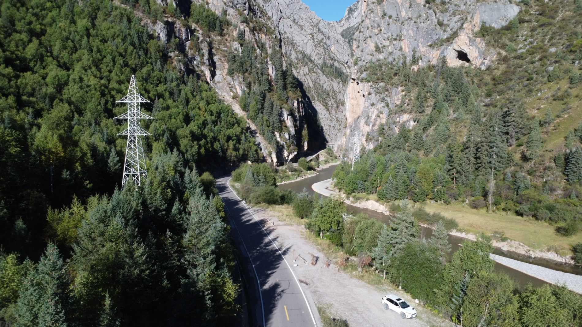
Most of the drive from Dege to Baiyu follows the Jinsha River, the upper reaches of the Yangtze. My hometown lies along the Yangtze downstream, so driving alongside its source felt deeply meaningful and emotional — what an incredible experience.
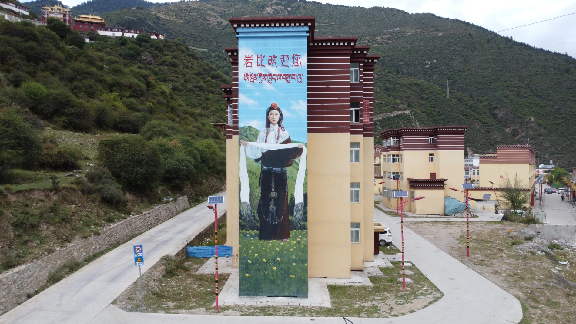
Soon I crossed a bridge into a Tibetan village where an enormous mural of a Tibetan woman was painted on the side of an apartment building. It was breathtaking — the drone shot turned out especially beautiful. The village is called Yanbi Village.
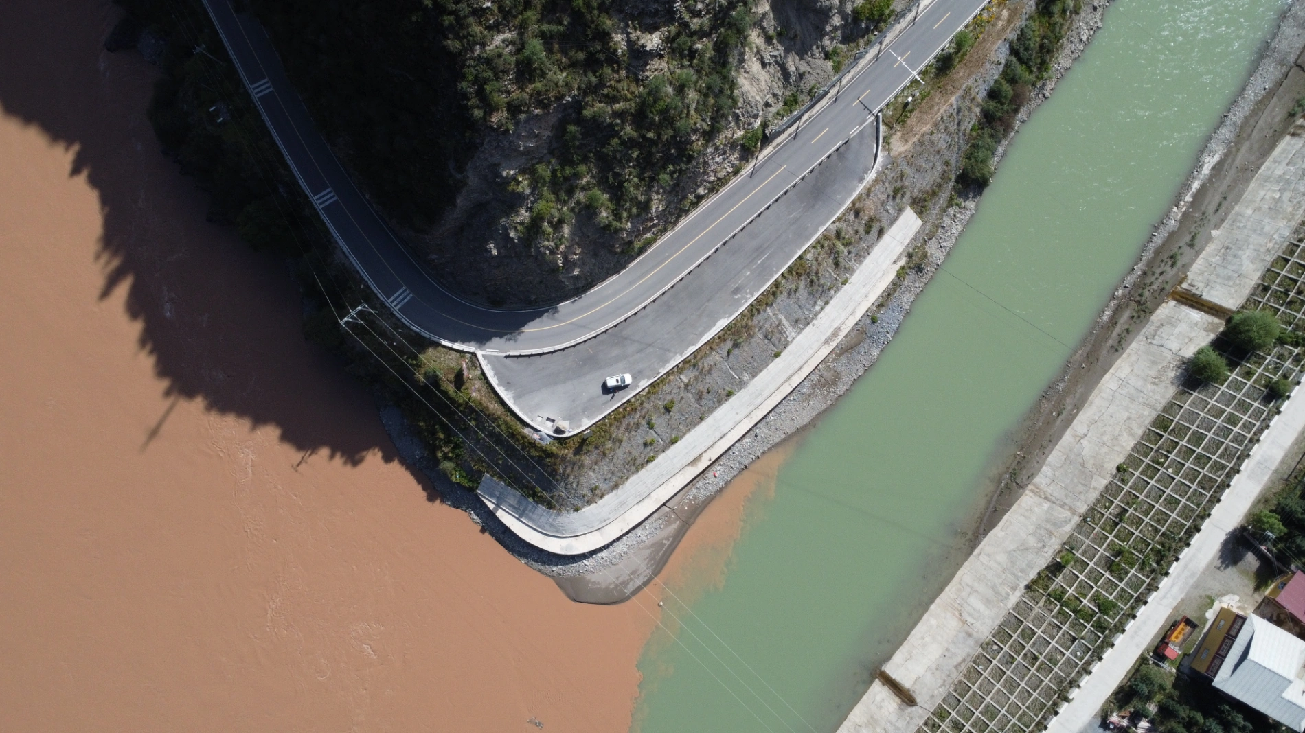
A bit further brought me to Jinsha River First Bend (there are several places claiming that title, but this one is in Baiyu County, Garzê Prefecture). Another stunning confluence — clear water meeting turbid in perfect contrast.
Next stop: Baiyu Temple, perched high on a mountain. The final stretch is narrow with very limited parking — if your driving skills aren’t confident or it’s peak season, better skip it. The temple’s red walls and golden roofs shine brilliantly in the sun. Climbing the weathered stone steps, prayer flags fluttering on both sides, the air thick with butter lamps and incense… At the top, the Jinsha River winds like a silk ribbon through the mountains. In front of the temple, huge prayer wheels stand in neat rows while an elderly monk slowly turns them, silently reciting the six-syllable mantra.

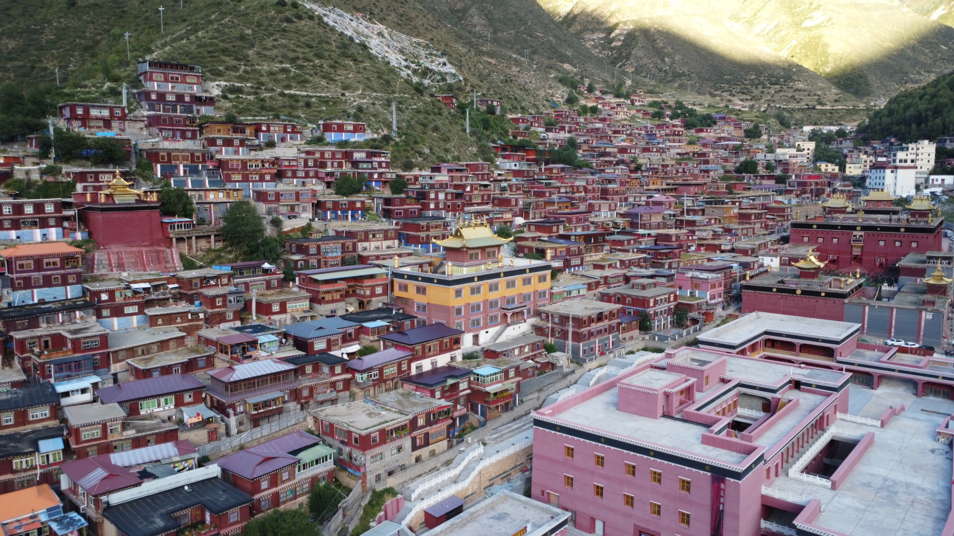
Coming down, I had planned to eat in Baiyu town, but couldn’t find parking anywhere and was already past my usual meal time — stomach growling. No choice but to keep driving. Later passed Changtai Grassland and Yachen Gar (also known as Yaqing Temple).
Yachen Gar is the largest nunnery in western Sichuan, surrounded by mountains on three sides like a blooming lotus, with hundreds of small nun houses densely packed in the valley — a spectacular sight. I didn’t explore everything because time was tight and I didn’t want to drive at night on the plateau. The nuns’ houses look almost identical to those in Seda (same color and size), and since both places are in Garzê Prefecture and I’ve already been to Seda, I didn’t feel the need for an in-depth visit. Still, Yachen’s extremely remote location brings a rare tranquility — far from main roads, perfect for those seeking true solitude.
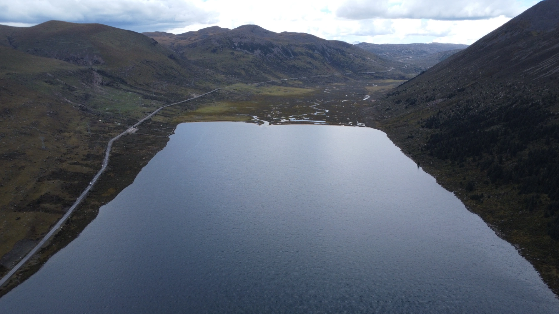
After Yachen, I soon reached Lalong Cuo Lake. I’d heard the name before but never knew where it was. Due to overcast weather, the lake looked small and not particularly photogenic, though the water was crystal clear. It’s a tectonic lake formed by crustal movement; in recent years, drought and high evaporation have caused significant shrinkage, exposing large salt flats. Some migratory birds still forage in the shallows, and scattered herder tents dot the shore — a quiet story of humans and nature coexisting amid change.

Continuing along the provincial road, the plateau wind grew colder, distant snow peaks appearing. Then came the famous best photo spot on Ganbai Road! The shape of Zhuo Da La Mountain in the distance is absolutely perfect for photography. I was flying my drone when a small tour group in two vans arrived and started their lengthy photo session — I moved on rather than wait.
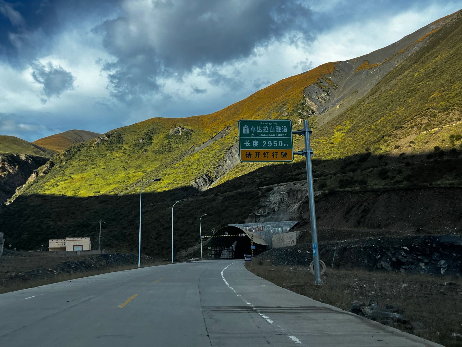
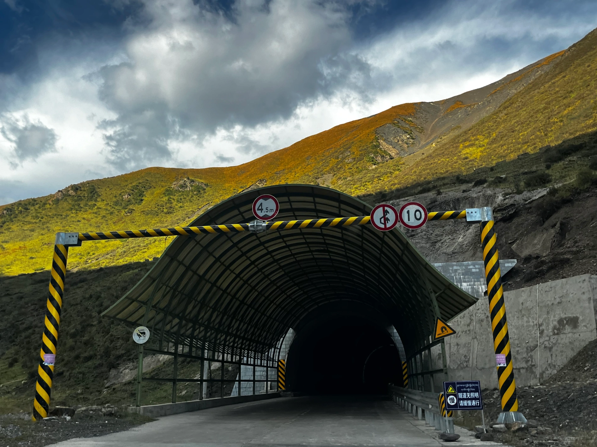
After an unknown stretch of driving, I entered the Zhuo Da La Mountain Tunnel. Emerging from the tunnel, the road immediately begins a long descent. The core continuous downhill section lasts roughly 15–20 kilometers, gradually flattening as you approach the gentle river valley of Garzê County.
The scenery on both sides is gorgeous, and there were hardly any other vehicles — it felt like I had this magnificent landscape all to myself.
Around an hour later, I arrived in Garzê County town. Having started early, it was already 6 PM by the time I checked in. I grabbed a quick dinner and rested at the hotel.
Day 18: Garzê County to Maerkang City
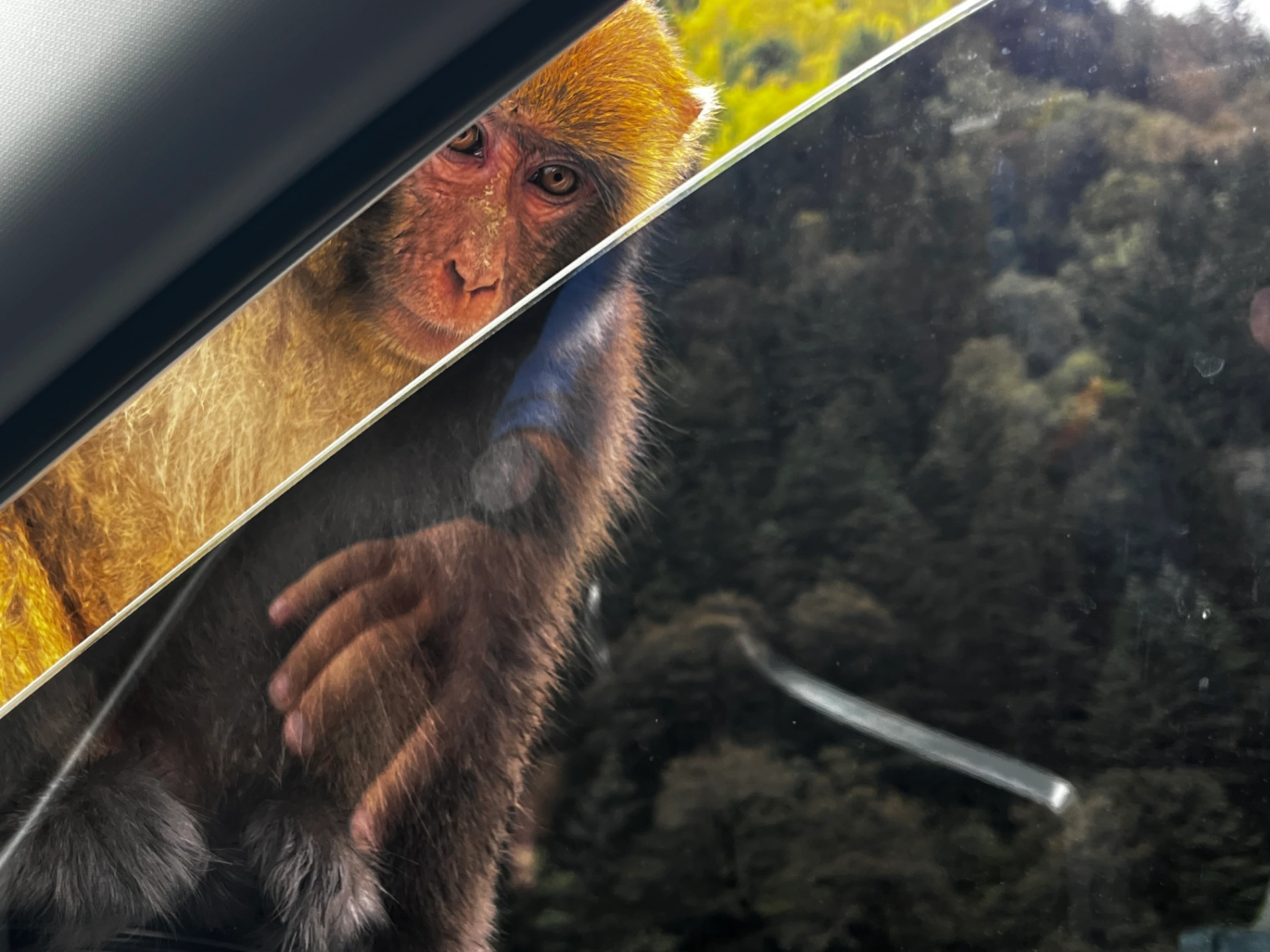
I had miscounted earlier — the entire trip was actually 19 days. Day 18 was from Garzê to Maerkang, the capital of Aba Prefecture. The route was mostly gentle downhill, passing through Daofu and Luhuo counties, with vibrant autumn colors everywhere. There weren’t any particularly famous attractions, so I just kept driving. At one point, a troop of monkeys jumped fearlessly onto my windshield and hood — they’re completely unafraid of humans, a lovely example of harmony between people and wildlife.

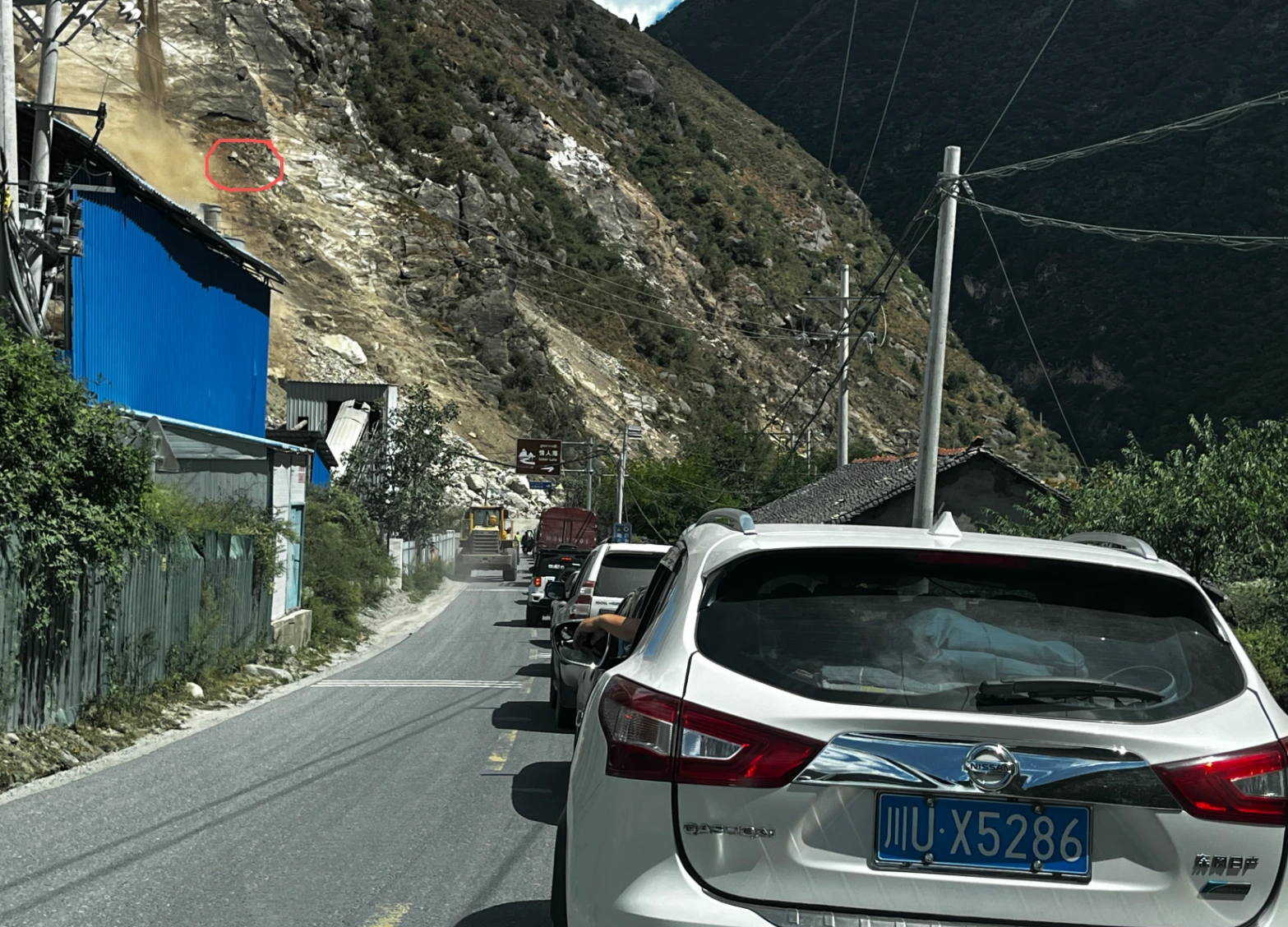
Then came a very long construction zone. I hadn’t expected so many dozens of kilometers of roadwork on the G317 northern route. The surface was pitted with loose gravel — slow and careful driving required. At one junction, an excavator high on the cliff was digging, and huge rocks occasionally tumbled down — heart-stopping to watch. I truly admire those operators; I wouldn’t do that job for 100,000 RMB a month. Yet every road, bridge, tunnel, and railway we enjoy is built by these brave workers — deep respect.

I reached the hotel around 4 PM, rested, ordered takeout (I’ve been to Maerkang twice before, so no desire to wander), wrote some travel notes, and went to bed.
Day 19: Maerkang to Chengdu
The final day. I left Maerkang early in the morning, heading south on the smooth G4217 expressway. Traffic gradually thickened, mountains remained grand but lost some of their wild vastness, and towns appeared more frequently.
Looking back on these 19 days — snow-capped peaks, endless plateaus, lonely roads, sheer cliffs, and the smiling strangers who warmed the high-altitude cold — I arrived in Chengdu exactly at 11 AM, returned the car, and immediately had lunch.
The journey ended quietly, yet left an indelible mark on my heart. A true journey measures not only the land but also the vastness and silence within. When the wheels finally stopped where they began, I realized: though my body had returned, my heart was still on the road.
Every mountain pass crossed tempered my will; every solitary mile brought deeper inner calm. Modern life’s noise suddenly felt superficial — it is the slanting sunlight on the plateau, a wisp of cooking smoke rising from a herder’s tent that feels most real.
This trip wasn’t escape; it was return — return to the natural harmony between humans and nature, return to a long-lost clarity and reverence in the soul.
Because this post is already very long, I’ll skip the daily summary this time. The full journey reflection will come in the next article — stay tuned!
(End of Part 5 – The Ultimate 5100km Solo Drive is now complete)
19 days, 5100 kilometers, from Chengdu into the heart of Tibet and all the way out via G317 – every raw mile, every drone shot, every hidden monastery and near-death dirt road is now yours forever if you grab the Lifetime Membership.
This is the end of this journey… but the beginning of many more.
See you on the next road.
Comments (0)
CC BY-NC-ND 4.0 License
Credit to Gerry Hu / ChinaTravelPDF
No commercial use
No modifications allowed
Unlock Remaining 70% Premium Content
This is a VIP Exclusive Article. Become a lifetime member to unlock all VIP articles and all available city guides.
🎁 1 Year Free Expert Q&A Support (Early Bird Exclusive - First 500 Only)
China National Highway 318
20 Must-Visit Attractions You'll Regret Missing (FREE PDF)
Related Articles

The Ultimate 5100km Solo Drive: I Ended Up in Hospital at 4500m & Still Say G317 Is Worth It – Here’s Exactly How to Survive It PART 5
Part 5 of the blog details the G317 Northern Route from Lhasa to Naqu and beyond, emphasizing high-altitude survival challenges. Starting at Lhasa's 3,650 meters, the drive north to Naqu (around 4,500 meters) involves steady climbs, with landscapes shifting to vast plateaus, grasslands, and snow-capped peaks under Bön religious influences. High passes and elevations exceed those on the G318 Southern Route, making altitude sickness the primary challenge; the author experienced severe oxygen deprivation at Naqu due to a poorly ventilated hotel without supplemental oxygen, leading to a midnight hospital visit for oxygen therapy at Naqu City People’s Hospital, where 10–15 minutes of treatment provided significant relief, and staying until morning ensured rest. Descending to Suo County (3,800 meters) alleviated symptoms, with tips like sipping glucose water for mild issues. High passes include the Nyenchen Tanglha Mountains viewpoint, but the route features smoother, flatter roads with lighter traffic—one-third of G318’s—and fewer steep climbs. Wildlife is minimally mentioned, with no specific encounters noted. Travel advice includes booking oxygen-supplied hotels (200–300 yuan extra), checking vehicles thoroughly before Lhasa departure due to remote repairs, carrying portable oxygen cans if altitude-sensitive, knowing personal limits, and preparing for profound, peaceful scenery in quieter northern Tibet.

The Ultimate 5100km Solo Drive: 4 Defining Days (5-8) Navigating the G318/G317's Highest Passes Part 3
In Part 3, the journey crosses from Sichuan into Tibet, starting in Batang (2,800 m) and entering via the Jinsha River Bridge into Mangkang, surrounded by flaming-red mountains. Day 5 involves conquering three high passes—Yela Shan, Jueba Shan, and Dongda Shan (5,130 m, the highest on G318 & G317)—with elevations up to 5,130 m, followed by a downhill to Zuogong (3,750 m). Precautions include watching for landslides and mud-rock flows. Day 6 features foggy starts in Zuogong, a revisit to Yela Shan (4,658 m), and the terrifying Nu River 72 Turns with narrow roads, crumbling rocks, sheer drops, potholes, and a 3-hour traffic jam from a landslide. Attractions include Bangda Grassland viewpoint. Overnight in Basu. Day 7 offers rewards like Ranwu Lake at sunrise (mirror-calm waters reflecting peaks) and Laigu Glacier (gigantic white glacier with boardwalk), with drone tips for cold winds. Day 8 includes Sutong Horseshoe Bend on Palong Zangbo River, Lulang Gongcuo Lake, Lulang Forest Sea, and Sejila Mountain (4,728 m). Ends in Nyingchi (Linzhi), Tibet's mild "Jiangnan." The Batang to Basu segment (~360 km) crosses three rivers (Jinsha, Lancang, Nu) and four major passes (Lawu at 4,338 m, Jueba at 3,940 m, Dongda at 5,130 m, Yela at 4,658 m), noted as the most epic and demanding. Advice: Check road conditions nightly via WeChat, avoid tired driving, book hotels and parking ahead, especially for plateau inexperience.

The Ultimate 5100km Solo Drive: Sacred Lakes, Mila Pass & The Guide to High-Altitude Safety PART 4
In Part 4, the journey covers the drive from Nyingchi to Lhasa via Mila Pass (5,013 meters), a key climatic divide where altitude sickness must be monitored. The author exits the expressway to take the national highway for the pass, enjoying its tranquil setting with prayer flags and snow-capped mountains, then descends while flying a drone outside restricted zones to capture the Yarlung Tsangpo River's shallow riverbed and sandbanks. From Lhasa, the route shifts to the G318 National Highway to Shigatse, offering scenic views of the river, farmlands, and mountains at the Qushui Bridge. Cultural highlights include visits to Drepung Monastery (famous for its Buddha Unfolding Festival), Tashilhunpo Monastery (seat of Panchen Lamas), and Shigatse Municipal Museum with its exhibits. On the return via a different route, stops feature Jiangsa National Wetland Park, Pelkor Chode Monastery with its 100,000-Buddha Kumbum Stupa, Gyantse Dzong Fortress (symbolizing historical resistance), and Manla Reservoir, described as a stunning blue sapphire reflecting peaks. The trip culminates at Yamdrok Lake, one of Tibet's Three Great Sacred Lakes at 4,441 meters, with its elegant, color-shifting waters like the Eye of the Earth, deemed worth any entrance fee for its unique beauty. Driving tips emphasize caution on mountain passes, avoiding strenuous activity at high altitudes, checking weather and road conditions to prevent landslides or fog-related risks, and adapting to extreme temperature differences with warm clothing and sun protection. Drone use is forbidden in Lhasa to avoid penalties.