The Ultimate 5100km Solo Drive: Chengdu → Lhasa & Back via G318 + G317 PART 2

On the morning of September 3, 2024, I boarded the Fuxing High-Speed Trainat at Kunming Station — the official kickoff to my long-awaited solo Sichuan-Tibet Highway adventure.
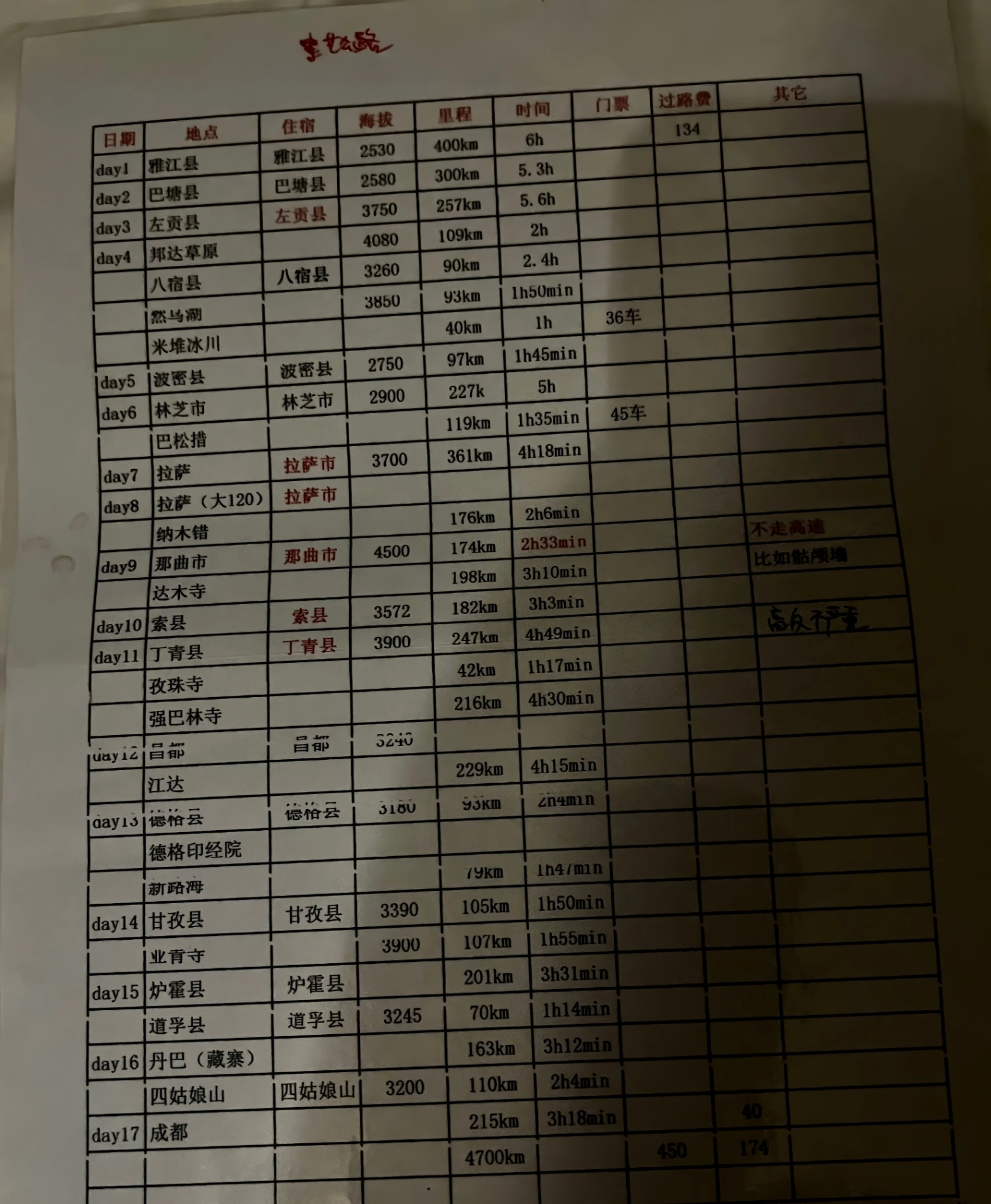
Here is my initial planned itinerary:
Departure was at 09:53, and exactly 7 hours and 37 minutes later, at 17:30, I stepped onto the platform at Chengdu South Station. This 900-kilometer journey on the brand-new Chengdu-Kunming High-Speed Railway (成昆复线) was far more than simple transportation; it felt like the dramatic overture to the greatest adventure of my life.
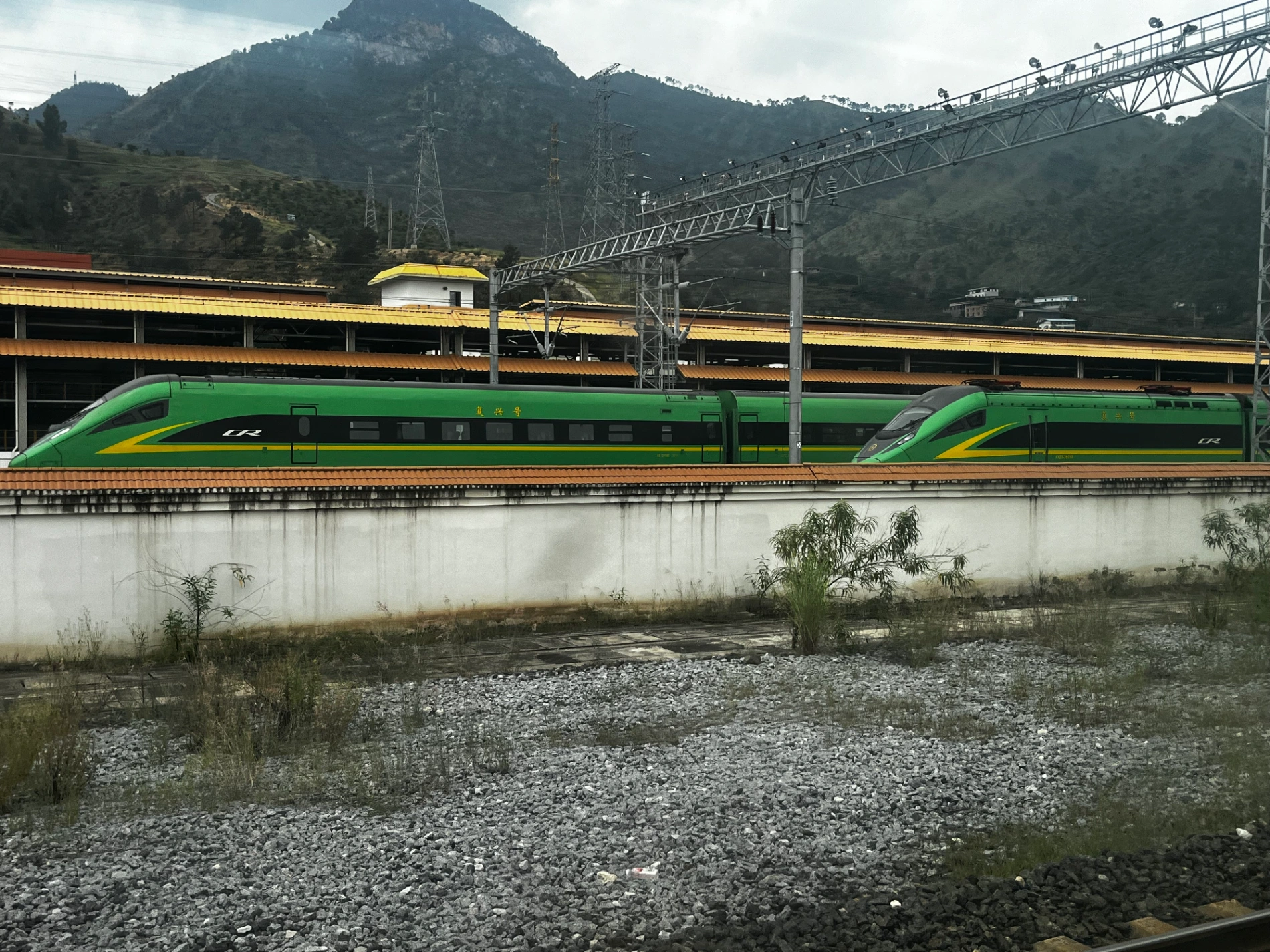
My route skipped the classic Yunnan tourist postcard spots — no Dongchuan red-soil terraces, no karst peaks, no Dali or Lijiang. Instead, shortly after leaving Kunming, the train raced through Chuxiong Yi Autonomous Prefecture and plunged straight into the rugged heart of southwest China toward Panzhihua. What followed was pure engineering magic: tunnel after tunnel (**over 150 tunnels and 180 bridges** in Yunnan alone), soaring across the deep canyons of the upper Jinsha River on viaducts hundreds of meters high. Every now and then the train burst into daylight, offering jaw-dropping glimpses of steep green slopes and raging turquoise rivers far below.
As we climbed from Kunming’s 1,900 m to the hotter, drier climate around Panzhihua, the temperature outside the window shifted noticeably. Then, almost without warning, the landscape softened as we descended into the vast Sichuan Basin. Rocky gorges gave way to golden rice fields, and suddenly Chengdu’s modern skyline appeared on the horizon.
Walking out of the station that afternoon with my backpack, excitement was electric. The smooth, air-conditioned comfort of high-speed rail had delivered me from Yunnan to Sichuan in less time than it takes to watch two movies — the perfect psychological launchpad for the raw, wild 5,100-kilometer odyssey that would officially begin the very next morning.

DAY 1: September 3, 2024 – Arrival in Chengdu
Landed in Chengdu, checked into a simple hotel near the station, had a bowl of spicy noodles, and went to bed early. Tomorrow the wheels start turning for real.
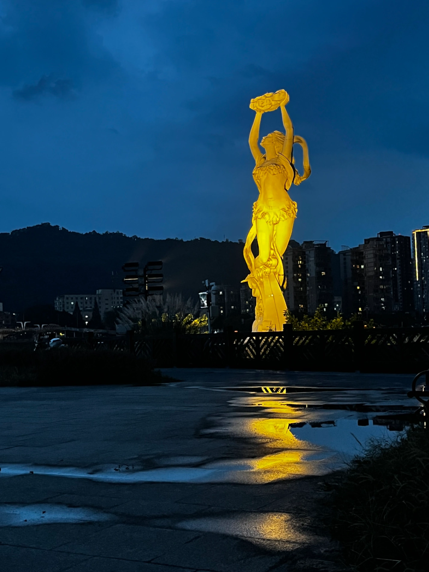
DAY 2: September 4, 2024 – Picking Up the Car & Heading to Ya’an
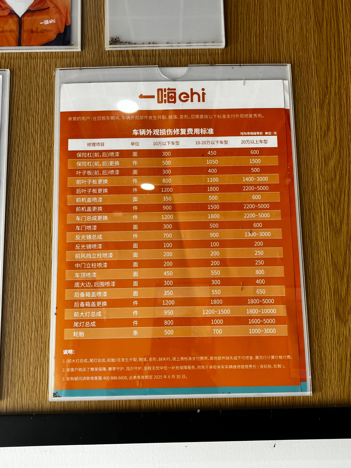
Morning: Went to Ehi Car Rental (一嗨租车) and picked up my trusty Toyota RAV4. Then straight to the Shuangliu Wanda Plaza supermarket for supplies. Because I was traveling solo, I bought a ridiculous amount of water and drinks — just carrying everything from the store to the parking lot left me exhausted!
Some gear (drone batteries, etc.) had been mailed to the rental office in advance, so I loaded everything up and hit the road west toward Ya’an.
I’ve been to Ya’an many times because it’s so close to Chengdu. The city is bisected by the wide, clear Qingyi River (青衣江), with lush trees lining both banks. That evening I strolled along the river as the famous “**Ya Rain (雅雨)**” mist rolled in — soft, gentle, and cool. Sitting by the water eating a bowl of authentic tata noodles (挞挞面), my mind was already racing ahead to tomorrow: Erlang Mountain, Kangding, and the true beginning of the G318.
Ya’an felt like a gentle, steady gatekeeper welcoming me into the highlands.
DAY 3: September 5, 2024 – Ya’an → Kangding → Yajiang (Yajiang)
Left Ya’an early, shrouded in thin morning mist over the Qingyi River. Today’s first major obstacle: Erlang Mountain (二郎山, 3,437 m) — once known as the “**most dangerous pass on the Sichuan-Tibet Highway**.” Thanks to the long tunnel, it’s now easy. After the tunnel I entered Luding County, home of the historic Luding Bridge over the roaring Daduo River — the iron-chain bridge famously seized by the Red Army in 1935.
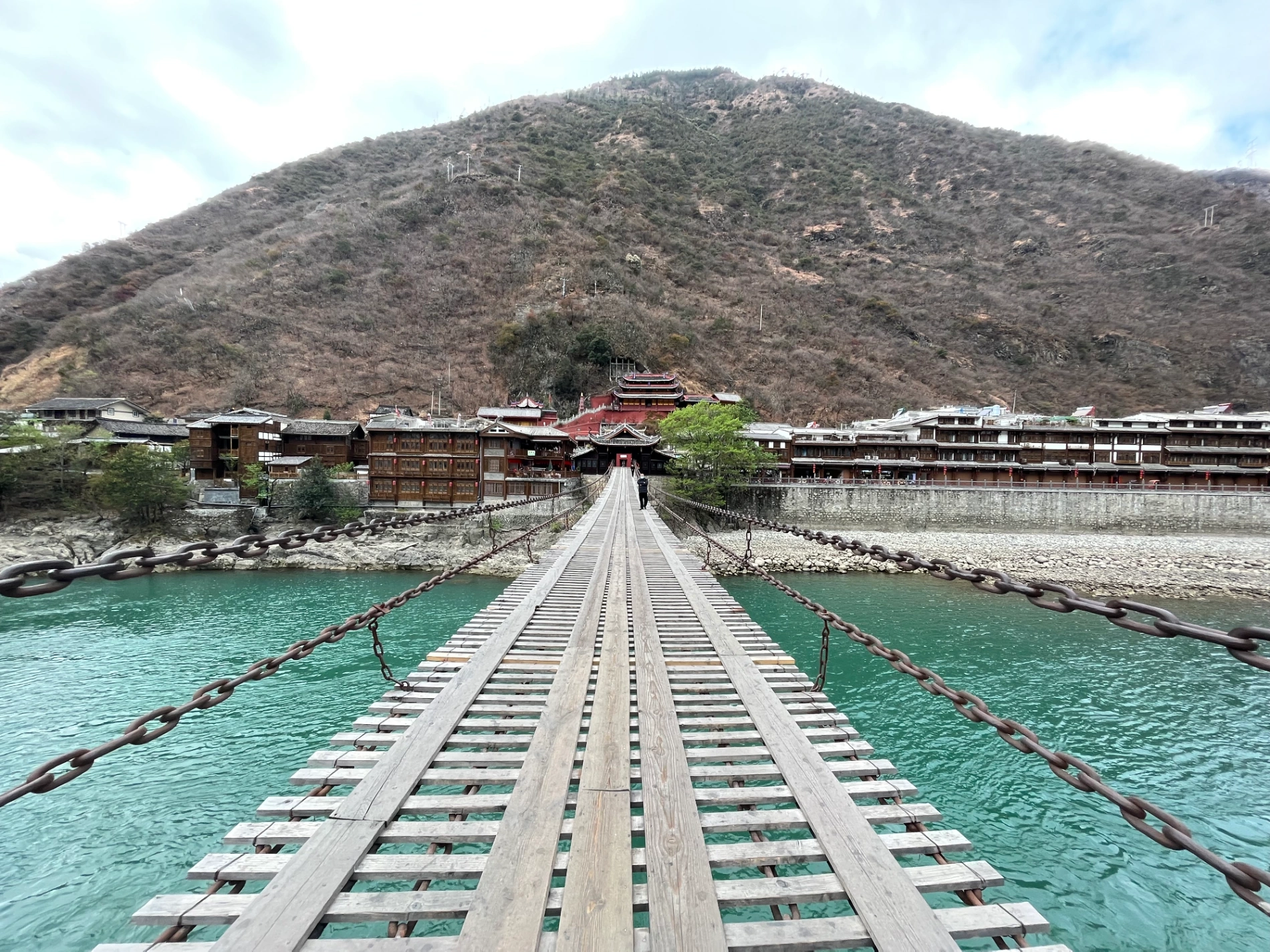
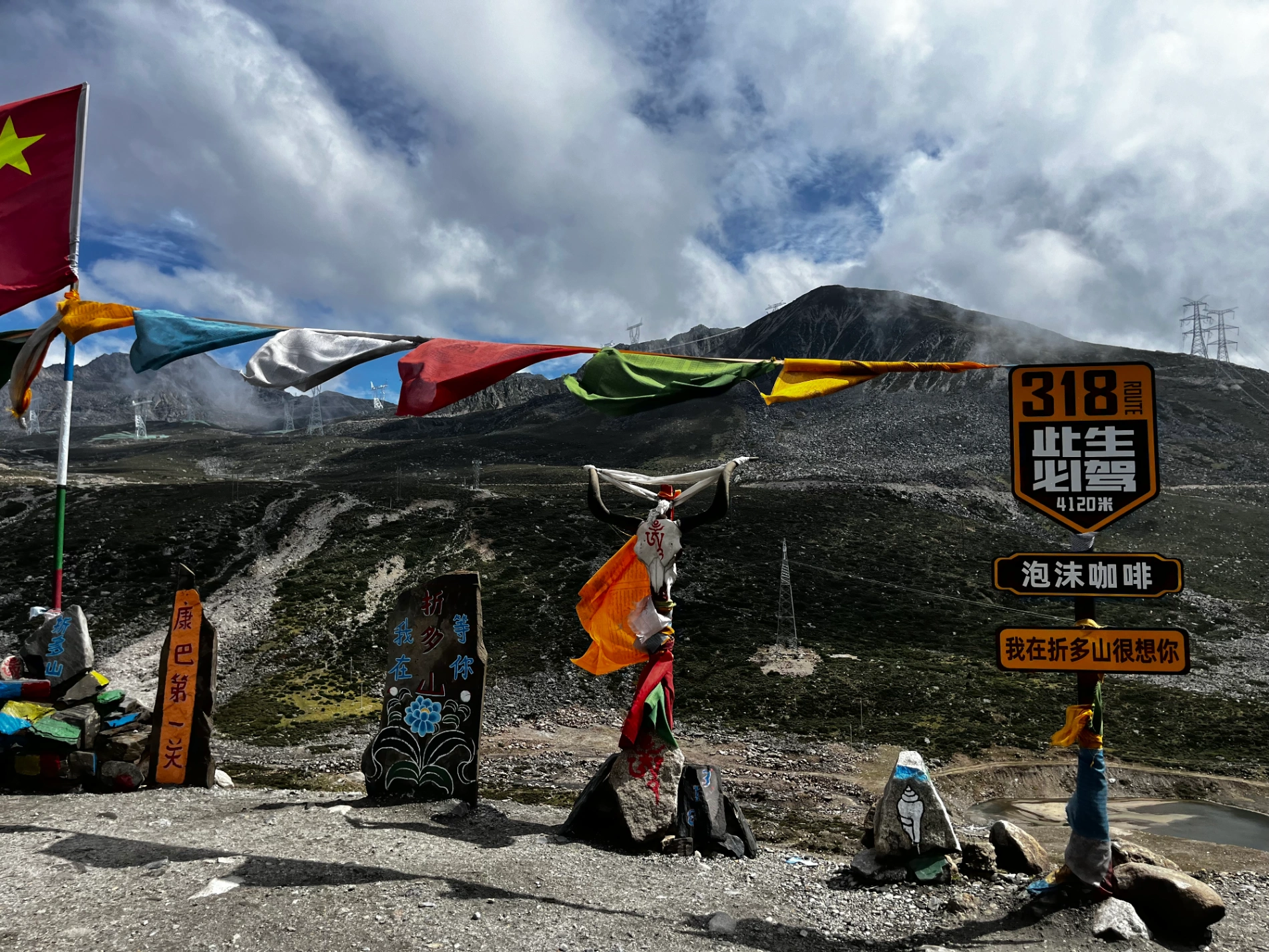
I’ve walked across Luding Bridge twice before, so no stop this time. The road from Ya’an to Kangding is actually quite relaxed now — mostly tunnels. After Erlang Mountain Tunnel, there are roughly 50 km of near-continuous tunnels all the way into Kangding. I took the expressway to save time (I’ve driven the old G318 twice before — highly recommend it if you’re not in a rush and want maximum scenery).
Quick lunch and a car-nap in Kangding (capital of Garzê Tibetan Autonomous Prefecture), then straight on. First-timers: stay overnight in Kangding — it’s worth it.
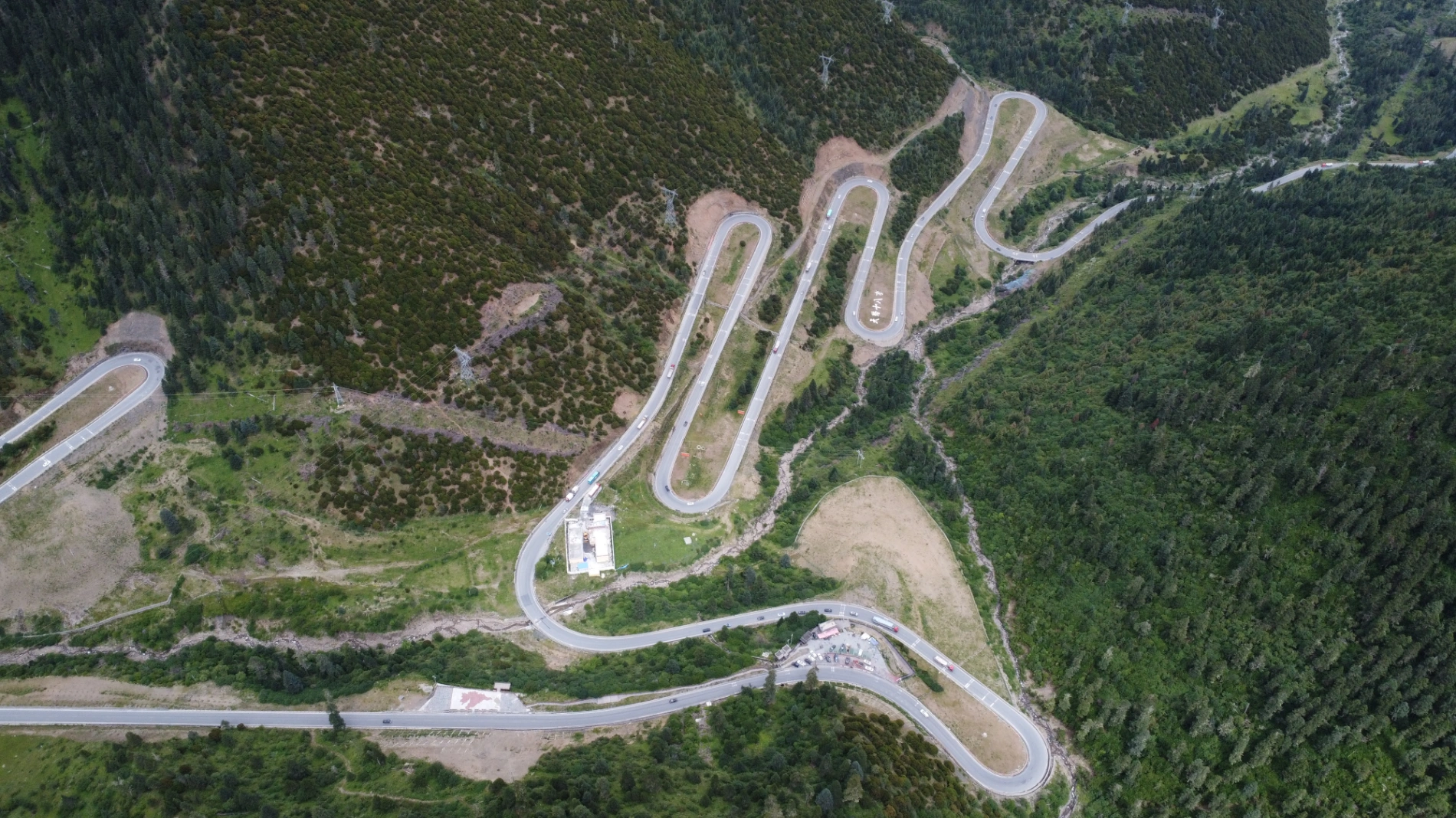
The real challenge began after Kangding: the climb over Jianziwan Mountain (剪子弯山, 4,659 m). Hairpin after hairpin, one side sheer cliff, the other rock wall. Mild altitude headache and heavier breathing kicked in. The famous “Heavenly Road 18 Bends (天路十八弯)” viewpoint is here — 180-degree switchbacks stacked like hairpins on a girl’s head. They exist because you have to gain huge elevation fast; only tight bends make it possible for vehicles.
I’ve photographed it many times, so I kept moving. The plateau opened up — endless sky, distant snow peaks, prayer flags snapping in the wind. By evening I reached Yajiang County, a town literally built inside a narrow canyon, houses stacked layer upon layer up the steep slopes.
Critical warning: Parking in Yajiang is a nightmare! Out of the entire 18-day trip, Yajiang had the worst parking situation. Call your hotel in advance and reserve a spot — otherwise you’ll circle forever or have to park illegally. Trust me on this one.
Checked in, rested, ate, slept.
DAY 4: September 6, 2024 – Yajiang → Litang → Batang
Morning departure from Yajiang, heading west along G318. The canyons grew deeper and more dramatic. Passed through the Ga’ersi Mountain Tunnel, then suddenly burst onto the vast Maoya Grassland — an endless green carpet under snowy peaks, prayer flags fluttering wildly.
Next came Haizi Mountain (4,618 m) — a desolate, high-altitude moonscape of ancient glacial rocks and small lakes.
Around noon I reached Litang (“**World’s Highest City**” at 4,014 m). Did a quick drone flight at the east gate (third time here), snapped the obligatory photo at the west gate, tried to nap in the car but light hypoxia kept me awake.
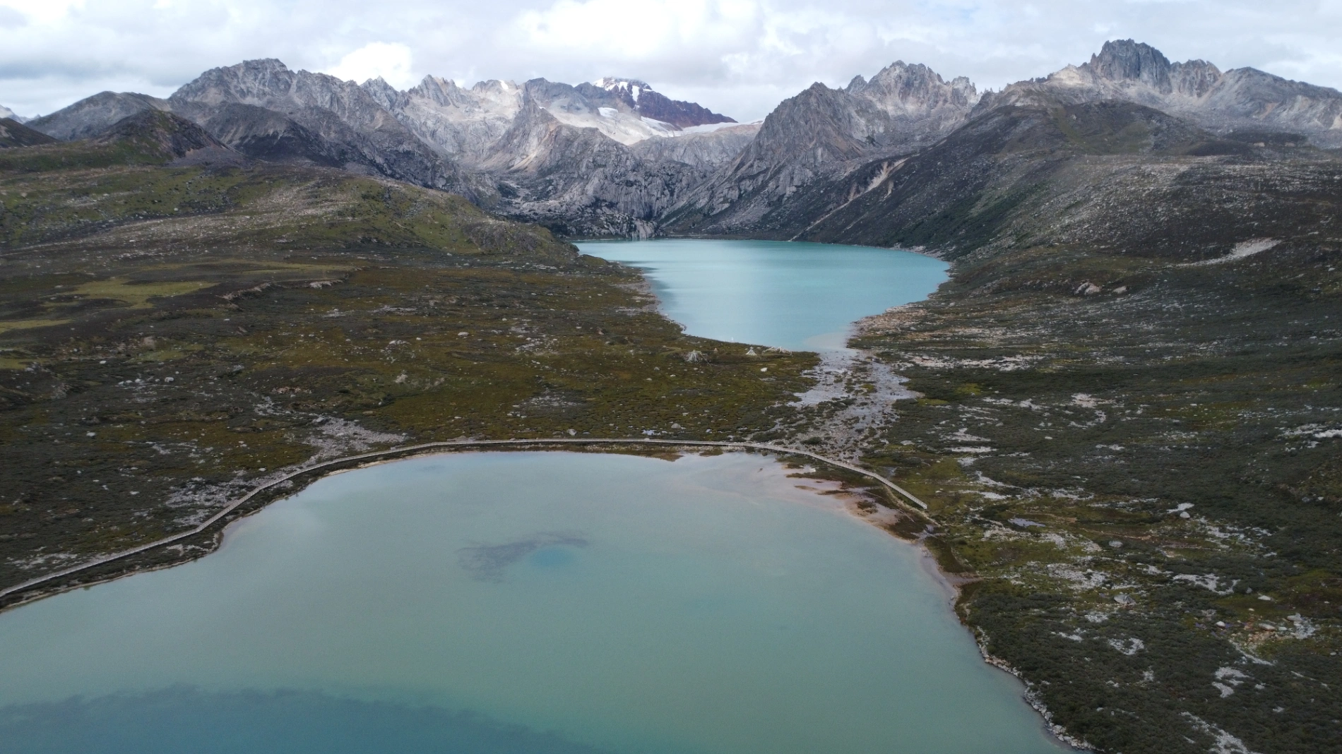
Continued west. Passed endless prayer-flag arrays and white stupas glowing under the plateau sun. Then — Sisters Lakes (姊妹湖), two sapphire jewels nestled between mountains. I visited in late winter 2022 when everything was frozen white; now in September the water was an insane deep blue.
Arrived Batang around 5 p.m. — the farthest west I had ever driven before this trip. Checked in, walked to the main town, flew the drone above Zhongshan Park, grabbed street food, and crashed early.
Why the First Four Days Felt Like Reuniting with Old Friends
I’ve driven western Sichuan more than 10 times, and even Litang and Batang 2–3 times each. For me, these four days were less “new discovery” and more “visiting beloved old friends” — every mountain pass, every river bend felt familiar and comforting.
But for first-timers, please take this seriously:
- Some sections of G318 are still under construction — landslides in rainy season, ice in winter. Check road conditions daily.
- Altitude sickness is real above 4,000 m (Litang, Haizi Mountain). Avoid strenuous activity, carry glucose, Rhodiola, and cold medicine.
- Fuel stations are far apart — fill up whenever you see one.

- Respect Tibetan customs — never touch prayer flags or mani stones.
- Book every night’s accommodation in advance (Ctrip first, then Meituan). If you get stuck at 3,500 m+ overnight because you missed the county town, cold + severe hypoxia can ruin or endanger your trip.

- Plan to reach a county town every night (usually 2,000–3,000 m) where altitude sickness is manageable.
China’s infrastructure is racing ahead — many brutal passes I once crawled over are now replaced by tunnels. Tunnels are safer and faster, but they hide the soul-shaking views that live at the mountain saddles (垭口). In a few years, when even more tunnels open, those raw, wind-whipped, heart-stopping high passes may vanish forever under the rock.

Come soon — while the old road still breathes, while the plateau still feels wild and free.
This is the recap of my first four days. Next episode: Batang (Sichuan) → Linzhi (Tibet), crossing the furious Nu River 72 Turns, passing Ranwu Lake, and finally entering the snowy wonderland of Nyingchi.
Stay tuned — the real Tibet is about to begin. 🚙❄️
(End of Part 2)
Comments (0)
CC BY-NC-ND 4.0 License
Credit to Gerry Hu / ChinaTravelPDF
No commercial use
No modifications allowed
Unlock Remaining 70% Premium Content
This is a VIP Exclusive Article. Become a lifetime member to unlock all VIP articles and all available city guides.
🎁 1 Year Free Expert Q&A Support (Early Bird Exclusive - First 500 Only)
China National Highway 318
20 Must-Visit Attractions You'll Regret Missing (FREE PDF)
Related Articles

The Ultimate 5100km Solo Drive: Leaving Tibet via G317 – Jinsha River, Dege Parkhang & 19-Day Goodbye – PART 6
In Part 6, the traveler departs Tibet via G317 after entering via G318, focusing on the eastward journey from Dingqing through eastern Tibet into Sichuan over several days. From Dingqing to Changdu on Day 15, the route includes skipping the bumpy, unpaved 11 km dirt road to Zizhu Temple at 5,000 meters due to poor conditions, opting instead for drone shots of the temple on Zizhu Mountain. Stops feature the massive Naicha Mani Stone Pile, a 3 km-long sacred site where pilgrims pray, and Qiangbalin Temple, the largest in Kham with roots in the Ming Dynasty. Evening brings a serene stroll at Qiangbalin Square, witnessing the crystal-clear Zhaqu River merging with the muddy Ngomqu to form the Lancang River (Mekong). On Day 16, from Changdu to Dege, the path crosses the Jinsha River (upper Yangtze) at the Sichuan-Tibet border, passing solar farms, red Aga-soil houses, and the Gangtuo 18th Army Crossing Memorial Hall. Entering Sichuan after a checkpoint, Dege offers peace, with a night visit to the majestic Dege Parkhang, a historic Tibetan printing house emitting chants and printing scents. Day 17 detours via Baiyu for superior scenery along Jinsha River, visiting Yanbi Village's mural, Jinsha River First Bend confluence, Baiyu Temple atop a steep climb with prayer wheels and incense, Changtai Grassland, Yachen Gar (largest nunnery in western Sichuan, remote and tranquil), and Lalong Cuo Lake, a shrinking tectonic lake with salt flats and herder tents. The route includes Zhuo Da La Mountain's photo spot and a long tunnel descent to Garzê County. Day 18 covers Garzê to Maerkang with gentle downhill, autumn colors, monkey encounters, and cautious navigation through extensive gravel construction zones with rockfall risks. The 19-day trip concludes on Day 19 with a smooth expressway drive to Chengdu, reflecting on plateaus, monasteries, and inner calm. Survival tips include early starts to avoid packed schedules, confident driving for narrow, steep accesses like Baiyu Temple, careful slow driving on unpaved or gravel sections, drone use limited by altitude, and awareness of high-plateau winds, cold, and emotional reluctance at borders.

The Ultimate 5100km Solo Drive: I Ended Up in Hospital at 4500m & Still Say G317 Is Worth It – Here’s Exactly How to Survive It PART 5
Part 5 of the blog details the G317 Northern Route from Lhasa to Naqu and beyond, emphasizing high-altitude survival challenges. Starting at Lhasa's 3,650 meters, the drive north to Naqu (around 4,500 meters) involves steady climbs, with landscapes shifting to vast plateaus, grasslands, and snow-capped peaks under Bön religious influences. High passes and elevations exceed those on the G318 Southern Route, making altitude sickness the primary challenge; the author experienced severe oxygen deprivation at Naqu due to a poorly ventilated hotel without supplemental oxygen, leading to a midnight hospital visit for oxygen therapy at Naqu City People’s Hospital, where 10–15 minutes of treatment provided significant relief, and staying until morning ensured rest. Descending to Suo County (3,800 meters) alleviated symptoms, with tips like sipping glucose water for mild issues. High passes include the Nyenchen Tanglha Mountains viewpoint, but the route features smoother, flatter roads with lighter traffic—one-third of G318’s—and fewer steep climbs. Wildlife is minimally mentioned, with no specific encounters noted. Travel advice includes booking oxygen-supplied hotels (200–300 yuan extra), checking vehicles thoroughly before Lhasa departure due to remote repairs, carrying portable oxygen cans if altitude-sensitive, knowing personal limits, and preparing for profound, peaceful scenery in quieter northern Tibet.

The Ultimate 5100km Solo Drive: 4 Defining Days (5-8) Navigating the G318/G317's Highest Passes Part 3
In Part 3, the journey crosses from Sichuan into Tibet, starting in Batang (2,800 m) and entering via the Jinsha River Bridge into Mangkang, surrounded by flaming-red mountains. Day 5 involves conquering three high passes—Yela Shan, Jueba Shan, and Dongda Shan (5,130 m, the highest on G318 & G317)—with elevations up to 5,130 m, followed by a downhill to Zuogong (3,750 m). Precautions include watching for landslides and mud-rock flows. Day 6 features foggy starts in Zuogong, a revisit to Yela Shan (4,658 m), and the terrifying Nu River 72 Turns with narrow roads, crumbling rocks, sheer drops, potholes, and a 3-hour traffic jam from a landslide. Attractions include Bangda Grassland viewpoint. Overnight in Basu. Day 7 offers rewards like Ranwu Lake at sunrise (mirror-calm waters reflecting peaks) and Laigu Glacier (gigantic white glacier with boardwalk), with drone tips for cold winds. Day 8 includes Sutong Horseshoe Bend on Palong Zangbo River, Lulang Gongcuo Lake, Lulang Forest Sea, and Sejila Mountain (4,728 m). Ends in Nyingchi (Linzhi), Tibet's mild "Jiangnan." The Batang to Basu segment (~360 km) crosses three rivers (Jinsha, Lancang, Nu) and four major passes (Lawu at 4,338 m, Jueba at 3,940 m, Dongda at 5,130 m, Yela at 4,658 m), noted as the most epic and demanding. Advice: Check road conditions nightly via WeChat, avoid tired driving, book hotels and parking ahead, especially for plateau inexperience.