The Ultimate 5100km Solo Drive: Sacred Lakes, Mila Pass & The Guide to High-Altitude Safety PART 4

Day 9: Nyingchi to Lhasa
We have successfully navigated what is currently considered the most challenging self-driving section of the Sichuan-Tibet Highway. The roads ahead will be relatively easier.
The next leg of our journey is from Nyingchi to Lhasa.
Since we arrived in Nyingchi early and the altitude is relatively low, I had a great night's rest. From Nyingchi to Lhasa, you have the option of taking the expressway or the national highway. Because I had been consistently driving on the national highway, and the scenery often felt quite homogenous, I decided to take the expressway out of Nyingchi first.

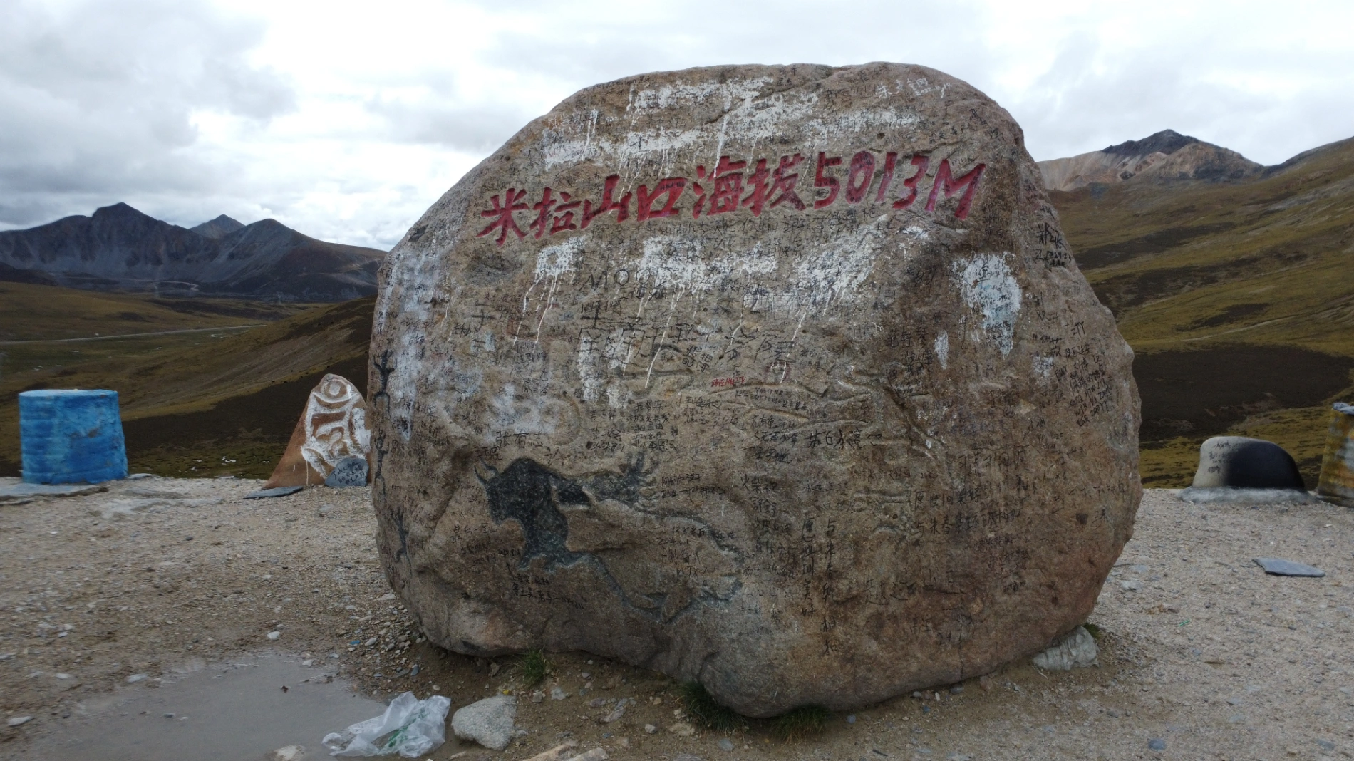
I then exited at the closest point to the Mila Pass. This approach allowed me to save time and prevent repetitive visual fatigue. The Mila Pass, with an altitude of 5,013 meters, is the climatic dividing line between Lhasa and Nyingchi, and one must be careful about altitude sickness when crossing it.
I felt that missing the Mila Pass would be a regret if I drove the entire way on the expressway, as it is the last major high mountain before Lhasa. So, I deliberately exited the expressway to take the national highway. Right after the exit, there was a small town where I had lunch and a short break before start driving over the mountains.
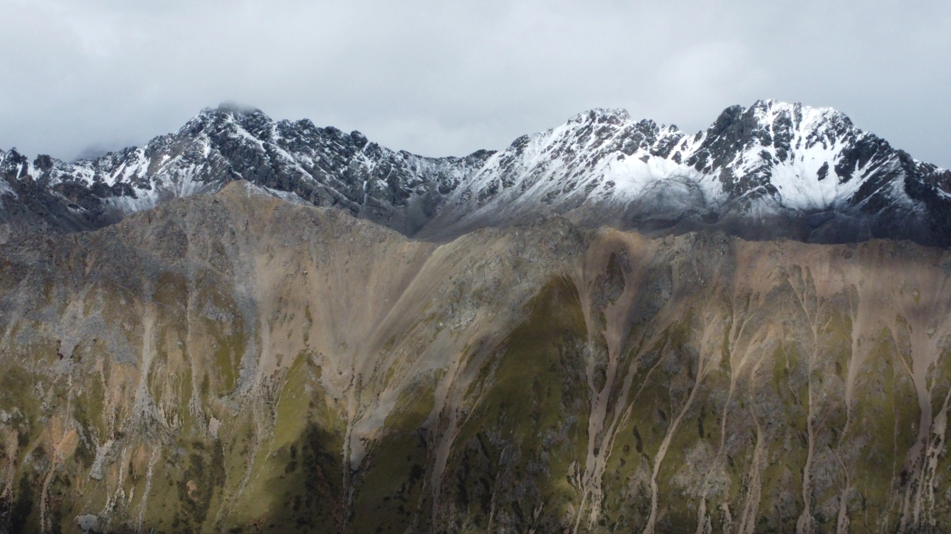
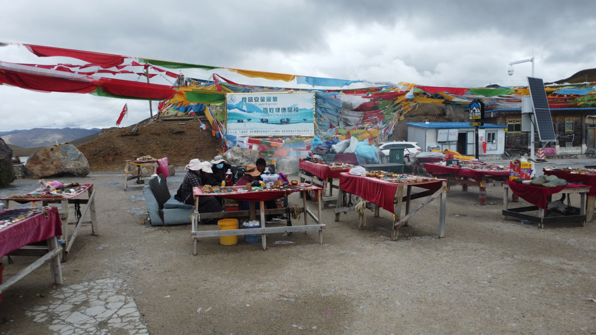
After driving for a while, I reached the Mila Pass. There were very few people there, likely because most choose the expressway to head straight to Lhasa. Compared to other famous peaks, the Mila Pass felt exceptionally tranquil. Prayer flags gently swayed in the wind, and the snow-capped mountains in the distance were vast and magnificent. I launched my drone for a short flight and then began the descent, preparing to head towards Lhasa.
I knew that flying a drone is forbidden in Lhasa, so I checked the no-fly zone in advance. I flew my drone in the area outside the restricted zone., mainly to film the Yarlung Tsangpo River. Many people might find it hard to believe that a major river can have many sections without water. The Yarlung Tsangpo River is exactly like that. The riverbed is very wide, but water doesn't cover all of it; instead, there are many shallow sandbanks and the water surface itself is quite shallow.

I saw someone fishing by the river. After the flight, I hurried towards Lhasa. Since the entire urban area of Lhasa is a no-fly zone for drones, I won't have any drone photos from my time in Lhasa, and can only share pictures taken with my phone.
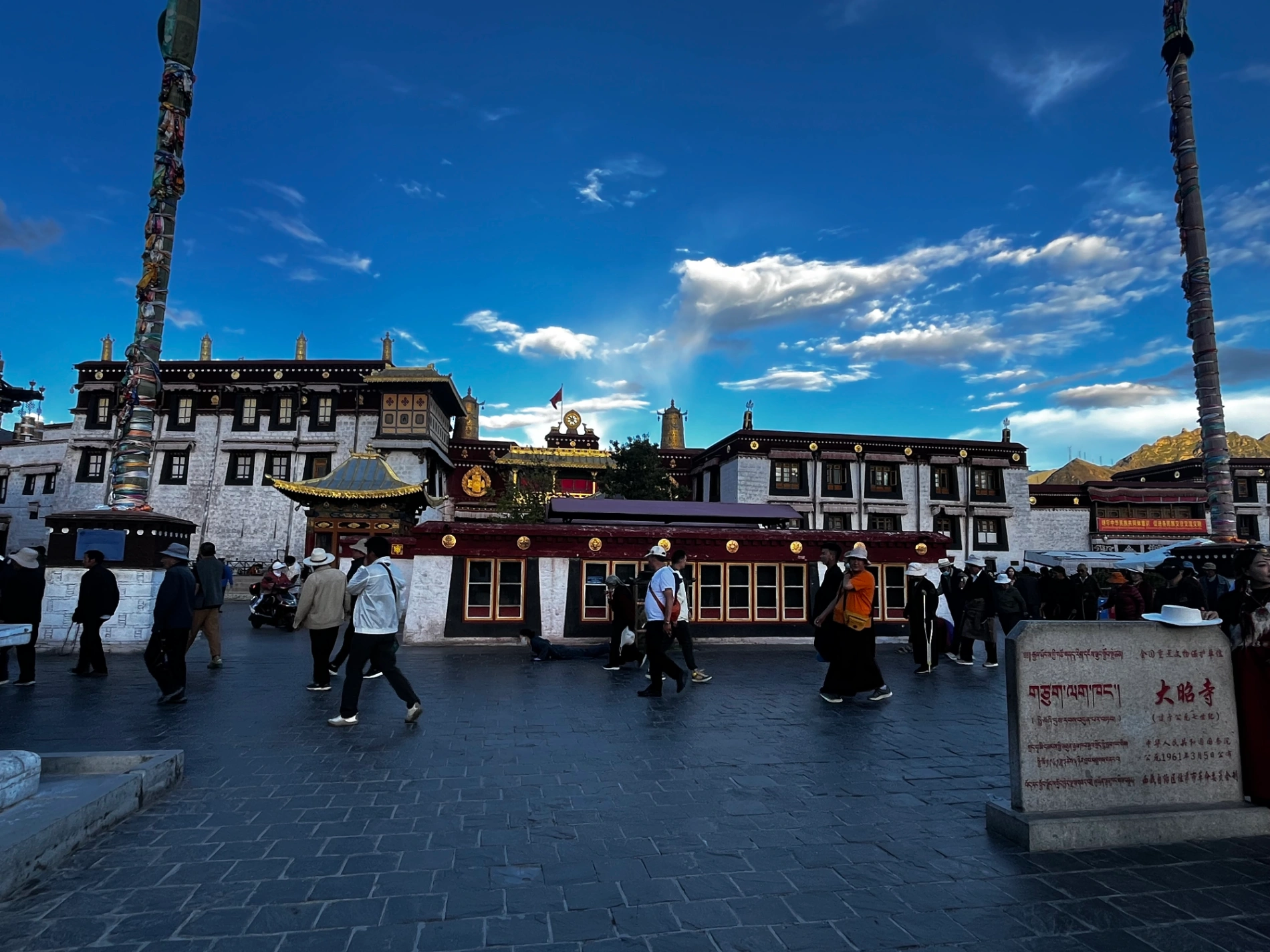
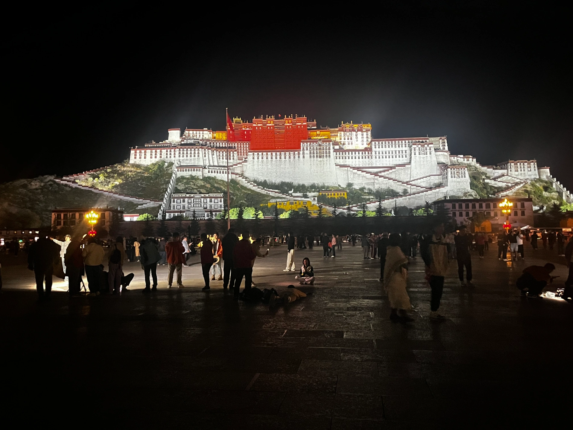
I have been to Lhasa before, so I didn't stay for too long this time. I visited the Jokhang Temple, Barkhor Street, and the Potala Palace Square on the same day. I arrived at the Potala Palace Square around 8:00 PM, and unexpectedly, there were quite a lot of people this time. After viewing it, I went back to the hotel to rest, preparing to head to Shigatse on Day 10.

Day 10: Lhasa to Shigatse
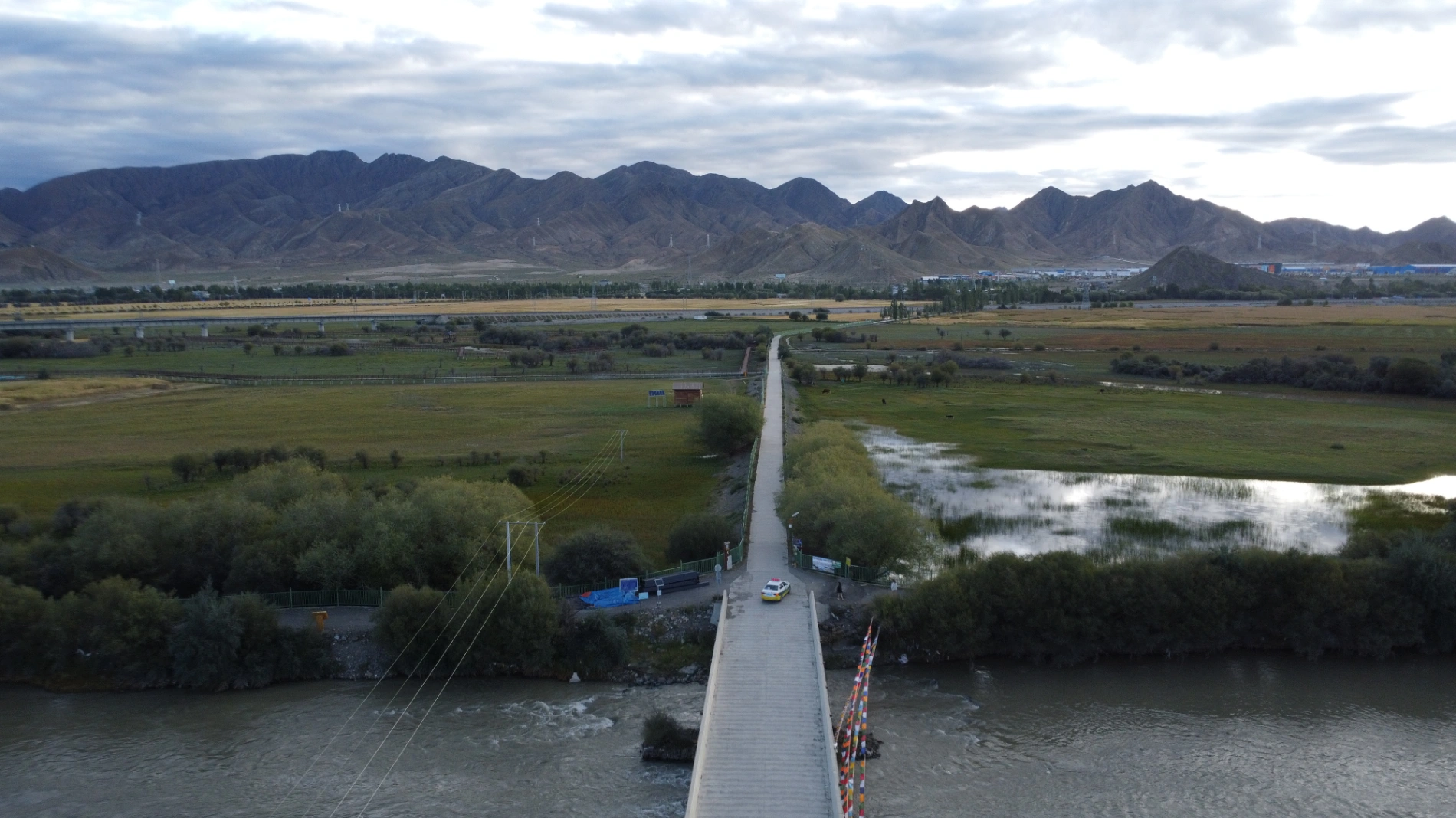
Lhasa is the largest city in Tibet and its administrative and economic center. However, it wasn't always this way; Shigatse was once the political center during the Tubo Kingdom period, before being gradually replaced by Lhasa. The entire journey from Lhasa to Shigatse is on the expressway with excellent road conditions, but I still chose to take the National Highway. After all, when you are on a self-driving trip, the scenery is on the road; taking the expressway would just be about rushing to the destination. The views along the G318 National Highway were still magnificent. As I passed the Qushui Yarlung Tsangpo River Bridge, the river water shimmered under the sun, contrasting beautifully with the distant farmland and snow-capped mountains.
On my previous trip to Lhasa, I didn't get a chance to visit the Drepung Monastery. So, this time I went there first. The scale of Drepung Monastery is immense, and it is most famous for its annual Buddha Unfolding Festival. After visiting the monastery, I drove directly to an observation deck in the suburbs of Shigatse. The view from the observation deck would be excellent .For tourists, having a drone provides an excellent perspective.

After spending some time at the observation deck, I visited the Shigatse Municipal Museum. The museum has a lot of exhibits and is well worth seeing. Afterward, I drove to the Tashilhunpo Monastery. Tashilhunpo Monastery is the most important monastery in Shigatse and the traditional seat of the Panchen Lamas. Because it was incredibly crowded and I had already visited Drepung Monastery in the morning, I didn't go inside. I just took a look from the entrance and returned to the hotel.
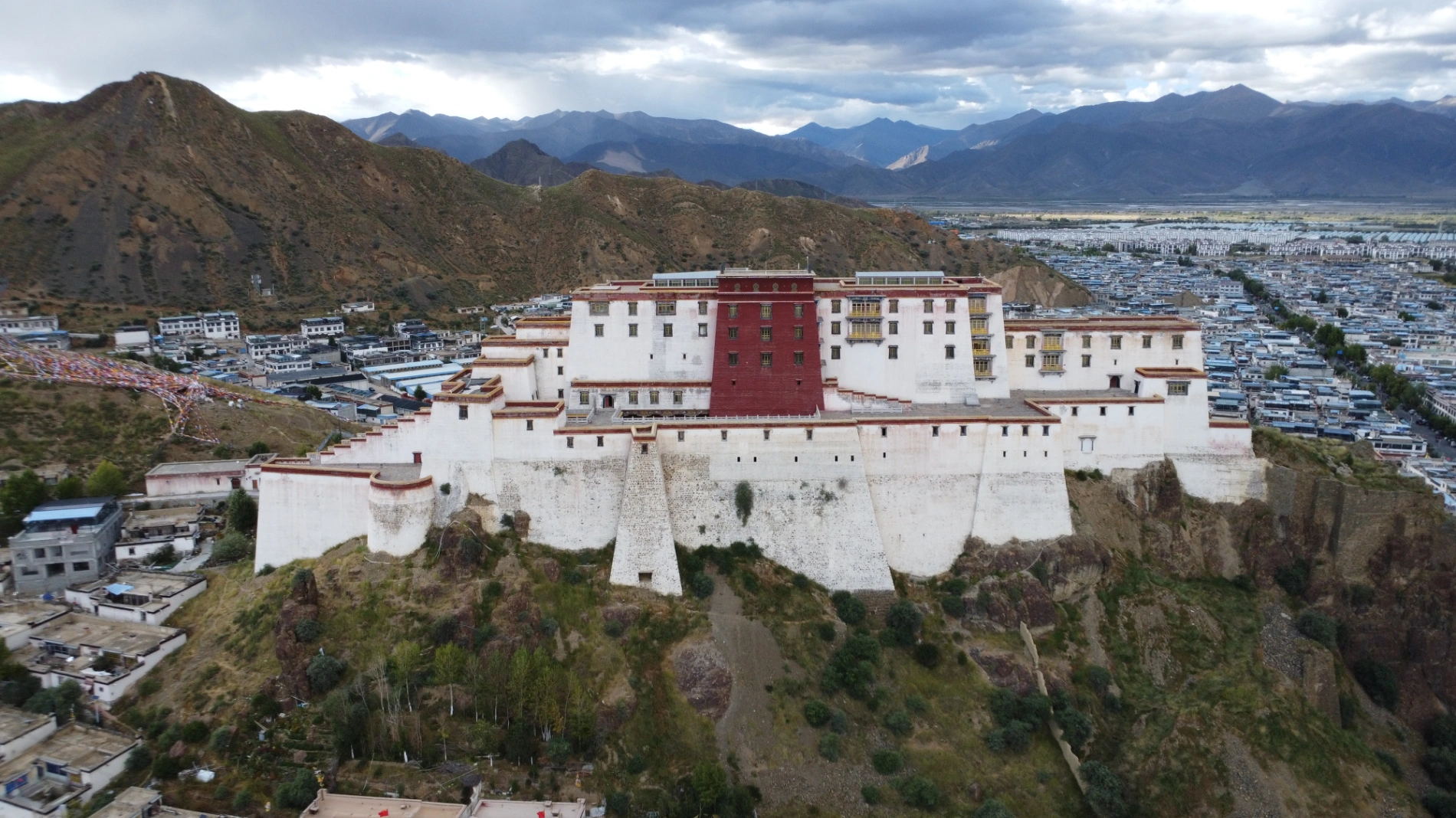
After dinner, I first checked out the Samdruptse Fortress. It is truly majestic and spectacular, looking very much like the Potala Palace from a distance. I took a photo for a local person, added them on WeChat, and sent them the picture. Later, I drove to the banks of the Yarlung Tsangpo River. The Yarlung Tsangpo River is the most important river in Tibet, and even in September, the water level was low. The wind by the riverbank carried fine sand over the stone shoals. The exposed riverbed was like the cracked palm lines of the earth, etched with the marks of time and flowing water.

This was the closest I have ever been to Mount Everest Base Camp. Mount Qomolangma (Everest) is the world's highest peak. I really, really wanted to see it. However, given my tight schedule this time, and the belief that I will have other opportunities in the future, I decided not to go. I will certainly return to Tibet someday to fulfill my dream of visiting Mount Everest Base Camp—but climbing the peak itself is out of the question; my physical strength couldn't handle it.
Day 11: Shigatse back to Lhasa
Although I drove from Lhasa to Shigatse yesterday, the route I took returning from Shigatse to Lhasa today was different.
The first stop today was the Jiangsa National Wetland Park in Shigatse. I arrived quite early, around 8 AM, and it felt like there were quite a lot of people; there might have been an event happening there today. I didn't get out much, just rested in the car for a while, and then continued my journey to the Pelkor Chode Monastery in Gyantse County.
The Kumbum (Bodhi Stupa) at Pelkor Chode Monastery is awe-inspiring, with 100,000 Buddha images hidden within its corridors. Each statue embodies the meticulous effort and faith of the artisans. Despite the erosion of time, the murals inside the temple still possess a vividness of color, as if narrating the past glory.

There is another very important place in Gyantse County: the Dzong Fortress. The Dzong Fortress stands majestically, its stone walls mottled yet imposing, bearing witness to the heroic chapter of the Gyantse military and civilians resisting the enemy throughout history. Looking out from the high ground of the fortress, today's Gyantse County has taken on a new look. What were once dirt roads have become thoroughfares, and low-rise houses have transformed into a modern streetscape. Only these stone walls silently bear the weight of history meeting the present.

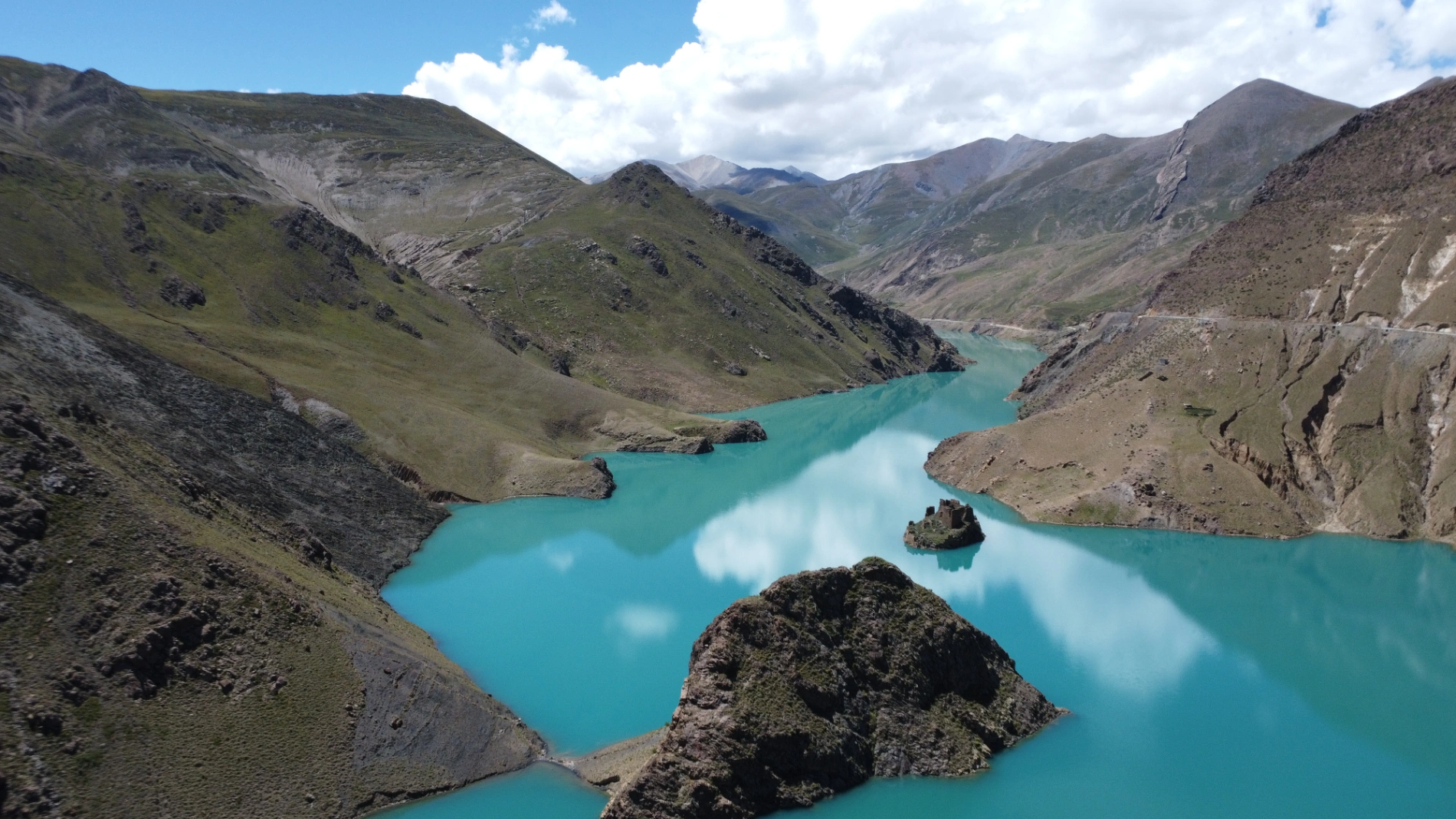
The next stop after the Dzong Fortress was the Manla Reservoir. I initially thought it was just an ordinary reservoir. It wasn't until I arrived at the Manla Reservoir that I was deeply shocked by the sight of the clear, blue, mirror-like lake surface. The water reflected the surrounding snow-capped peaks, looking like a blue sapphire set in the valley. This was the first time in my life that I had seen water this blue. I had known from reading geography magazines about the many such lakes in Tibet, but seeing it in person was still incredibly stunning.
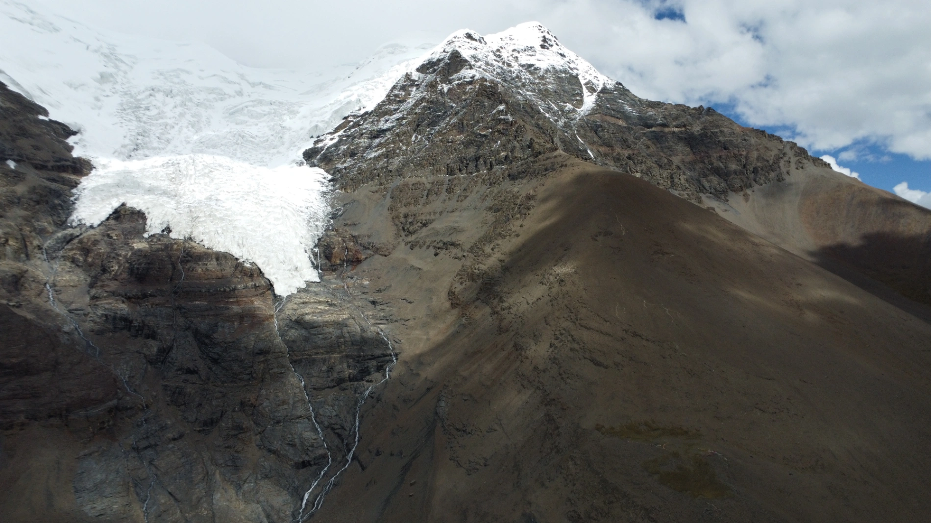
After Manla Reservoir, I went to Karola Glacier first, which was the second glacier I saw on this trip. Karola Glacier can be viewed directly up close, with a straight-line distance of only 20 meters from the glacier. It's just that it's relatively high, and drones can't fly to the highest point. There were a lot of people, and after checking in, I immediately headed to Yamdrok Lake.
Yamdrok Lake is one of the Three Great Sacred Lakes of Tibet. The lake surface is at an altitude of 4,441 meters, resembling a blue silk ribbon wrapped around the mountains. It lacks the vastness and grandeur of Namtso Lake, and it isn't as secluded as Manasarovar Lake; instead, it rests gently in the folds of the plateau with a soft elegance. The color of its water changes with the light, sometimes deep blue, sometimes emerald green, like the Eye of the Earth, gazing upon the sky and the human world.
I visited before they started charging an entrance fee, though I heard they charge one now. But the fee is worth it. You won't see this kind of water anywhere else. I spent about an hour at Yamdrok Lake, just silently gazing at the water surface, letting my thoughts wander, and feeling the thin yet pure air of the plateau fill my lungs. The beauty of the moment made me feel that everything was worthwhile.
Afterward, I drove back to Lhasa. The road from Yamdrok Lake to Lhasa involves crossing a mountain pass, so everyone must be careful, especially if you follow my route, as the return to Lhasa will be quite late. Driving at night on the plateau requires even greater caution. I arrived in Lhasa around 7 PM. It hadn't gotten completely dark yet, but the darkness was setting in quickly, with mountain shadows merging rapidly with the twilight. After parking my car and having dinner, I prepared to rest, as today's schedule was also quite rushed.
Summary and Travel Tips
Crucially, do not fly a drone in Lhasa. Do not challenge this rule. You are a tourist, and having your passport confiscated would be a major inconvenience. Remember: do not fly a drone.

Furthermore, try to avoid seeking travel companions in Lhasa. Although there are many tourists in Lhasa, interactions between strangers are mixed with too much uncertainty. Some people may appear friendly but have ulterior motives. Especially in a plateau region, rescue and communication can be difficult should any disputes or accidents occur.
Moreover, the plateau climate is highly changeable, so be sure to prepare warm clothing and sun protection before your trip. The day-night temperature difference is extreme; the midday sun is blazing hot, but the night brings chilling cold. Without attention, it's easy to catch a cold or suffer from hypothermia. When walking by the sacred lakes or between mountain passes, you should adapt to the altitude gradually and absolutely avoid strenuous exercise.
Also, be aware that some pharmacies may exaggerate the effectiveness of medicines or health supplements for altitude sickness and sell them to tourists at inflated prices. Be careful of this. Specific advice regarding altitude sickness will be available in my later updates to the Lifetime VIP Blog for your reading. If you are interested, you can purchase our Lifetime VIP membership.
Note: The road conditions on the Sichuan-Tibet Highway change with the seasons. Landslides and rockfalls are common in the summer, potentially cutting off roads that were previously easy to travel. In some places, there are no detour routes, or the detour is very long and inconvenient. Also, road maintenance sometimes occurs, requiring single-lane alternating traffic, so patience is required for waiting.

Conditions like heavy snow, rain, or fog must also be considered. Even if the road surface is good, a vehicle getting stuck due to heavy snow can block the main road and cause congestion along the entire route, which is more common in high-altitude sections like the Zheduo Mountain and Dongda Mountain. Heavy rain and fog severely restrict visibility and make the road surface slippery, increasing driving risk. Therefore, always check the weather forecast and road conditions before traveling and try to avoid bad weather and peak times.
There are techniques for checking real-time road conditions. Specific suggestions on this topic will be available in my later updates to the Lifetime VIP Blog for your reading. If you are interested, you can purchase our Lifetime VIP membership.
(End of Part 4)
Comments (0)
CC BY-NC-ND 4.0 License
Credit to Gerry Hu / ChinaTravelPDF
No commercial use
No modifications allowed
Unlock Remaining 70% Premium Content
This is a VIP Exclusive Article. Become a lifetime member to unlock all VIP articles and all available city guides.
🎁 1 Year Free Expert Q&A Support (Early Bird Exclusive - First 500 Only)
China National Highway 318
20 Must-Visit Attractions You'll Regret Missing (FREE PDF)
Related Articles

The Ultimate 5100km Solo Drive: Leaving Tibet via G317 – Jinsha River, Dege Parkhang & 19-Day Goodbye – PART 6
In Part 6, the traveler departs Tibet via G317 after entering via G318, focusing on the eastward journey from Dingqing through eastern Tibet into Sichuan over several days. From Dingqing to Changdu on Day 15, the route includes skipping the bumpy, unpaved 11 km dirt road to Zizhu Temple at 5,000 meters due to poor conditions, opting instead for drone shots of the temple on Zizhu Mountain. Stops feature the massive Naicha Mani Stone Pile, a 3 km-long sacred site where pilgrims pray, and Qiangbalin Temple, the largest in Kham with roots in the Ming Dynasty. Evening brings a serene stroll at Qiangbalin Square, witnessing the crystal-clear Zhaqu River merging with the muddy Ngomqu to form the Lancang River (Mekong). On Day 16, from Changdu to Dege, the path crosses the Jinsha River (upper Yangtze) at the Sichuan-Tibet border, passing solar farms, red Aga-soil houses, and the Gangtuo 18th Army Crossing Memorial Hall. Entering Sichuan after a checkpoint, Dege offers peace, with a night visit to the majestic Dege Parkhang, a historic Tibetan printing house emitting chants and printing scents. Day 17 detours via Baiyu for superior scenery along Jinsha River, visiting Yanbi Village's mural, Jinsha River First Bend confluence, Baiyu Temple atop a steep climb with prayer wheels and incense, Changtai Grassland, Yachen Gar (largest nunnery in western Sichuan, remote and tranquil), and Lalong Cuo Lake, a shrinking tectonic lake with salt flats and herder tents. The route includes Zhuo Da La Mountain's photo spot and a long tunnel descent to Garzê County. Day 18 covers Garzê to Maerkang with gentle downhill, autumn colors, monkey encounters, and cautious navigation through extensive gravel construction zones with rockfall risks. The 19-day trip concludes on Day 19 with a smooth expressway drive to Chengdu, reflecting on plateaus, monasteries, and inner calm. Survival tips include early starts to avoid packed schedules, confident driving for narrow, steep accesses like Baiyu Temple, careful slow driving on unpaved or gravel sections, drone use limited by altitude, and awareness of high-plateau winds, cold, and emotional reluctance at borders.

The Ultimate 5100km Solo Drive: I Ended Up in Hospital at 4500m & Still Say G317 Is Worth It – Here’s Exactly How to Survive It PART 5
Part 5 of the blog details the G317 Northern Route from Lhasa to Naqu and beyond, emphasizing high-altitude survival challenges. Starting at Lhasa's 3,650 meters, the drive north to Naqu (around 4,500 meters) involves steady climbs, with landscapes shifting to vast plateaus, grasslands, and snow-capped peaks under Bön religious influences. High passes and elevations exceed those on the G318 Southern Route, making altitude sickness the primary challenge; the author experienced severe oxygen deprivation at Naqu due to a poorly ventilated hotel without supplemental oxygen, leading to a midnight hospital visit for oxygen therapy at Naqu City People’s Hospital, where 10–15 minutes of treatment provided significant relief, and staying until morning ensured rest. Descending to Suo County (3,800 meters) alleviated symptoms, with tips like sipping glucose water for mild issues. High passes include the Nyenchen Tanglha Mountains viewpoint, but the route features smoother, flatter roads with lighter traffic—one-third of G318’s—and fewer steep climbs. Wildlife is minimally mentioned, with no specific encounters noted. Travel advice includes booking oxygen-supplied hotels (200–300 yuan extra), checking vehicles thoroughly before Lhasa departure due to remote repairs, carrying portable oxygen cans if altitude-sensitive, knowing personal limits, and preparing for profound, peaceful scenery in quieter northern Tibet.

The Ultimate 5100km Solo Drive: 4 Defining Days (5-8) Navigating the G318/G317's Highest Passes Part 3
In Part 3, the journey crosses from Sichuan into Tibet, starting in Batang (2,800 m) and entering via the Jinsha River Bridge into Mangkang, surrounded by flaming-red mountains. Day 5 involves conquering three high passes—Yela Shan, Jueba Shan, and Dongda Shan (5,130 m, the highest on G318 & G317)—with elevations up to 5,130 m, followed by a downhill to Zuogong (3,750 m). Precautions include watching for landslides and mud-rock flows. Day 6 features foggy starts in Zuogong, a revisit to Yela Shan (4,658 m), and the terrifying Nu River 72 Turns with narrow roads, crumbling rocks, sheer drops, potholes, and a 3-hour traffic jam from a landslide. Attractions include Bangda Grassland viewpoint. Overnight in Basu. Day 7 offers rewards like Ranwu Lake at sunrise (mirror-calm waters reflecting peaks) and Laigu Glacier (gigantic white glacier with boardwalk), with drone tips for cold winds. Day 8 includes Sutong Horseshoe Bend on Palong Zangbo River, Lulang Gongcuo Lake, Lulang Forest Sea, and Sejila Mountain (4,728 m). Ends in Nyingchi (Linzhi), Tibet's mild "Jiangnan." The Batang to Basu segment (~360 km) crosses three rivers (Jinsha, Lancang, Nu) and four major passes (Lawu at 4,338 m, Jueba at 3,940 m, Dongda at 5,130 m, Yela at 4,658 m), noted as the most epic and demanding. Advice: Check road conditions nightly via WeChat, avoid tired driving, book hotels and parking ahead, especially for plateau inexperience.